Asselborn

Last updated
Asselborn
Aasselbuer
Asselborn
Country Luxembourg
District Diekirch
Canton Clervaux
CreatedOriginal commune
Abolished1 January 1978
CurrentlyPart of Wincrange

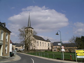
Asselborn (Luxembourgish : Aasselbuer) is a small town in the commune of Wincrange, in northern Luxembourg. As of 2024, the town has a population of 454. [1]

Contents

Asselborn was a commune in the canton of Clervaux until 1 January 1978, when it was merged with the communes of Boevange, Hachiville, and Oberwampach to form the new commune of Wincrange. The law creating Wincrange was passed on 31 October 1977. [2]

Climate

Climate data for Asselborn (1991–2020)
MonthJanFebMarAprMayJunJulAugSepOctNovDecYear
Record high °C (°F)12.5
(54.5)
20.3
(68.5)
21.9
(71.4)
23.3
(73.9)
29.6
(85.3)
33.4
(92.1)
37.9
(100.2)
36.5
(97.7)
32.4
(90.3)
26.9
(80.4)
20.4
(68.7)
13.7
(56.7)
37.9
(100.2)
Mean daily maximum °C (°F)3.2
(37.8)
4.4
(39.9)
8.7
(47.7)
13.2
(55.8)
17.3
(63.1)
20.4
(68.7)
22.5
(72.5)
22.2
(72.0)
18.0
(64.4)
12.8
(55.0)
7.1
(44.8)
3.9
(39.0)
12.8
(55.0)
Daily mean °C (°F)1.2
(34.2)
1.7
(35.1)
4.7
(40.5)
8.4
(47.1)
12.1
(53.8)
15.2
(59.4)
17.0
(62.6)
16.5
(61.7)
12.8
(55.0)
9.0
(48.2)
4.7
(40.5)
2.0
(35.6)
8.8
(47.8)
Mean daily minimum °C (°F)−1.5
(29.3)
−1.5
(29.3)
0.7
(33.3)
3.2
(37.8)
7.0
(44.6)
9.9
(49.8)
11.8
(53.2)
11.4
(52.5)
8.4
(47.1)
5.7
(42.3)
2.2
(36.0)
−0.5
(31.1)
4.7
(40.5)
Record low °C (°F)−19.7
(−3.5)
−18.4
(−1.1)
−17.6
(0.3)
−7.2
(19.0)
−2.7
(27.1)
−2.5
(27.5)
3.2
(37.8)
0.8
(33.4)
−0.4
(31.3)
−7.4
(18.7)
−14.1
(6.6)
−21.7
(−7.1)
−18.4
(−1.1)
Average precipitation mm (inches)74.9
(2.95)
61.0
(2.40)
59.7
(2.35)
48.3
(1.90)
68.2
(2.69)
70.5
(2.78)
64.9
(2.56)
80.6
(3.17)
63.7
(2.51)
67.5
(2.66)
69.7
(2.74)
90.2
(3.55)
819.2
(32.25)
Average precipitation days (≥ 1.0 mm)12.811.211.09.110.310.410.210.39.411.512.913.8132.7
Source: NOAA [3]

Former commune

The former commune consisted of the villages:

Related Research Articles

<span class="mw-page-title-main">Hosingen</span> Former commune in Clervaux, Luxembourg

Hosingen is a small village and former commune in northern Luxembourg.
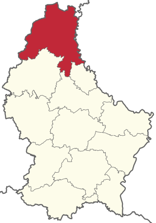
<span class="mw-page-title-main">Canton of Clervaux</span> Canton in Luxembourg

Clervaux is the largest, northernmost, highest and least densely populated canton of Luxembourg. It makes up a large part of the Éislek region. It borders Belgium & Germany.

<span class="mw-page-title-main">Clervaux</span> Commune in Luxembourg

Clervaux is a commune and town in northern Luxembourg, situated in the canton of the same name.
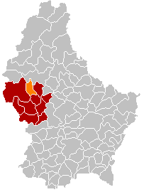
<span class="mw-page-title-main">Wahl, Luxembourg</span> Commune in Redange, Luxembourg

Wahl is a former commune and small village in western Luxembourg, in the canton of Redange.

<span class="mw-page-title-main">Heinerscheid</span> Former commune in Clervaux, Luxembourg

Heinerscheid is a small town in northern Luxembourg, in the commune of Clervaux.

<span class="mw-page-title-main">Wincrange</span> Commune in Clervaux, Luxembourg

Wincrange is a commune and village in northern Luxembourg, in the canton of Clervaux. The commune is the largest in Luxembourg by geographic area.

<span class="mw-page-title-main">Waldbillig</span> Commune in Echternach, Luxembourg

Waldbillig is a commune and small town in the canton of Echternach, Luxembourg.

<span class="mw-page-title-main">Bous, Luxembourg</span> Commune in Remich, Luxembourg

Bous is a former commune and small town in south-eastern Luxembourg. It is part of the canton of Remich.
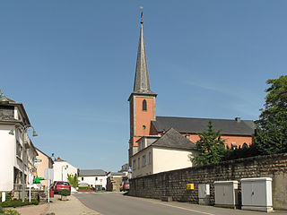
<span class="mw-page-title-main">Boevange-sur-Attert</span> Place in Mersch, Luxembourg

Boevange-sur-Attert is a small town in central Luxembourg, in the canton of Mersch. It is situated on the river Attert. It had a population of 989 as of 2024.
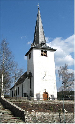
<span class="mw-page-title-main">Boevange</span> Former commune of Luxembourg in Diekirch

Boevange is a village in the commune of Wincrange, in northern Luxembourg. As of 2024, the village had a population of 301.
<span class="mw-page-title-main">Tuntange</span> Place in Luxembourg

Tuntange is a small town in western Luxembourg, in the canton of Mersch. As of 2024, it had a population of 1,364.

<span class="mw-page-title-main">Fouhren</span> Former commune of Luxembourg in Diekirch

Fouhren is a small town in the commune of Tandel, in north-eastern Luxembourg. As of 2024, the town has a population of 442.

Bastendorf is a small town in the commune of Tandel, in north-eastern Luxembourg. As of 2024, the town has a population of 640.

Kautenbach is a village in the commune of Kiischpelt, in northern Luxembourg. In 2024, the village had a population of 152.

<span class="mw-page-title-main">Doennange</span> Place in Diekirch, Luxembourg

Doennange is a village in the commune of Wincrange, in northern Luxembourg. As of 2024, the village has a population of 158.

Hachiville is a village in the commune of Wincrange, in northern Luxembourg. As of 2024, the village has a population of 206.

<span class="mw-page-title-main">Oberwampach</span> Former commune of Luxembourg in Diekirch

Oberwampach is a village in the commune of Wincrange, in northern Luxembourg. As of 2024, the village had a population of 263.

<span class="mw-page-title-main">Harlange</span> Former commune of Luxembourg in Wiltz

Harlange is a small town in the commune of Lac de la Haute-Sûre, in north-western Luxembourg. As of 2024, the town has a population of 590.

<span class="mw-page-title-main">Mecher</span> Former commune of Luxembourg in Wiltz

Mecher is a village in the commune of Lac de la Haute-Sûre, in north-western Luxembourg.It is 60.7 km far from capital city Luxembourg. As of 2024, the village has a population of 74.

<span class="mw-page-title-main">Stockem</span>

Stockem is a village in the commune of Wincrange, in northern Luxembourg. As of 2024, the village has a population of 132.

References

  1. "Registre national des personnes physiques RNPP : Population par localité". data.public.lu. 2024-01-07.
  2. "Mémorial A, 1977, No. 70" (PDF) (in French). Service central de législation. Archived from the original (PDF) on 2005-04-26. Retrieved 2006-08-11.
  3. "World Meteorological Organization Climate Normals for 1991-2020 — Asselborn". National Oceanic and Atmospheric Administration. Retrieved January 13, 2024.

50°05′46″N5°58′31″E / 50.0962°N 5.9752°E / 50.0962; 5.9752 (Asselborn)