Iyal Surayh District is a district of the 'Amran Governorate, Yemen. As of 2003, the district had a population of 54,015 inhabitants.
Kharif District is a district of the 'Amran Governorate, Yemen. As of 2003, the district had a population of 45,977 inhabitants. On July 13, 2020, it is reported that the Houthi militia captured the last Jews of Yemen in the Kharif District.
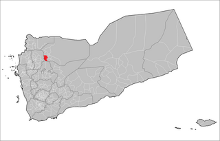
Thula District (Arabic: مديرية ثلاء) is a district of the 'Amran Governorate, Yemen. As of 2003, the district had a population of 40,971 inhabitants.
Al Matammah District is a district of the Al Jawf Governorate, Yemen. As of 2003, the district had a population of 28,935 inhabitants.
Rajuzah District is a district of the Al Jawf Governorate, Yemen. As of 2003, the district had a population of 73,723 inhabitants.
Ma'een District is a district of the Amanat Al Asimah Governorate, Yemen. As of 2003, the district had a population of 265,269 inhabitants.
Shu'aub District is a district of the Amanat Al Asimah Governorate, Yemen. As of 2003, the district had a population of 213,939 inhabitants.
Hawrah District is a district of the Hadhramaut Governorate, Yemen. As of 2003, the district had a population of 28,474 inhabitants.

Al Qabbaytah District is a district of the Lahij Governorate, Yemen. As of 2003, the district had a population of 94,516 inhabitants.

Arhab District is a district of the Sana'a Governorate, Yemen. As of 2003, the district had a population of 90,038 inhabitants.
Attyal District is a district of the Sana'a Governorate, Yemen. As of 2003, the district had a population of 36,253 inhabitants. Hajrat Shawkan village is in this district.
Bani Dhabyan District is a district of the Sana'a Governorate, Yemen. As of 2003, the district had a population of 16,262 inhabitants. As of 2023, it is one of the only districts controlled by tribal forces.
Bani Hushaysh District is a district in Sana'a Governorate, Yemen. As of 2003, the district had a population of 73,957 inhabitants. It's also famous for grape plantations.
Bilad Ar Rus District is a district of the Sana'a Governorate, Yemen. As of 2003, the district had a population of 31,259 inhabitants.
Hamdan District is a district of the Sana'a Governorate, Yemen. As of 2003, the district had a population of 85,370 inhabitants. It is named after the ancient Yemeni tribe of Hamdan.
Jihanah District is a district of the Sana'a Governorate, Yemen. As of 2003, the district had a population of 50,747 inhabitants.
Khawlan District is a district of the Sanaa Governorate, Yemen. As of 2003, the district had a population of 28,925 inhabitants.

Nihm District is a district of the Sana'a Governorate, Yemen. As of 2003, the district had a population of 41,502 inhabitants.
Sanhan and Bani Bahlul District is a district of the Sana'a Governorate, Yemen. Its seat is Sanhan. As of 2003, the district had a population of 400,399 inhabitants. The former President of Yemen Ali Abdullah Saleh comes from Beit al-Ahmar, which lies in Sanhan District.

The Mosque of the Dome of the Mahdi or Al-Mahdi Mosque is one of the historical mosques in the historic old city of Sana'a, Yemen. It forms a part of UNESCO World Heritage Site Old City of Sana'a. It is located in the Al-Kareem Al-Mahdi neighborhood in the western Sarar district. It was built in 1651 by the order of Imam Mahdi Abbas bin Mansour. The tomb was built after the death of Imam Mahdi Abbas in 1768.
