Atkins, Nebraska | |
|---|---|
 Atkins  Atkins | |
| Coordinates: 41°43′26″N103°12′55″W / 41.72389°N 103.21528°W | |
| Country | |
| State | |
| County | Morrill |
Atkins is an unincorporated community in Morrill County, Nebraska, United States. [1]
Atkins, Nebraska | |
|---|---|
| Atkins Atkins | |
| Coordinates: 41°43′26″N103°12′55″W / 41.72389°N 103.21528°W | |
| Country | |
| State | |
| County | Morrill |
Atkins is an unincorporated community in Morrill County, Nebraska, United States. [1]
Atkins was a station on the Chicago, Burlington and Quincy Railroad. [2] The community was named for Col. A. W. Atkins. [3]
{{cite book}}: CS1 maint: ignored ISBN errors (link) A 1925 edition is available for download at University of Nebraska—Lincoln Digital Commons. ![]() Media related to Atkins, Nebraska at Wikimedia Commons
Media related to Atkins, Nebraska at Wikimedia Commons
Municipalities and communities of Morrill County, Nebraska, United States | ||
|---|---|---|
| Cities | 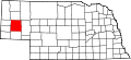 | |
| Village | ||
| Unincorporated communities | ||
41°43′26″N103°12′55″W / 41.72389°N 103.21528°W
| | This Morrill County, Nebraska state location article is a stub. You can help Wikipedia by adding missing information. |