Angora, Nebraska

Last updated

Angora, Nebraska
Angora, Nebraska 1.JPG
Angora, seen from the east across U.S. Highway 385
USA Nebraska location map.svg
Red pog.svg
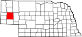
Angora
Location within the state of Nebraska
Usa edcp location map.svg
Red pog.svg
Angora
Angora (the United States)
Coordinates: 41°51′04″N103°07′33″W / 41.85111°N 103.12583°W / 41.85111; -103.12583 [1]
Country United States
State Nebraska
County Morrill
Elevation
[1]
4,265 ft (1,300 m)
Time zone UTC-7 (Mountain (MST))
  Summer (DST) UTC-6 (MDT)
ZIP code
69331
Area code 308

Angora (also Antelope Hill) is an unincorporated community in northern Morrill County, Nebraska, United States. It lies along U.S. Route 385, north of the city of Bridgeport, the county seat of Morrill County. [2] The community was established in 1900 by the Chicago, Burlington, and Quincy Railroad; [3] it was named for the Turkish city of Ankara, which was then known as Angora. [1] The Angora post office was established in 1901, [4] and it remains open with the assigned ZIP code of 69331. [5]

Climate

According to the Köppen climate classification, Angora has a semiarid climate, BSk on climate maps. [6]

Related Research Articles

Heidelberg is an unincorporated community in Lee County, Kentucky, United States. It lies along Route 399 southwest of the city of Beattyville, the county seat of Lee County. Its elevation is 718 feet (219 m), and it is located at (37.5553639|-83.7788073). It no longer has a post office and the ZIP code is now 41311, same as Beattyville. Said post office was established in 1904, and is said to be named for the hometown of an early German-American settler.

Pine Ridge is an unincorporated community in Wolfe County, Kentucky, United States. It lies along Route 15 northwest of the city of Campton, the county seat of Wolfe County. Its elevation is 1,266 feet (386 m). The community has a ZIP code of 41360.

Isonville is an unincorporated community in Elliott County, Kentucky, United States. It lies along Routes 32 and 486 east of the city of Sandy Hook, the county seat of Elliott County. Its elevation is 709 feet (216 m). It has a post office with the ZIP code 41149.

Crockett is an unincorporated community in Morgan County, Kentucky, United States. It lies along Route 172 northeast of the city of West Liberty, the county seat of Morgan County. Its elevation is 912 feet (278 m). It has a post office with the ZIP code 41413.

Lefor is an unincorporated community in southern Stark County, North Dakota, United States. It lies southeast of the city of Dickinson, the county seat of Stark County. Its elevation is 2,592 feet (790 m). Lefor's post office closed November 2, 2002, but the town still has its own ZIP code of 58641.

<span class="mw-page-title-main">Champion, Nebraska</span> Census-designated place in Nebraska, United States

Champion is an unincorporated community and census-designated place in central Chase County, Nebraska, United States. As of the 2010 census, it had a population of 103. It has a post office with the ZIP code 69023.

<span class="mw-page-title-main">Dickens, Nebraska</span> Unincorporated community in Nebraska, United States

Dickens is an unincorporated community in southwestern Lincoln County, Nebraska, United States. It lies along Nebraska Highway 23 southwest of the city of North Platte, the county seat of Lincoln County. Its elevation is 3,136 feet (956 m). The community is named for Charles Dickens. Although Dickens is unincorporated, it has a post office, with the ZIP code of 69132.

<span class="mw-page-title-main">Amelia, Nebraska</span> Unincorporated community in Nebraska, United States

Amelia is an unincorporated community in southwestern Holt County, Nebraska, United States. It lies along local roads near Nebraska Highways 11 and 95, southwest of the city of O'Neill, the county seat of Holt County. The community is named for Amelia A. Bliss. Although Amelia is unincorporated, it has a post office, with the ZIP code of 68711.

<span class="mw-page-title-main">Ames, Nebraska</span> CDP in Nebraska, United States

Ames is an unincorporated hamlet in southern Dodge County, Nebraska, United States. As of the 2010 census it had a population of 24.

<span class="mw-page-title-main">Enders, Nebraska</span> Census-designated place in Nebraska, United States

Enders is an unincorporated community and census-designated place in Chase County, Nebraska, United States. As of the 2010 census it had a population of 42. Although Enders is unincorporated, it has a post office, with the ZIP code of 69027.

<span class="mw-page-title-main">Inavale, Nebraska</span> Census-designated place in Webster County, Nebraska, United States

Inavale is a census-designated place in western Webster County, Nebraska, United States.

<span class="mw-page-title-main">Inland, Nebraska</span> Census-designated place in Clay County, Nebraska, United States

Inland is a census-designated place in northwestern Clay County, Nebraska, United States. As of the 2010 census it had a population of 62. Although Inland is unincorporated, it has a post office, with the ZIP code of 68954.

<span class="mw-page-title-main">Keystone, Nebraska</span> Census-designated place in Nebraska, United States

Keystone is an unincorporated community and census-designated place in central Keith County, Nebraska, United States. As of the 2010 census its population was 59.

<span class="mw-page-title-main">Lakeside, Nebraska</span> Unincorporated community in Sheridan County, Nebraska, United States

Lakeside is an unincorporated community in southern Sheridan County, Nebraska, United States. It lies along Nebraska Highway 2 and Nebraska Highway 250, south of the city of Rushville, the county seat of Sheridan County, at an elevation of 3,881 feet (1,183 m). Lakeside has a post office, with ZIP code 69351.

<span class="mw-page-title-main">Martell, Nebraska</span> Unincorporated community and Census designated place in Nebraska, United States

Martell is an unincorporated community in southwestern Lancaster County, Nebraska, United States. It lies along local roads southwest of the city of Lincoln, the county seat of Lancaster County and Nebraska's state capital. Although Martell is unincorporated, it has a post office, with the ZIP code of 68404.

<span class="mw-page-title-main">Purdum, Nebraska</span> Unincorporated community in Blaine County, Nebraska, United States

Purdum is an unincorporated community in northwestern Blaine County, Nebraska, United States. It lies along local roads northwest of the village of Brewster, the county seat of Blaine County. Its elevation is 2,700 feet (823 m). Although Purdum is unincorporated, it has a post office, with the ZIP code of 69157. The town is also home to the Purdum State Bank, and a half-dozen small businesses, a church, and a fire station. In the immediate environs are several livestock ranches.

<span class="mw-page-title-main">St. Libory, Nebraska</span> Census-designated place in Nebraska, United States

St. Libory or Saint Libory is an unincorporated community and census-designated place (CDP) in southeastern Howard County, Nebraska, United States. As of the 2010 census it had a population of 264.

<span class="mw-page-title-main">Parks, Nebraska</span> Census-designated place in Dundy County, Nebraska, United States

Parks is a namesake census-designated place in southern Dundy County, Nebraska, United States. As of the 2020 census, its population was 12.

Bittinger is an unincorporated community in northeastern Garrett County, Maryland, United States, on the western edge of the Savage River State Forest. It lies along Maryland Route 495 northeast of the city of Oakland, the county seat of Garrett County. Its elevation is 2,690 feet (820 m). Although Bittinger is unincorporated, it has a post office, with the ZIP code of 21522. The post office was established in 1885.

Toyahvale is an unincorporated community in southern Reeves County, Texas, United States. It lies along State Highway 17 and FM 3078, south of the city of Pecos, the county seat of Reeves County.

References

  1. 1 2 3 Geographic Names Information System Feature Detail Report. Geographic Names Information System. 1979-03-09. Retrieved 2010-09-15.
  2. Rand McNally. The Road Atlas '08. Chicago: Rand McNally, 2008, p. 62.
  3. Nebraska Historic Buildings Survey: Reconnaissance Survey Final Report of Morrill County, Nebraska. [usurped] Nebraska State Historical Society. [usurped] 1990-03-01. Retrieved 2010-09-15.
  4. "Morrill County". Jim Forte Postal History. Retrieved August 19, 2014.
  5. Zip Code Lookup Archived June 15, 2011, at the Wayback Machine
  6. Climate Summary for Angora, Nebraska