Atlantification of the Arctic

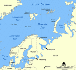
Last updated
Sea surface temperature difference between the decades 1960-1970 and 2010-2020 in degrees C. Atlantification data2.png
Sea surface temperature difference between the decades 1960-1970 and 2010-2020 in degrees C.
Location of the Barents Sea in the Arctic Ocean. Barents Sea map.png
Location of the Barents Sea in the Arctic Ocean.

Atlantification is the increasing influence of Atlantic water in the Arctic. Warmer and saltier Atlantic water is extending its reach northward into the Arctic Ocean. [2] The Arctic Ocean is becoming warmer and saltier and sea-ice is disappearing as a result. [3] The process can be seen on the figure on the far right, where the sea surface temperature change in the past 50 years is shown, which is up to 5 degrees in some places. This change in the Arctic climate is most prominent in the Barents Sea, a shallow shelf sea north of Scandinavia, where sea-ice is disappearing faster than in any other Arctic region, impacting the local and global ecosystem.

Contents

Structure of the Arctic Ocean

Temperature and salinity profiles in the Arctic Ocean. Image created by Brn-Bld. Temperature and salinity profiles in the Arctic Ocean.svg
Temperature and salinity profiles in the Arctic Ocean. Image created by Brn-Bld.

The largest part of the Arctic Ocean has a strong division between ocean layers. At the top is a mixed layer of fresh water with a temperature near the freezing point and a salinity of around 30 psu (practical salinity unit). [4] This water is fed by rivers and melting of sea-ice. Underneath this fresh water is a layer where the salinity increases strongly but the temperature remains low: the cold halocline layer. Below this layer, the temperature increases with depth to above the freezing point. This layer which holds this temperature gradient is called the pycnocline layer. [5] The water underneath is warm and salty, carried in from the Atlantic Ocean by the Atlantic Meridional Overturning Circulation (AMOC). This layer is warmer than the surface layer but because of its salinity it has a higher density than the water above. This means this layer is less buoyant than the surface layer. The cold freshwater therefore floats on top and the halocline across which mixing tends to be weak [6] even under ice free conditions [7] and therefore protects the surface from the heat in the Atlantic water. [8] Under the Atlantic water layer is a deep layer of Arctic bottom water extending to the bottom of the ocean.

Process of Atlantification

The increasing influence of Atlantic water flowing into the Arctic Ocean and the loss of stratification causes the warm Atlantic water to mix with the fresh water at the surface. As can be seen in the figure below, the halocline weakens and therefore heat from the Atlantic water reaches the surface. This warming of the surface water causes a retreat in sea-ice in winter and a total absence of sea-ice in summer. [9] The loss of winter sea-ice means that in summer, the colder layer of freshwater at the surface is less replenished by melting ice, lessening the temperature difference between the layers. Also, a lack of sea-ice increases the influence of wind on the sea surface, mixing the layers further. [10]

Model predictions do not show an upward trend in volume transport into the Arctic from the North Atlantic nor an increase in the temperature of the inflowing water leading some to conclude that the Atlantification of the Arctic is not caused by a process in the Atlantic Ocean but rather by atmospheric forcing in the Arctic region, amplified by sea-ice loss. [11]

However observations show a regime shift from winter sea ice cover to open water in the southern Barents Sea in response to the warming of the inflowing Atlantic water. [9] Observations also reveal the increasing influence of Atlantic water heat further to the east, in the eastern Eurasian Basin, where in recent years the heat flux from the Atlantic water towards the surface has overtaken the atmospheric contribution in this region. [12] Furthermore, an observed weakening of the halocline over this period coincided increasing wind driven upper ocean currents, pointing to increased mixing. [13]

Process of Atlantification in the Eurasian Basin of the Barents Sea. Red arrows indicate heat transfer, the blue arrow indicated inflow of Atlantic water. The red and blue colors indicate warm and cold water respectively. Recreated from Polyakov et al. Atlantification Artic.png
Process of Atlantification in the Eurasian Basin of the Barents Sea. Red arrows indicate heat transfer, the blue arrow indicated inflow of Atlantic water. The red and blue colors indicate warm and cold water respectively. Recreated from Polyakov et al.

Consequences

At the moment, the largest part of inflowing heat from the Atlantic Ocean is lost to the atmosphere within the Barents Sea. It is expected though, that the temperature in the Barents Sea will increase due to changes in the interaction with the atmosphere. As a result, the water flowing out from the Barents Sea in between Franz Josef Land and Novaya Zemlya (Barents Sea exit) will warm significantly from -0.2 to 2.2 C in 2080. [14] This shows that warm Atlantic water will penetrate further into the Arctic Ocean, ultimately extending throughout the Eurasian basin, leading to reduction in sea-ice thickness in this region.

Organisms

Atlantification as part of the climate changing in the Arctic has major consequences for all organisms living there. Due to the warming of Barents Sea, phytoplankton blooms are moving further into the Eurasian Basin each year. Typical species have moved 5 degrees further North compared to 1989. [15] Also, fish communities are moving Northward at the pace of the local climate change, a process called borealization. Some predators that reach areas previously not warm enough change the ecological systems of the Arctic. As a result, Arctic shelf fish are being expelled and retract Northwards as well. For some species, depth might limit their options and this will induce changes in the biodiversity of the Arctic Ocean. [16] This change in marine ecosystem also influences the bird and mammal species living in the Arctic region. Sea birds, seals and whales depend directly on the fish populations. Land mammals like polar bears live on seals and are also strongly dependant on the sea-ice to live on. [17]

Tipping point

There are growing concerns that the Arctic climate might be moving to a so-called tipping point, meaning that if a critical point is reached, the system will settle around a different equilibrium state. In the Arctic this different state could be one with much less or no sea-ice. [18]

Related Research Articles

<span class="mw-page-title-main">North Atlantic Deep Water</span> Deep water mass formed in the North Atlantic Ocean

North Atlantic Deep Water (NADW) is a deep water mass formed in the North Atlantic Ocean. Thermohaline circulation of the world's oceans involves the flow of warm surface waters from the southern hemisphere into the North Atlantic. Water flowing northward becomes modified through evaporation and mixing with other water masses, leading to increased salinity. When this water reaches the North Atlantic it cools and sinks through convection, due to its decreased temperature and increased salinity resulting in increased density. NADW is the outflow of this thick deep layer, which can be detected by its high salinity, high oxygen content, nutrient minima, high 14C/12C, and chlorofluorocarbons (CFCs).

<span class="mw-page-title-main">Barents Sea</span> Marginal sea of the Arctic Ocean, off the northern coasts of Norway and Russia

The Barents Sea is a marginal sea of the Arctic Ocean, located off the northern coasts of Norway and Russia and divided between Norwegian and Russian territorial waters. It was known earlier among Russians as the Northern Sea, Pomorsky Sea or Murman Sea ; the current name of the sea is after the historical Dutch navigator Willem Barentsz.

<span class="mw-page-title-main">Ocean current</span> Directional mass flow of oceanic water generated by external or internal forces

An ocean current is a continuous, directed movement of seawater generated by a number of forces acting upon the water, including wind, the Coriolis effect, breaking waves, cabbeling, and temperature and salinity differences. Depth contours, shoreline configurations, and interactions with other currents influence a current's direction and strength. Ocean currents are primarily horizontal water movements.

<span class="mw-page-title-main">East Greenland Current</span> Current from Fram Strait to Cape Farewell off the eastern coat of Greenland

The East Greenland Current (EGC) is a cold, low-salinity current that extends from Fram Strait (~80N) to Cape Farewell (~60N). The current is located off the eastern coast of Greenland along the Greenland continental margin. The current cuts through the Nordic Seas and through the Denmark Strait. The current is of major importance because it directly connects the Arctic to the Northern Atlantic, it is a major contributor to sea ice export out of the Arctic, and it is a major freshwater sink for the Arctic.

<span class="mw-page-title-main">Sea surface temperature</span> Water temperature close to the oceans surface

Sea surface temperature (SST), or ocean surface temperature, is the ocean temperature close to the surface. The exact meaning of surface varies according to how we measure it. It is between 1 millimetre (0.04 in) and 20 metres (70 ft) below the sea surface. Sea surface temperatures greatly modify air masses in the Earth's atmosphere within a short distance of the shore. Local areas of heavy snow can form in bands downwind of warm water bodies within an otherwise cold air mass. Warm sea surface temperatures can develop and strengthen cyclones over the Ocean. Experts call this process tropical cyclogenesis. Tropical cyclones can also cause a cool wake. This is due to turbulent mixing of the upper 30 metres (100 ft) of the ocean. Sea surface temperature changes during the day. This is like the air above it, but to a lesser degree. There is less variation in sea surface temperature on breezy days than on calm days. Ocean currents, such as the Atlantic Multidecadal Oscillation, can affect sea surface temperatures over several decades. Thermohaline circulation has a major impact on average sea surface temperature throughout most of the world's oceans.

<span class="mw-page-title-main">Polar vortex</span> Persistent cold-core low-pressure area that circles one of the poles

A circumpolar vortex, or simply polar vortex, is a large region of cold, rotating air; polar vortices encircle both of Earth's polar regions. Polar vortices also exist on other rotating, low-obliquity planetary bodies. The term polar vortex can be used to describe two distinct phenomena; the stratospheric polar vortex, and the tropospheric polar vortex. The stratospheric and tropospheric polar vortices both rotate in the direction of the Earth's spin, but they are distinct phenomena that have different sizes, structures, seasonal cycles, and impacts on weather.

<span class="mw-page-title-main">Norwegian Current</span> A current that flows northeasterly along the Atlantic coast of Norway into the Barents Sea

The Norwegian Current is one of two dominant arctic inflows of water. It can be traced from near Shetland, north of Scotland, otherwise from the eastern North Sea at depths of up to 100 metres. It finally passes the Opening into the Barents Sea, a large outcrop of the Arctic Ocean. Compared to its partial source the North Atlantic Current it is colder and less salty; the other sources are the less saline North and Baltic seas and the Norwegian fjords and rivers. It is considerably warmer and saltier than the Arctic Ocean, which is freshened by precipitation and ice in and around it. Winter temperatures in the flow are typically between 2 and 5 °C — the co-parent North Atlantic flow, a heat remnant of its Gulf Stream chief contributor, exceeds 6 °C.

Ocean stratification is the natural separation of an ocean's water into horizontal layers by density, which is generally stable because warm water floats on top of cold water, and heating is mostly from the sun, which reinforces that arrangement. Stratification is reduced by wind-forced mechanical mixing, but reinforced by convection. Stratification occurs in all ocean basins and also in other water bodies. Stratified layers are a barrier to the mixing of water, which impacts the exchange of heat, carbon, oxygen and other nutrients. The surface mixed layer is the uppermost layer in the ocean and is well mixed by mechanical (wind) and thermal (convection) effects. Climate change is causing the upper ocean stratification to increase.

<span class="mw-page-title-main">Mixed layer</span> Layer in which active turbulence has homogenized some range of depths

The oceanic or limnological mixed layer is a layer in which active turbulence has homogenized some range of depths. The surface mixed layer is a layer where this turbulence is generated by winds, surface heat fluxes, or processes such as evaporation or sea ice formation which result in an increase in salinity. The atmospheric mixed layer is a zone having nearly constant potential temperature and specific humidity with height. The depth of the atmospheric mixed layer is known as the mixing height. Turbulence typically plays a role in the formation of fluid mixed layers.

<span class="mw-page-title-main">Atlantic meridional overturning circulation</span> System of surface and deep currents in the Atlantic Ocean

The Atlantic meridional overturning circulation (AMOC) is part of a global thermohaline circulation in the oceans and is the zonally integrated component of surface and deep currents in the Atlantic Ocean. It is characterized by a northward flow of warm, salty water in the upper layers of the Atlantic, and a southward flow of colder, deep waters. These "limbs" are linked by regions of overturning in the Nordic and Labrador Seas and the Southern Ocean, although the extent of overturning in the Labrador Sea is disputed. The AMOC is an important component of the Earth's climate system, and is a result of both atmospheric and thermohaline drivers.

<span class="mw-page-title-main">Ocean heat content</span> Thermal energy stored in ocean water

Ocean heat content (OHC) is the energy absorbed and stored by oceans. To calculate the ocean heat content, it is necessary to measure ocean temperature at many different locations and depths. Integrating the areal density of ocean heat over an ocean basin or entire ocean gives the total ocean heat content. Between 1971 and 2018, the rise in ocean heat content accounted for over 90% of Earth’s excess thermal energy from global heating. The main driver of this increase was anthropogenic forcing via rising greenhouse gas emissions. By 2020, about one third of the added energy had propagated to depths below 700 meters. In 2022, the world’s oceans were again the hottest in the historical record and exceeded the previous 2021 record maximum. The four highest ocean heat observations occurred in the period 2019–2022. The North Pacific, North Atlantic, the Mediterranean, and the Southern Ocean all recorded their highest heat observations for more than sixty years. Ocean heat content and sea level rise are important indicators of climate change.

<span class="mw-page-title-main">Polar amplification</span>

Polar amplification is the phenomenon that any change in the net radiation balance tends to produce a larger change in temperature near the poles than in the planetary average. This is commonly referred to as the ratio of polar warming to tropical warming. On a planet with an atmosphere that can restrict emission of longwave radiation to space, surface temperatures will be warmer than a simple planetary equilibrium temperature calculation would predict. Where the atmosphere or an extensive ocean is able to transport heat polewards, the poles will be warmer and equatorial regions cooler than their local net radiation balances would predict. The poles will experience the most cooling when the global-mean temperature is lower relative to a reference climate; alternatively, the poles will experience the greatest warming when the global-mean temperature is higher.

<span class="mw-page-title-main">Arctic Ocean</span> Ocean in the north polar region

The Arctic Ocean is the smallest and shallowest of the world's five major oceans. It spans an area of approximately 14,060,000 km2 (5,430,000 sq mi) and is known as one of the coldest of oceans. The International Hydrographic Organization (IHO) recognizes it as an ocean, although some oceanographers call it the Arctic Mediterranean Sea. It has also been described as an estuary of the Atlantic Ocean. It is also seen as the northernmost part of the all-encompassing World Ocean.

<span class="mw-page-title-main">Beaufort Gyre</span> Wind-driven ocean current in the Arctic Ocean polar region

The Beaufort Gyre is one of the two major ocean currents in the Arctic Ocean. It is roughly located north of the Alaskan and Canadian coast. In the past, Arctic sea-ice would circulate in the Beaufort gyre up to several years, leading to the formation of very thick multi-year sea-ice. Due to warming temperatures in the Arctic, the gyre has lost an extensive amount of ice, practically turning what used to be a nursery for sea-ice to mature and grow into the thickest and oldest ice of the Arctic Ocean into a "graveyard" for older ice.

Fiona McLaughlin is a senior Oceanographer, employed by Canada's Department of Fisheries and Oceans. McLaughlin joined government service in 1972. Since 1994 she has concentrated on the ecology of the Arctic Ocean.

<span class="mw-page-title-main">West Spitsbergen Current</span> Warm, salty current that runs poleward just west of Spitsbergen

The West Spitsbergen Current (WSC) is a warm, salty current that runs poleward just west of Spitsbergen,, in the Arctic Ocean. The WSC branches off the Norwegian Atlantic Current in the Norwegian Sea. The WSC is of importance because it drives warm and salty Atlantic Water into the interior Arctic. The warm and salty WSC flows north through the eastern side of Fram Strait, while the East Greenland Current (EGC) flows south through the western side of Fram Strait. The EGC is characterized by being very cold and low in salinity, but above all else it is a major exporter of Arctic sea ice. Thus, the EGC combined with the warm WSC makes the Fram Strait the northernmost ocean area having ice-free conditions throughout the year in all of the global ocean.

<span class="mw-page-title-main">Arctic sea ice decline</span> Sea ice loss observed in recent decades in the Arctic Ocean

Sea ice in the Arctic has declined in recent decades in area and volume due to climate change. It has been melting more in summer than it refreezes in winter. Global warming, caused by greenhouse gas forcing is responsible for the decline in Arctic sea ice. The decline of sea ice in the Arctic has been accelerating during the early twenty‐first century, with a decline rate of 4.7% per decade. It is also thought that summertime sea ice will cease to exist sometime during the 21st century.

<span class="mw-page-title-main">Cyclonic Niño</span> Climatological phenomenon

Cyclonic Niño is a climatological phenomenon that has been observed in climate models where tropical cyclone activity is increased. Increased tropical cyclone activity mixes ocean waters, introducing cooling in the upper layer of the ocean that quickly dissipates and warming in deeper layers that lasts considerably more, resulting in a net warming of the ocean.

<span class="mw-page-title-main">Pacific Meridional Mode</span> Climate mode in the North Pacific

Pacific Meridional Mode (PMM) is a climate mode in the North Pacific. In its positive state, it is characterized by the coupling of weaker trade winds in the northeast Pacific Ocean between Hawaii and Baja California with decreased evaporation over the ocean, thus increasing sea surface temperatures (SST); and the reverse during its negative state. This coupling develops during the winter months and spreads southwestward towards the equator and the central and western Pacific during spring, until it reaches the Intertropical Convergence Zone (ITCZ), which tends to shift north in response to a positive PMM.

Mary-Louise Elizabeth Timmermans is a marine scientist known for her work on the Arctic Ocean. She is the Damon Wells Professor of Earth and Planetary Sciences at Yale University.

References

  1. Data provided by Physical Sciences Laboratory, NOAA, Boulder, Colorado, from their Web site at https://psl.noaa.gov/.
  2. 1 2 Polyakov, Igor V.; Pnyushkov, Andrey V.; Alkire, Matthew B.; Ashik, Igor M.; Baumann, Till M.; Carmack, Eddy C.; Goszczko, Ilona; Guthrie, John; Ivanov, Vladimir V.; Kanzow, Torsten; Krishfield, Richard; Kwok, Ronald; Sundfjord, Arild; Morison, James; Rember, Robert (2017-04-21). "Greater role for Atlantic inflows on sea-ice loss in the Eurasian Basin of the Arctic Ocean". Science. 356 (6335): 285–291. Bibcode:2017Sci...356..285P. doi:10.1126/science.aai8204. hdl: 1912/8975 . ISSN   0036-8075. PMID   28386025. S2CID   206653114.
  3. Ivanov, Vladimir; Alexeev, Vladimir; Koldunov, Nikolay V.; Repina, Irina; Sandø, Anne Britt; Smedsrud, Lars Henrik; Smirnov, Alexander (2016-05-01). "Arctic Ocean Heat Impact on Regional Ice Decay: A Suggested Positive Feedback". Journal of Physical Oceanography. 46 (5): 1437–1456. Bibcode:2016JPO....46.1437I. doi: 10.1175/JPO-D-15-0144.1 . ISSN   0022-3670. S2CID   129560108.
  4. Björk, Göran (1989-01-01). "A One-Dimensional Time-Dependent Model for the Vertical Stratification of the Upper Arctic Ocean". Journal of Physical Oceanography. 19 (1): 52–67. Bibcode:1989JPO....19...52B. doi: 10.1175/1520-0485(1989)019<0052:AODTDM>2.0.CO;2 . ISSN   0022-3670.
  5. Polyakov, Igor V; Pnyushkov, Andrey V; Carmack, Eddy C (2018-12-17). "Stability of the arctic halocline: a new indicator of arctic climate change". Environmental Research Letters. 13 (12): 125008. doi: 10.1088/1748-9326/aaec1e . ISSN   1748-9326. S2CID   158108872.
  6. Lenn, Y. D.; Wiles, P. J.; Torres-Valdes, S.; Abrahamsen, E. P.; Rippeth, T. P.; Simpson, J. H.; Bacon, S.; Laxon, S. W.; Polyakov, I.; Ivanov, V.; Kirillov, S. (2009-03-03). "Vertical mixing at intermediate depths in the Arctic boundary current". Geophysical Research Letters. 36 (5): L05601. Bibcode:2009GeoRL..36.5601L. doi: 10.1029/2008GL036792 . ISSN   0094-8276. S2CID   56420618.
  7. Lincoln, Ben J.; Rippeth, Tom P.; Lenn, Yueng-Djern; Timmermans, Mary Louise; Williams, William J.; Bacon, Sheldon (2016-09-28). "Wind-driven mixing at intermediate depths in an ice-free Arctic Ocean: WIND MIXING IN AN ICE-FREE ARCTIC OCEAN". Geophysical Research Letters. 43 (18): 9749–9756. doi: 10.1002/2016GL070454 . S2CID   41714220.
  8. Steele, Michael; Boyd, Timothy (1998-05-15). "Retreat of the cold halocline layer in the Arctic Ocean". Journal of Geophysical Research: Oceans. 103 (C5): 10419–10435. Bibcode:1998JGR...10310419S. doi:10.1029/98JC00580.
  9. 1 2 Barton, Benjamin I.; Lenn, Yueng-Djern; Lique, Camille (2018-08-01). "Observed Atlantification of the Barents Sea Causes the Polar Front to Limit the Expansion of Winter Sea Ice". Journal of Physical Oceanography. 48 (8): 1849–1866. Bibcode:2018JPO....48.1849B. doi: 10.1175/JPO-D-18-0003.1 . ISSN   0022-3670. S2CID   134212469.
  10. Dunne, Daisy (2020-01-16). "Explainer: How 'Atlantification' is making the Arctic Ocean saltier and warmer". Carbon Brief. Retrieved 2023-04-11.
  11. Wang, Qiang; Wekerle, Claudia; Wang, Xuezhu; Danilov, Sergey; Koldunov, Nikolay; Sein, Dmitry; Sidorenko, Dmitry; Appen, Wilken‐Jon; Jung, Thomas (2020-02-16). "Intensification of the Atlantic Water Supply to the Arctic Ocean Through Fram Strait Induced by Arctic Sea Ice Decline". Geophysical Research Letters. 47 (3). Bibcode:2020GeoRL..4786682W. doi: 10.1029/2019GL086682 . ISSN   0094-8276. S2CID   211572378.
  12. Polyakov, Igor V.; Rippeth, Tom P.; Fer, Ilker; Alkire, Matthew B.; Baumann, Till M.; Carmack, Eddy C.; Ingvaldsen, Randi; Ivanov, Vladimir V.; Janout, Markus; Lind, Sigrid; Padman, Laurie; Pnyushkov, Andrey V.; Rember, Robert (2020-09-15). "Weakening of Cold Halocline Layer Exposes Sea Ice to Oceanic Heat in the Eastern Arctic Ocean". Journal of Climate. 33 (18): 8107–8123. Bibcode:2020JCli...33.8107P. doi:10.1175/JCLI-D-19-0976.1. hdl: 10037/19601 . ISSN   0894-8755. S2CID   224975091.
  13. Polyakov, Igor V.; Rippeth, Tom P.; Fer, Ilker; Baumann, Till M.; Carmack, Eddy C.; Ivanov, Vladimir V.; Janout, Markus; Padman, Laurie; Pnyushkov, Andrey V.; Rember, Robert (2020-08-28). "Intensification of Near‐Surface Currents and Shear in the Eastern Arctic Ocean". Geophysical Research Letters. 47 (16). Bibcode:2020GeoRL..4789469P. doi: 10.1029/2020GL089469 . ISSN   0094-8276. S2CID   225229292.
  14. Årthun, Marius; Eldevik, Tor; Smedsrud, Lars H. (2019-06-01). "The Role of Atlantic Heat Transport in Future Arctic Winter Sea Ice Loss". Journal of Climate. 32 (11): 3327–3341. Bibcode:2019JCli...32.3327A. doi: 10.1175/JCLI-D-18-0750.1 . ISSN   0894-8755. S2CID   134670803.
  15. Neukermans, Griet; Oziel, Laurent; Babin, Marcel (2018-02-02). "Increased intrusion of warming Atlantic water leads to rapid expansion of temperate phytoplankton in the Arctic". Global Change Biology. 24 (6): 2545–2553. Bibcode:2018GCBio..24.2545N. doi:10.1111/gcb.14075. PMID   29394007. S2CID   3386710.
  16. Fossheim, Maria; Primicerio, Raul; Johannesen, Edda; Ingvaldsen, Randi B.; Aschan, Michaela M.; Dolgov, Andrey V. (2015-05-18). "Recent warming leads to a rapid borealization of fish communities in the Arctic". Nature Climate Change. 5 (7): 673–677. Bibcode:2015NatCC...5..673F. doi:10.1038/nclimate2647. ISSN   1758-6798.
  17. Descamps, Sébastien; Aars, Jon; Fuglei, Eva; Kovacs, Kit M.; Lydersen, Christian; Pavlova, Olga; Pedersen, Åshild Ø.; Ravolainen, Virve; Strøm, Hallvard (2016-06-02). "Climate change impacts on wildlife in a High Arctic archipelago - Svalbard, Norway". Global Change Biology. 23 (2): 490–502. doi: 10.1111/gcb.13381 . PMID   27250039. S2CID   34897286.
  18. Lenton, Timothy M. (2012-02-01). "Arctic Climate Tipping Points". Ambio. 41 (1): 10–22. doi:10.1007/s13280-011-0221-x. ISSN   1654-7209. PMC   3357822 . PMID   22270703.