Atmakur, Suryapet district

Last updated

Atmakur

Atmakur (S)
Telangana locator map.svg
Red pog.svg
Atmakur
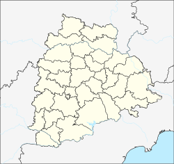
Location in Telangana, India
India location map.svg
Red pog.svg
Atmakur
Atmakur (India)
Coordinates: 16°43′23″N79°20′15″E / 16.723015°N 79.337425°E / 16.723015; 79.337425 Coordinates: 16°43′23″N79°20′15″E / 16.723015°N 79.337425°E / 16.723015; 79.337425
Country India
State Telangana
District Suryapet
Population
 (2011) [1]
  Total5,960 [2]
Languages
  Official Telugu
Time zone UTC+5:30 (IST)
Vehicle registration TS 29

Atmakur is a village in Suryapet district of the Indian state of Telangana. It is located in Athmakur (S) mandal of Suryapet division. [3]

Suryapet district District of Telangana in India

Suryapet district is a district in the Indian state of Telangana. The city of Suryapet is the district headquarters. The district shares boundaries with Nalgonda, Khammam, Yadadri, Jangaon and Mahabubabad districts and with Andhra pradesh state.

Telangana State in southern India

Telangana is a state in India situated on the centre-south stretch of the Indian peninsula on the high Deccan Plateau. It is the eleventh largest state and the twelfth-most populated state in India with a geographical area of 112,077 km2 (43,273 sq mi) and 35,193,978 residents as per 2011 census. On 2 June 2014, the area was separated from the northwestern part of Andhra Pradesh as the newly formed 29th state with Hyderabad as its historic permanent capital. Its other major cities include Warangal, Nizamabad and Karimnagar. Telangana is bordered by the states of Maharashtra to the north, Chhattisgarh to the east, Karnataka to the west, and Andhra Pradesh to the east and south. The terrain of Telangana region consists mostly of hills, mountain ranges, and thick dense forests covering an area of 27,292 sq. km. As of 2019, the state of Telangana is divided into 33 districts.

Athmakur (S) mandal Mandal in Telangana, India

Athmakur (S) mandal is one of the 23 mandals in Suryapet district of the Indian state of Telangana. It is under the administration of Suryapet revenue division with its headquarters at Atmakur. It is bounded by Chivvemla mandal towards South, Nuthankal mandal towards North, Mothey mandal towards East, Suryapet mandal towards South.
Related Research Articles

Kodad Town in Telangana, India

Kodad is a town in Suryapet district of the Indian state of Telangana. It is a municipality and the mandal headquarters of Kodad mandal in Kodad revenue division. It lies on the National Highway 65 between Hyderabad and Vijayawada.It is 44 km far away from the district headquarters Suryapet.

Mellachervu Village in Telangana, India

Mellacheruvu is a village in Suryapet district of the Indian state of Telangana. It is located in Mellachervu mandal of Kodad revenue division..It is about 64km from the district headquarters Suryapet.

Thirumalagiri, Suryapet district Town in Telangana, India

Tirumalagiri is a new municipality in Suryapet district of the Indian state of Telangana. It is located in Thirumalagiri mandal of Suryapet division.

Huzurnagar Town in Telangana, India

Huzurnagar is the third largest town in the Suryapet district of the Indian state of Telangana.Huzurnagar is a Municipality and the Mandal Headquarters of Huzurnagar Mandal . It is 54 km far away from the district Headquarters Suryapet.

Garidepally Census town in Telangana, India

Garidepally is a census town in the Suryapet district of Telangana, India. It is the headquarters of the Garidepally mandal of the Suryapet revenue division. It is located 33 kilometres from its district headquarters in Suryapet.

Munagala Village in Telangana, India

Munagala is a village in the Suryapet district in the state of Telangana. It is located in Munagala mandal of Kodad revenue division..It is 24km far away from the district headquarters Suryapet.

Mattampally is a village in the Suryapet district, Telangana, India. It is located 13 km from the banks of the Krishna River, in Mattampally mandal of Kodad revenue division..It is located about 69km from the district headquarters Suryapet.

Nadigudem Village in Telangana, India

Nadigudem is a village in Suryapet district, of the Indian state of Telangana. It is located in Nadigudem mandal of Kodad revenue division.

Mothey Village in Telangana, India

Moteh or Mothey is a village in Suryapet district of the Indian state of Telangana. It is located in Mothey mandal of Suryapet division.

Chivvemla Place in Telangana, India

Chivemla is a village in Suryapet district of the Indian state of Telangana. It is located Chivvemla mandal of Suryapet division.

Penpahad Place in Telangana, India

Penpahad is a village in Suryapet district of the Indian state of Telangana. It is the headquarters of Penpahad mandal of Suryapet division. It is located 18 km from district headquarters, Suryapet.

Neredcherla Place in Telangana, India

Nereducharla is a new municipality in Suryapet district of Telangana, India. It is located in Neredcherla mandal of Suryapet revenue division. It is about 38km from the district headquarters Suryapet.

Noothankal or Nuthankal is a village in Suryapet district of the Indian state of Telangana.It is located in Nuthankal mandal of Suryapet division in Suryapet district..It is located 25km from the district headquarters Suryapet.

Jajireddigudem is a village in Suryapet district of the Indian state of Telangana. It is located in Jajireddygudem mandal of Suryapet division..It is about 30 km from the district headquarters Suryapet.

Yadadri Bhuvanagiri district District of Telangana in India

Yadadri Bhuvanagiri district is a district in the Indian state of Telangana. The administrative headquarters is located at Bhongir. It was a part of the Nalgonda district before the re-organisation of districts in the state. The district shares boundaries with Suryapet, Nalgonda, Jangaon, Siddipet, Medchal, Rangareddy districts.

Maddirala mandal Mandal in Telangana, India

Maddirala mandal is one of the 23 mandals in Suryapet district of the Indian state of Telangana. It is under the administration of Suryapet revenue division with its headquarters at Maddirala. It is carved out from Thungaturthy and Nuthankal mandals. It is bounded by Thungaturthy mandal towards West, Nuthankal mandal towards South, Mahabubabad district towards North.

Potlapahad Village in Telangana, India

Potlapahad is a village in Penpahad mandal of Suryapet district in Telangana, India.It is located 22km from district headquarters, Suryapet.

References

  1. 2011 Census
  2. "Suryapet district" (PDF). New Districts Formation Portal. Archived from the original (PDF) on 11 October 2016. Retrieved 11 October 2016.