You can help expand this article with text translated from the corresponding article in German. (March 2009)Click [show] for important translation instructions.
|
Attenhofen | |
|---|---|
 Coat of arms | |
Location of Attenhofen within Kelheim district 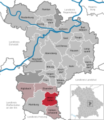 | |
 Attenhofen  Attenhofen | |
| Coordinates: 48°39′N11°51′E / 48.650°N 11.850°E | |
| Country | Germany |
| State | Bavaria |
| Admin. region | Niederbayern |
| District | Kelheim |
| Municipal assoc. | Mainburg |
| Government | |
| • Mayor (2020–26) | Franz Stiglmaier [1] |
| Area | |
• Total | 31.48 km2 (12.15 sq mi) |
| Elevation | 465 m (1,526 ft) |
| Population (2023-12-31) [2] | |
• Total | 1,400 |
| • Density | 44/km2 (120/sq mi) |
| Time zone | UTC+01:00 (CET) |
| • Summer (DST) | UTC+02:00 (CEST) |
| Postal codes | 84091 |
| Dialling codes | 08751 |
| Vehicle registration | KEH |
| Website | www |
Attenhofen is a municipality located in the district of Kelheim in Bavaria in Germany.
