The Saône is a river in eastern France. It is a right tributary of the Rhône, rising at Vioménil in the Vosges department and joining the Rhône in Lyon, at the southern end of the Presqu'île.

The Aller is a 215-kilometre-long (134 mi) river in the states of Saxony-Anhalt and Lower Saxony in Germany. It is a right-hand, and hence eastern, tributary of the Weser and is also its largest tributary. Its last 117 kilometres (73 mi) form the Lower Aller federal waterway. The Aller was extensively straightened, widened and, in places, dyked, during the 1960s to provide flood control of the river. In a 20-kilometre-long (12 mi) section near Gifhorn, the river meanders in its natural river bed.

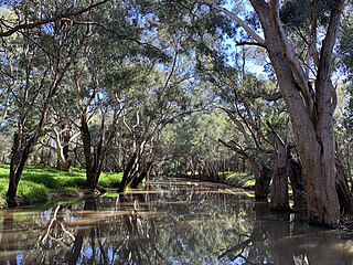
Gwydir River, a major inland perennial river of the Barwon catchment within the Murray–Darling basin, is located in the Northern Tablelands, North West Slopes, and Orana districts of New South Wales, Australia.

The Waipā River is in the Waikato region of the North Island of New Zealand. The headwaters are in the Rangitoto Range east of Te Kuiti. It flows north for 115 kilometres (71 mi), passing through Ōtorohanga and Pirongia, before flowing into the Waikato River at Ngāruawāhia. It is the Waikato's largest tributary. The Waipā's main tributary is the Puniu River.

The Aconcagua River is a river in Chile that rises from the conflux of two minor tributary rivers at 1,430 metres (4,690 ft) above sea level in the Andes, Juncal River from the east and Blanco River from the south east. The Aconcagua river flows westward through the broad Aconcagua valley and enters the Pacific Ocean near the city of Concon, 20 kilometres (12 mi) north of Valparaíso.

Ahr is a river in Germany, a left tributary of the Rhine. Its source is at an elevation of approximately 470 metres (1,540 ft) above sea level in Blankenheim in the Eifel, in the cellar of a timber-frame house near the castle of Blankenheim. After 18 kilometres (11 mi) it crosses from North Rhine-Westphalia into Rhineland-Palatinate.

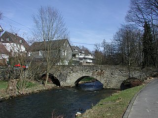
The Volme is a river in North Rhine-Westphalia, Germany, and is a tributary of the river Ruhr. It is 50.5 kilometres (31.4 mi) long, of which about 21 km (13 mi) lie within the city limits of Hagen. Its largest tributary is the Ennepe.

The Rur or Roer is a major river that flows through portions of Belgium, Germany and the Netherlands. It is a right (eastern) tributary to the Meuse. About 90 percent of the river's course is in Germany.

The Doubs is a 453-kilometre (281 mi) river in far eastern France which strays into western Switzerland. It is a left-bank tributary of the Saône. It rises near Mouthe in the western Jura mountains, at 946 metres (3,104 ft) and its mouth is at Verdun-sur-le-Doubs, a village and commune in Saône-et-Loire at about 175 m (574 ft) above sea level. It is the tenth-longest river in France.

The Sulm is a river in the Heilbronn district of Baden-Württemberg, Germany. It is an unnavigable right tributary of the Neckar. It rises in the Löwenstein Mountains and after 26.3 kilometres (16.3 mi) distance and 315 metres (1,033 ft) elevation drop flows into the Neckar at Bad Friedrichshall, near Untereisesheim and Neckarsulm. Its valley together with its tributary valleys is also known as the Weinsberg Valley, after Weinsberg, which is located there. The medieval region of Sulmgau, as well as the city of Neckarsulm, were named for it. The upper valley of the Sulm is a protected area.

The Pioneer River is a river in North Queensland, Australia. The 120-kilometre (75 mi) long river flows through the city of Mackay.

Himachal Pradesh provides water to both the Indus and Ganges basins. The drainage systems of the region are the Chenab, the Ravi, the Beas, the Satluj and the Yamuna. These rivers are perennial and are fed by snow and rainfall. They are protected by an extensive cover of natural vegetation.

The Swist is a stream, 43.6 kilometres (27.1 mi) long, in the German Rhineland. It rises on the northern edge of the Eifel at 330 metres above sea level and empties from the right and southeast into the Rhine tributary, the Erft, between Weilerswist and Bliesheim. Occasionally the Swist is also called the Swistbach, and locals often just call it der Bach.

The Große Aue is an 88-kilometre-long (55 mi), southwestern, left tributary of the River Weser in northern North Rhine-Westphalia and central Lower Saxony in Germany.

The Buckland River, a perennial river of the North-East Murray catchment of the Murray-Darling basin, is located in the Alpine region of Victoria, Australia. It flows from the eastern slopes of the Buffalo Range in the Australian Alps, joining with the Ovens River at Porepunkah.

The Argen is a river in Baden-Württemberg, Germany. It flows into Lake Constance between Kressbronn am Bodensee and Langenargen as the third largest tributary to the lake. It is 23.4 kilometres (14.5 mi) long; if one includes the Obere Argen and its source river Seelesgraben, the combined length is 73.2 kilometres (45.5 mi).
The Wiehl is a 33.6-kilometre-long, orographically left tributary of the River Agger in the German state of North Rhine-Westphalia. It is the longest river situated entirely within the county of Oberbergischer Kreis and the third longest tributary of the Agger.

Wipperfelder Bach is a river of North Rhine-Westphalia, Germany. It is 3.4 kilometres (2.1 mi) long. It is an orographic right tributary of the Kürtener Sülz.
Mirrool Creek, a watercourse that is part of the Lachlan sub-catchment of the Murrumbidgee catchment in the Murray–Darling basin, is in the Riverina region of New South Wales, Australia. The course of the Mirrool Creek is indefinite at various locations.

The Fensch or Fentsch is a river in the Moselle department of the Grand Est region of France. It is a left tributary of the Moselle, and thus a sub-tributary of the Rhine.