
The Ruhr is a river in western Germany, a right tributary (east-side) of the Rhine.

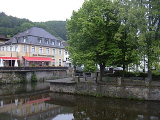
Ahr is a river in Germany, a left tributary of the Rhine. Its source is at an elevation of approximately 470 metres (1,540 ft) above sea level in Blankenheim in the Eifel, in the cellar of a timber-frame house near the castle of Blankenheim. After 18 kilometres (11 mi) it crosses from North Rhine-Westphalia into Rhineland-Palatinate.

The Wupper is a right tributary of the Rhine in the state of North Rhine-Westphalia, Germany. Rising near Marienheide in western Sauerland it runs through the mountainous region of the Bergisches Land in Berg County and enters the Rhine at Leverkusen, south of Düsseldorf. Its upper course is called the Wipper.

The Agger is a river in Germany, a right tributary of the Sieg in North Rhine-Westphalia. It is 69.5 kilometres (43.2 mi) long. Its source is in the Sauerland hills, near Meinerzhagen. It winds through the towns Engelskirchen, Overath and Lohmar. Near Siegburg the Agger flows into the Sieg.

The Swist is a stream, 43.6 kilometres (27.1 mi) long, in the German Rhineland. It rises on the northern edge of the Eifel at 330 metres above sea level and empties rom the right and southeast into the Rhine tributary, the Erft, between Weilerswist and Bliesheim. Occasionally the Swist is also called the Swistbach, and locals often just call it der Bach.

The Else is a left tributary of the river Werre in the northeast of North Rhine-Westphalia and in southern Lower Saxony. The Else is a distributary of the river Hase and begins at a river bifurcation near Melle.

The Arnsberg Forest Nature Park is a nature park in the districts of Hochsauerlandkreis and Soest within the administrictive region of Arnsberg in the German state of North Rhine-Westphalia. The park was established in 1960 and covers an area of 482 km². Nearly 350 km² of the protection is forested and the park's wooded hills rise up to 581.5 m above sea level (NN).
The Olef is a river in Liège, Belgium and North Rhine-Westphalia, Germany. It is 27.9 kilometres (17.3 mi) long and a left-hand tributary of the Urft. It flows through the Eifel Mountains in the western part of the Germany and eastern part of Belgium.

The Große Aue is an 88-kilometre-long (55 mi), southwestern, left tributary of the River Weser in northern North Rhine-Westphalia and central Lower Saxony in Germany.

The Aa is a 20.6 km long, orographic left tributary of the Nethe river in North Rhine-Westphalia, Germany. The Aa belongs as a tributary of the Nethe to the river system of the Weser.

The Armuthsbach is an 18.4-kilometre-long, orographically left-hand tributary of the Ahr in the German states of North Rhine-Westphalia and Rhineland-Palatinate.
Kleine Aa is a river of North Rhine-Westphalia, Germany, a tributary of the Aabach. Thus it is part of the Rhine River Basin.
Strombach is a river of North Rhine-Westphalia, Germany. It is a right tributary of the Agger.

Wipperfelder Bach is a river of North Rhine-Westphalia, Germany. It is 3.4 kilometres (2.1 mi) long. It is an orographic right tributary of the Kürtener Sülz.

The Riveris is an orographically right-hand, southern tributary of the River Ruwer in the German state of Rhineland-Palatinate. It was impounded in 1953 by the Riveris Dam which inter alia supplies water to the town of Trier. The name Riveris is derived from the Latin and means "little river".
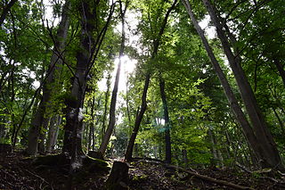
Münstereifel Forest is densely wooded region in the northern part of the Eifel mountains in North Rhine-Westphalia, Germany. In the south it borders on the state of Rhineland-Palatinate. It has an area of 237 km² and lies at a height of between 200 and 500 m above sea level (NHN).
The Kuttenbach is a 5.3 kilometre-long, orographically left-hand tributary of the Urft in North Rhine-Westphalia, Germany, in the municipality of Kall.

The Enz is a 37.9-kilometre-long (23.5 mi), orographically right-hand tributary of the Prüm in the Eifel mountains of Germany.
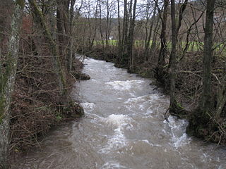
The Platißbach is a roughly seven-kilometre-long (4.3 mi), southern and orographically right-hand tributary of the River Olef in the municipality of Hellenthal in Germany.

The Aubach is an orographically left tributary of the River Wiehl in the German state of North Rhine-Westphalia.
