Look up Aubrey in Wiktionary, the free dictionary.
Aubrey is a given name and surname of French origin.
Contents
Aubrey may also refer to:
Aubrey is a given name and surname of French origin.
Aubrey may also refer to:

Mohave County occupies the northwestern corner of the U.S. state of Arizona. As of the 2020 census, its population was 213,267. The county seat is Kingman, and the largest city is Lake Havasu City. It is the fifth largest county in the United States.
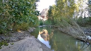
El Capitan is the name of a rock formation in Yosemite National Park, California.
The Big Sandy River is both an intermittent and perennial stream in Mohave and La Paz counties in northwestern Arizona in the United States. It begins where Cottonwood Wash and Trout Creek converge in the Hualapai Indian Reservation east of U.S. Route 93 then flows past Wikieup south of Kingman. The Big Sandy River then passes the Signal Ghost Town Site, meanders through the Arrastra Mountain Wilderness, and joins the Santa Maria River in Southern Mohave County to form the Bill Williams River. The Bill Williams River then empties into Alamo Lake State Park. The Big Sandy River is 55.7 miles (89.6 km) long.

The Hualapai are a federally recognized Native American tribe in Arizona with about 2300 enrolled citizens. Approximately 1353 enrolled citizens reside on the Hualapai Reservation, which spans over three counties in Northern Arizona.

The Hualapai Mountains are a mountain range located in Mohave County, east of Kingman, Arizona. Rising up to 8,417 feet at its highest peak, the higher elevations of the Hualapai Mountains support Madrean Sky Island habitats, and are host to a plethora of unique flora and fauna in a wide range of microclimates, high above the surrounding Mojave Desert.

The Cerbat Mountains is a mountain range in Mohave County in northwest Arizona immediately north of Kingman. The Cerbat Mountains and the White Hills (Arizona) adjacent north, are the dividing ranges between the Detrital Valley west, and the Hualapai Valley east.

Aubrey Cliffs are a series of cliff escarpments located in Coconino County, in northwestern Arizona.
The Centennial Wash (Mohave County) is a northern minor wash tributary to the west-flowing Bill Williams River. The wash drains from the western third of the Rawhide Mountains, and partially forms the southeast border of the wilderness at the northwest of the Rawhide's, the Aubrey Peak Wilderness.
The Rawhide Mountains are a mountain range of western Arizona, in the southwest of Mohave County. It is part of a block of mountain ranges on the north of an insular region called the Maria fold and thrust belt, containing mountain ranges, valleys, and plains. The Rawhide Mountains border the much smaller Artillery Mountains southeast, bordering on Alamo Lake State Park and the south-flowing Big Sandy River.
The Aubrey Peak Wilderness is a 15,400-acre (6,230 ha) wilderness administered by the Bureau of Land Management (BLM). The wilderness is located in northwest Arizona in the southwest of Mohave County, a region of the southeastern Mojave Desert's extension into northwest Arizona.
Aubrey Peak, also known as Grooms Peak, is a summit located 35 miles east-northeast of Lake Havasu City in Mohave County, Arizona and is in the Hualapai Mountains.
Dutch Flat of Arizona is a valley south of the Sacramento Valley and Interstate 40 in southern Mohave County.
The Aquarius Mountains are a 45-mi (72 km) long mountain range in southeast Mohave County, Arizona. The range lies in the northwest of the Arizona transition zone, and at the southwest of the Coconino Plateau, a subsection of the Colorado Plateau.
Aubrey Valley is a 35-mile (56 km) long valley located in southwest Coconino County, Arizona with the northwest border of Yavapai County. The valley is located at the southwest border of the Aubrey Cliffs; to the west and southwest, the Yampai Divide and the Seventyfour Plains form flatlands between four bordering mountain ranges at the northwest terminus of the Arizona transition zone.

The Toroweap Fault of northwest Arizona and southwest Utah is part of a fault system of the west Grand Canyon region, Arizona, US; also the west perimeter regions of the Coconino and Colorado Plateaus. The Hurricane Fault originates at the Toroweap Fault, in the region of the Colorado River, and strikes as the westerly depression of the Toroweap Fault. The Toroweap strikes northerly from the Colorado at the east of Toroweap Valley, and enters south Utah; from the Colorado River, the Hurricane Fault strikes north-northwest along the west flank of the small, regional Uinkaret Mountains, the west border of Toroweap Valley. The Hurricane Fault, and the Hurricane Cliffs strike into southwest Utah as part of the west, and southwest perimeter of the Colorado Plateau. The Hurricane Cliffs are made of Kaibab Limestone, an erosion resistant, cliff-forming rock unit.
The Peacock Mountains are a small, 26 mi (42 km) long mountain range in northwest Arizona, US. The range is a narrow sub-range, and an extension north, at the northeast of the Hualapai Mountains massif, which lies to the southwest. The range is defined by the Hualapai Valley to the northwest, and north and south-flowing washes on its east border, associated with faults and cliffs; the Cottonwood Cliffs are due east, and are connected to the Aquarius Cliffs southward at the west perimeter of the Aquarius Mountains; the cliffs are a result of the Aquarius Fault, which is an extension southward from the Grand Wash Cliffs and Grand Wash Fault which crosses the Colorado River at Lake Mead, and the west perimeter of the Grand Canyon/Colorado Plateau.
The Hualapai are a tribe of Native Americans that live in Arizona. Hualapai may also refer to:

Antares is an unincorporated community and census designated place (CDP) in Mohave County, Arizona, United States. As of the 2020 census, it had a population of 132. It exists along part of historic U.S. Route 66.

The Grand Wash Cliffs extend south-southeast from the Grand Canyon-Parashant National Monument in northwest Arizona west of the Shivwits Plateau south through the Grand Cliffs Wilderness and into the Lake Mead Recreation Area. The Grand Wash Cliffs cross the Grand Canyon where the Colorado River enters Lake Mead. To the south of the Grand Canyon the Grand Wash Cliffs continue past the east side of Grapevine Mesa and then southeast above and east of the Hualapai Valley forming the southwest margin of the Music Mountains.

Hualapai Peak is a 8,417-foot (2,566 m) mountain summit in Mohave County, Arizona and is the highest point of the Hualapai Mountains. It is located about 15 miles (24 km) southeast of Kingman in Hualapai Mountain County Park.