Related Research Articles

Protected areas of Australia include Commonwealth and off-shore protected areas managed by the Australian government, as well as protected areas within each of the six states of Australia and two self-governing territories, the Australian Capital Territory and the Northern Territory, which are managed by the eight state and territory governments.

Dhilba Guuranda–Innes National Park, formerly Innes National Park, is an IUCN-designated protected area in the Australian state of South Australia located on the southwest tip of Yorke Peninsula about 300 kilometres (190 mi) west of the state capital of Adelaide. It is a popular destination for camping, bushwalking, fishing, surfing and scuba diving.

Pitt Street is a major street in the Sydney central business district in New South Wales, Australia. The street runs through the entire city centre from Circular Quay in the north to Waterloo, although today's street is in two disjointed sections after a substantial stretch of it was removed to make way for Sydney's Central railway station. Pitt Street is well known for the pedestrian only retail centre of Pitt Street Mall, a section of the street which runs from King Street to Market Street.

North Sydney Council is a local government area on the Lower North Shore of Sydney, New South Wales, Australia, established on 29 July 1890 through the amalgamation of three boroughs.
The National Pollutant Inventory (NPI) is a database of Australian pollution emissions managed by the Australian Commonwealth, State and Territory Governments. A condensed version of the information collected is available to the public via the NPI website www.npi.gov.au.

Semaphore is a northwestern suburb of Adelaide in the Australian state of South Australia. It is located on the Gulf St Vincent coastline of the Lefevre Peninsula about 14 kilometres (8.7 mi) from the Adelaide city centre.

Wine Australia is an Australian Government statutory corporation that promotes and regulates the Australian wine industry. It was created as the Australian Wine and Brandy Corporation (AWBC) in 1981 to replace the Australian Wine Board by the Australian Wine and Brandy Corporation Act 1980, and had its name changed by the amended Wine Corporation Act 1980, passed in December 2010. Wine Australia is now governed by the superseding law, Wine Australia Act 2013. Wine Australia determines the boundaries of Australia's wine regions and sometimes names them. Wine Australia also regulates wine exports, ensuring the quality and integrity of each shipment of wine exported. Wine Australia has three main departments; Compliance, Market Development and Knowledge Development.
The Natural Heritage Trust (NHT), or National Heritage Trust Account was set up in 1997 by means of the Natural Heritage Trust of Australia Act 1997, with the main objective of conserving the "natural capital infrastructure" of Australia. Money from the NHT Account must be spent on the environment, sustainable agriculture and natural resources management (NRM). Since its establishment, a considerable number of community groups and organisations have received funding for environmental and natural resource management projects, delivered via a number of different initiatives since 1997. As of June 2020, the NHT account is funding a program known as Phase Two of the National Landcare Program. The original National Landcare Program was launched in 1992, but in 2014 merged with the Caring for our Country program.

The Environment Protection and Biodiversity Conservation Act 1999(Cth) is an Act of the Parliament of Australia that provides a framework for protection of the Australian environment, including its biodiversity and its natural and culturally significant places. Enacted on 17 July 2000, it established a range of processes to help protect and promote the recovery of threatened species and ecological communities, and preserve significant places from decline. The Act is as of June 2020 administered by the Department of Agriculture, Water and the Environment. Lists of threatened species are drawn up under the Act, and these lists, the primary reference to threatened species in Australia, are available online through the Species Profile and Threats Database (SPRAT).

The Grafton Bridge is a heritage-listed bascule truss bridge that carries the Bent Street and North Coast railway line across the Clarence River in Grafton, New South Wales, Australia. The bridge links the Grafton central business district with South Grafton, and was added to the New South Wales State Heritage Register on 2 April 1999.
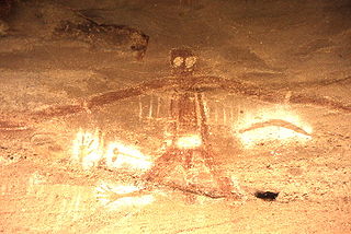
An Australian Aboriginal sacred site is a place deemed significant and meaningful by Aboriginal Australians based on their beliefs. It may include any feature in the landscape, and in coastal areas, these may lie underwater. The site's status is derived from an association with some aspect of social and cultural tradition, which is related to ancestral beings, collectively known as Dreamtime, who created both physical and social aspects of the world. The site may have its access restricted based on gender, clan or other Aboriginal grouping, or other factors.

Colonel Walter Liberty Vernon was an English architect who migrated to Australia and pursued his career as an architect in Sydney, New South Wales. In his role as the New South Wales Government Architect he is noted for designing multiple government buildings, many of which are extant with listings on national and state heritage registers.
Australian heritage laws exist at the national (Commonwealth) level, and at each of Australian Capital Territory, New South Wales, Northern Territory, Queensland, South Australia, Tasmania, Victoria, Western Australia state and territory levels. Generally there are separate laws governing Aboriginal cultural heritage and sacred sites, and historical heritage. State laws also allow heritage to be protected through local government regulations, such as planning schemes, as well.
The Australian Heritage Database is a searchable online database of heritage sites in Australia. It is maintained by the Department of Agriculture, Water and the Environment as of 2022, in consultation with Australian Heritage Council. There are more than 20,000 entries in the database, which includes natural, historic and Indigenous heritage places, held in separately maintained lists.
The Australasian Underwater Cultural Heritage Database (AUCHD) is an online, searchable database containing data on shipwrecks, aircraft that have been submerged underwater or wrecked on the shore, and other artefacts of cultural significance which are or have been underwater. It includes what used to be called the Australian National Shipwreck Database (ANSDB), originally developed by the Australasian Institute of Maritime Archaeology in December 2009, now significantly expanded to include other objects. The database was hosted and maintained by the Department of the Environment and Energy until the environment functions of that department, including AUCHD, were taken over by the Department of Agriculture, Water and the Environment on 1 February 2020.
Daguragu, previously also known as Wattie Creek by the Gurindji people, is a locality in the Northern Territory of Australia located about 551 kilometres (342 mi) south of the territory capital of Darwin and located about 460 kilometres (290 mi) south-west of the municipal seat in Katherine. Daguragu community is situated on Aboriginal land held under perpetual title; it was also formerly a local government area until its amalgamation into the Victoria Daly Shire on 1 July 2008.
The Department of the Environment and Energy (DEE) was an Australian government department in existence between 2016 and 2020.
The Australian Department of Agriculture, Water and the Environment (DAWE) was an Australian Government department which operated from 1 February 2020 until 30 June 2022. It represented Australia's national interests in agriculture, water and the environment.
This is a list of places on the Commonwealth Heritage List in Western Australia. The Commonwealth Heritage List is a heritage register which lists places of historic, cultural and natural heritage on Commonwealth land or in Commonwealth waters, or owned or managed by the Commonwealth Government. To be listed, a place has to meet one or more of the nine Commonwealth Heritage List criteria.
References
- ↑ "About the Australian Heritage Places Inventory". Department of Agriculture, Water and the Environment, Australian Government. 6 August 2015. Retrieved 21 April 2020.