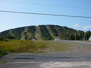
Authier-Nord, Quebec

Last updated
Authier-Nord
Municipality
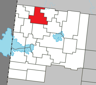
Authier-Nord Quebec location diagram.png
Location within Abitibi-Ouest RCM.
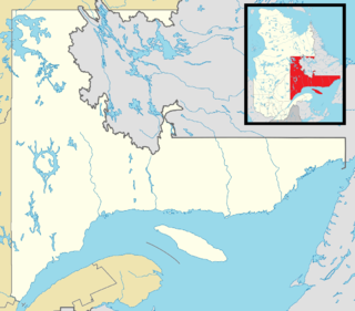
Canada Western Quebec location map.png
Red pog.svg

Authier-Nord
Location in western Quebec.
Coordinates: 48°50′N78°52′W / 48.833°N 78.867°W / 48.833; -78.867 Coordinates: 48°50′N78°52′W / 48.833°N 78.867°W / 48.833; -78.867 [1]
CountryFlag of Canada.svg  Canada
Province Flag of Quebec.svg  Quebec
Region Abitibi-Témiscamingue
RCM Abitibi-Ouest
Settled c. 1922
Constituted January 1, 1983
Government [2]
  Mayor Alain Gagnon
   Federal riding Abitibi—Témiscamingue
   Prov. riding Abitibi-Ouest
Area [2] [3]
  Total 294.40 km2 (113.67 sq mi)
  Land 280.92 km2 (108.46 sq mi)
Population (2011) [3]
  Total 273
  Density 1.0/km2 (3/sq mi)
  Pop 2006-2011Decrease2.svg 13.9%
  Dwellings 103
Time zone EST (UTC−5)
  Summer (DST) EDT (UTC−4)
Postal code(s) J0Z 1E0
Area code(s) 819
Highways No major routes
Website authier-nord.ao.ca

Authier-Nord is a municipality in northwestern Quebec, Canada, in the Abitibi-Ouest Regional County Municipality. It covers 289.79 km² and had a population of 273 as of the Canada 2011 Census.
Quebec Province of Canada

Quebec is one of the thirteen provinces and territories of Canada. It is bordered to the west by the province of Ontario and the bodies of water James Bay and Hudson Bay; to the north by Hudson Strait and Ungava Bay; to the east by the Gulf of Saint Lawrence and the province of Newfoundland and Labrador; and to the south by the province of New Brunswick and the U.S. states of Maine, New Hampshire, Vermont, and New York. It also shares maritime borders with Nunavut, Prince Edward Island, and Nova Scotia. Quebec is Canada's largest province by area and its second-largest administrative division; only the territory of Nunavut is larger. It is historically and politically considered to be part of Central Canada.

Canada Country in North America

Canada is a country in the northern part of North America. Its ten provinces and three territories extend from the Atlantic to the Pacific and northward into the Arctic Ocean, covering 9.98 million square kilometres, making it the world's second-largest country by total area. Canada's southern border with the United States is the world's longest bi-national land border. Its capital is Ottawa, and its three largest metropolitan areas are Toronto, Montreal, and Vancouver. As a whole, Canada is sparsely populated, the majority of its land area being dominated by forest and tundra. Consequently, its population is highly urbanized, with over 80 percent of its inhabitants concentrated in large and medium-sized cities, many near the southern border. Canada's climate varies widely across its vast area, ranging from arctic weather in the north, to hot summers in the southern regions, with four distinct seasons.
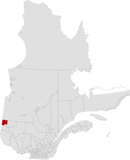
Abitibi-Ouest Regional County Municipality Regional county municipality in Quebec, Canada

Abitibi-Ouest Regional County Municipality is a regional county municipality located in the Abitibi-Témiscamingue region of Quebec. Its seat is La Sarre.

Contents

The municipality was incorporated on January 1, 1983.

Demographics

Population

Canada census – Authier-Nord, Quebec community profile
2011 2006
Population:273 (-13.9% from 2006)317 (-5.9% from 2001)
Land area:280.92 km2 (108.46 sq mi)280.92 km2 (108.46 sq mi)
Population density:1.0/km2 (2.6/sq mi)1.1/km2 (2.8/sq mi)
Median age:37.9 (M: 34.5, F: 41.0)34.1 (M: 36.0, F: 31.8)
Total private dwellings:103142
Median household income:$.N/A$55,167
Notes: 2011 income data for this area has been suppressed for data quality or confidentiality reasons. – References: 2011 [4] 2006 [5] earlier [6]
Historical Census Data - Authier-Nord, Quebec [7]
YearPop.±%
1991 377    
1996 374−0.8%
YearPop.±%
2001 337−9.9%
2006 317−5.9%
YearPop.±%
2011 273−13.9%

Language

Canada Census Mother Tongue - Authier-Nord, Quebec [7]
Census Total
French
English
French & English
Other
Year Responses Count Trend Pop % Count Trend Pop % Count Trend Pop % Count Trend Pop %
2011
275
275Steady2.svg 0.0% 100.00% 0Steady2.svg 0.0% 0.00% 0Steady2.svg 0.0% 0.00% 0Steady2.svg 0.0% 0.00%
2006
275
275Decrease2.svg 19.1% 100.00% 0Steady2.svg 0.0% 0.00% 0Steady2.svg 0.0% 0.00% 0Steady2.svg 0.0% 0.00%
2001
340
340 Decrease2.svg 11.7% 100.00% 0Steady2.svg 0.0% 0.00% 0 Steady2.svg 0.0% 0.00% 0Steady2.svg 0.0% 0.00%
1996
385
385 n/a 100.00% 0 n/a 0.00% 0 n/a 0.00% 0 n/a 0.00%

See also

Municipal council

Related Research Articles

Antoine-Labelle Regional County Municipality Regional county municipality in Quebec, Canada

Antoine-Labelle is a regional county municipality located in the Laurentides region of Quebec, Canada. Its seat is Mont-Laurier. It is named for Antoine Labelle.

DAutray Regional County Municipality Regional county municipality in Quebec, Canada

D'Autray is a regional county municipality in the Lanaudière region of Quebec, Canada. Its seat is Berthierville.

La Haute-Gaspésie Regional County Municipality Regional county municipality in Quebec, Canada

La Haute-Gaspésie is a regional county municipality in the Gaspésie–Îles-de-la-Madeleine region of eastern Quebec, Canada, on the Gaspé peninsula. The regional county municipality seat is in Sainte-Anne-des-Monts.

La Jacques-Cartier Regional County Municipality Regional county municipality in Quebec, Canada

La Jacques-Cartier is a regional county municipality in the Capitale-Nationale region of Quebec, Canada. The seat is in Shannon. It is named after the Jacques-Cartier River which runs through it and takes its source in its upper country.

Le Val-Saint-François Regional County Municipality Regional county municipality in Quebec, Canada

Le Val-Saint-François is a regional county municipality in the Estrie region of Quebec, Canada. The seat is Richmond.

Matawinie Regional County Municipality Regional county municipality in Quebec, Canada

Matawinie is a regional county municipality in the region of Lanaudière in southwestern Quebec, Canada. Its seat is Rawdon. The population according to the Canada 2011 Census is 49,516.

Témiscamingue Regional County Municipality Regional county municipality in Quebec, Canada

Témiscamingue is a regional county municipality in the Abitibi-Témiscamingue region of western Quebec, Canada. The county seat is Ville-Marie.

Hemmingford, Quebec (village) Village municipality in Quebec, Canada

Hemmingford is a village municipality located in Les Jardins-de-Napierville Regional County Municipality of southern Quebec. The population as of 2016 was 755.

Authier, Quebec Municipality in Quebec, Canada

Authier is a municipality in northwestern Quebec, Canada, in the Abitibi-Ouest Regional County Municipality. It had a population of 282 in the Canada 2011 Census.

Chazel, Quebec Municipality in Quebec, Canada

Chazel is a municipality in northwestern Quebec, Canada, in the Abitibi-Ouest Regional County Municipality. It had a population of 289 in the Canada 2011 Census.

Dupuy, Quebec Municipality in Quebec, Canada

Dupuy is a municipality in northwestern Quebec, Canada, in the Abitibi-Ouest Regional County Municipality. It covers 123.48 km² and had a population of 930 as of the Canada 2011 Census.

Clermont, Abitibi-Témiscamingue, Quebec Township municipality in Quebec, Canada

Clermont is a township municipality in northwestern Quebec, Canada, in Abitibi-Ouest Regional County Municipality. It had a population of 482 in the Canada 2011 Census. The population centre itself is also known as Saint-Vital-de-Clermont.

Rivière-Ojima, Quebec Unorganized territory in Quebec, Canada

Rivière-Ojima is an unorganized territory in the Abitibi-Témiscamingue region of Quebec, Canada. It consists of two non-contiguous areas in the Abitibi-Ouest Regional County Municipality, separated by the municipality of Authier-Nord. The communities of Languedoc and Saint-Eugène-de-Chazel are located within its boundaries.

Aguanish, Quebec Municipality in Quebec, Canada

Aguanish is a municipality and village in the Côte-Nord region of the province of Quebec in Canada.

Rivière-Saint-Jean, Quebec Municipality in Quebec, Canada

Rivière-Saint-Jean is a municipality and village in the Côte-Nord region of the province of Quebec in Canada.

Escuminac, Quebec Municipality in Quebec, Canada

Escuminac is a municipality in Quebec, Canada, on the north shore of the Restigouche River.

Saint-Zénon-du-Lac-Humqui, Quebec Parish municipality in Quebec, Canada

Saint-Zénon-du-Lac-Humqui is a parish municipality in Quebec, Canada.

Sainte-Irène, Quebec Parish municipality in Quebec, Canada

Sainte-Irène is a parish municipality in Quebec, Canada. It is where the Quebec French version of King of the Hill takes place.

Saint-René-de-Matane, Quebec Municipality in Quebec, Canada

Saint-René-de-Matane is a municipality in Quebec, Canada.

References

  1. Reference number 133605 of the Commission de toponymie du Québec (in French)
  2. 1 2 "Authier-Nord". Répertoire des municipalités (in French). Ministère des Affaires municipales, des Régions et de l'Occupation du territoire. Retrieved 2011-01-10.
  3. 1 2 "Authier-Nord census profile". 2011 Census data . Statistics Canada. Retrieved 2011-01-10.
  4. "2011 Community Profiles". Canada 2011 Census . Statistics Canada. July 5, 2013. Retrieved 2014-03-30.
  5. "2006 Community Profiles". Canada 2006 Census . Statistics Canada. March 30, 2011. Retrieved 2014-03-30.
  6. "2001 Community Profiles". Canada 2001 Census . Statistics Canada. February 17, 2012.
  7. 1 2 Statistics Canada: 1996, 2001, 2006, 2011 census