La Sarre

Last updated • 3 min readFrom Wikipedia, The Free Encyclopedia

La Sarre
LaSarre.jpg
Church of La Sarre
Blason ville ca La Sarre (Quebec).svg
Motto: 
Oblivisci Nescius
La Sarre Quebec location diagram.png
Location within Abitibi-Ouest RCM
Canada Western Quebec location map.png
Red pog.svg
La Sarre
Location in western Quebec
Coordinates: 48°48′N79°12′W / 48.800°N 79.200°W / 48.800; -79.200 [1]
Country Canada
Province Quebec
Region Abitibi-Témiscamingue
RCM Abitibi-Ouest
Settled1912
Constituted19 April 1980
Government
[2]
  MayorYves Dubé
   Federal riding Abitibi—Témiscamingue
   Prov. riding Abitibi-Ouest
Area
  Total
153.24 km2 (59.17 sq mi)
  Land148.36 km2 (57.28 sq mi)
Population
 (2021) [3]
  Total
7,358
  Density49.6/km2 (128/sq mi)
  Pop (2016-21)
Increase2.svg 1.0%
  Dwellings
3,698
Time zone UTC−5 (EST)
  Summer (DST) UTC−4 (EDT)
Postal code(s)
J9Z
Area code 819
HighwaysQc111.svg R-111 Qc393.svg R-393
Website www.ville.lasarre.qc.ca OOjs UI icon edit-ltr-progressive.svg

La Sarre (French pronunciation: [lasaʁ] ) is a town in northwestern Quebec, Canada, and is the most populous town and seat of the Abitibi-Ouest Regional County Municipality. [1] [4] It is located at the intersection of Routes 111 and 393, on the La Sarre River, a tributary of Lake Abitibi.

Contents

In addition to La Sarre itself, the town's territory also includes the community of Bienvenu, located along Route 111 west of the La Sarre River.

History

Tribute panel to the pioneer families of La Sarre, installed in the municipal park. La Sarre-Panneau hommage aux familles pionnieres.jpg
Tribute panel to the pioneer families of La Sarre, installed in the municipal park.

Before colonization, the area was home to the indigenous Algonquin who called the place Wabakin, from wàba and akin meaning "there is a mountain of hardwood", and called the La Sarre River Adikameg Sibi, which was also identified as Amikitik. [1]

The first white settlers, six in number, settled as squatters on the land in the late 19th century and were discovered during the survey of the township in 1908. Real colonization began at the time when the National Transcontinental Railway running through the Abitibi region was completed. The first permanent pioneer family arrived in 1912, followed by more settlers and development drawn to the area for its mining, forestry, and agricultural potential, and resulted in the formation of the settlement. In 1915, the post office opened, and a year later, the La Sarre Township was proclaimed, named after the La Sarre Regiment that was recognized for its part in the Battle of Carillon and the capture of Fort Oswego. In 1917, the Township Municipality of La Sarre was established, the same year as the Parish of Saint-André-de-la-Sarre. The Hudson's Bay Company opened a post in 1932, and only operated until 1941. [1] [5]

In 1937, the village separated from the township and was incorporated as the Village Municipality of La Sarre. It gained town (ville) status on 17 August 1949. In April 1980, the town and township municipality merged to form the current municipality. [1]

Geography

Climate

La Sarre has a borderline humid continental climate (Köppen Dfb), close to a subarctic climate (Dfc). Winters are very cold and snowy, with an annual snowfall of 2.47 metres or 97.24 inches, although thaws due to inflows of warm air from the southeast can raise temperatures above freezing and on 6 February 1988 temperatures rose to a remarkable 20.5 °C or 68.9 °F. The hotter half of the year is pleasantly warm, though it can rain frequently.

Climate data for La Sarre
MonthJanFebMarAprMayJunJulAugSepOctNovDecYear
Record high °C (°F)7.8
(46.0)
20.5
(68.9)
17.0
(62.6)
29.0
(84.2)
31.7
(89.1)
35.0
(95.0)
37.2
(99.0)
33.3
(91.9)
32.2
(90.0)
26.1
(79.0)
17.8
(64.0)
11.1
(52.0)
37.2
(99.0)
Mean daily maximum °C (°F)−11.7
(10.9)
−8.9
(16.0)
−1.8
(28.8)
7.2
(45.0)
15.9
(60.6)
21.5
(70.7)
23.5
(74.3)
21.5
(70.7)
15.7
(60.3)
8.7
(47.7)
−0.6
(30.9)
−8.6
(16.5)
6.9
(44.4)
Daily mean °C (°F)−18.2
(−0.8)
−16.2
(2.8)
−8.8
(16.2)
0.8
(33.4)
8.9
(48.0)
14.3
(57.7)
16.9
(62.4)
15.2
(59.4)
10.3
(50.5)
4.3
(39.7)
−4.5
(23.9)
−14
(7)
0.7
(33.3)
Mean daily minimum °C (°F)−24.6
(−12.3)
−23.4
(−10.1)
−15.7
(3.7)
−5.7
(21.7)
1.8
(35.2)
7.0
(44.6)
10.3
(50.5)
8.7
(47.7)
4.7
(40.5)
−0.2
(31.6)
−8.4
(16.9)
−19.4
(−2.9)
−5.4
(22.3)
Record low °C (°F)−47
(−53)
−47
(−53)
−43.9
(−47.0)
−31.7
(−25.1)
−12
(10)
−6.7
(19.9)
−2
(28)
−3.5
(25.7)
−8.5
(16.7)
−13
(9)
−34
(−29)
−44.5
(−48.1)
−47
(−53)
Average precipitation mm (inches)58.6
(2.31)
37.9
(1.49)
52.4
(2.06)
55.9
(2.20)
78.2
(3.08)
84.7
(3.33)
101.0
(3.98)
99.0
(3.90)
110.7
(4.36)
81.5
(3.21)
67.6
(2.66)
62.3
(2.45)
889.8
(35.03)
Average rainfall mm (inches)5.4
(0.21)
2.8
(0.11)
14.4
(0.57)
40.5
(1.59)
74.8
(2.94)
84.7
(3.33)
101
(4.0)
99
(3.9)
110.1
(4.33)
73.5
(2.89)
30.1
(1.19)
7.3
(0.29)
643.6
(25.35)
Average snowfall cm (inches)53.3
(21.0)
35.1
(13.8)
38
(15)
15.5
(6.1)
3.4
(1.3)
0
(0)
0
(0)
0
(0)
0.6
(0.2)
8.1
(3.2)
37.5
(14.8)
55
(22)
246.5
(97.4)
Average precipitation days (≥ 0.2 mm)14.811.010.210.012.613.414.814.416.114.915.116.7164
Average rainy days (≥ 0.2 mm)0.760.673.17.412.313.414.814.415.913.35.51.5103.03
Average snowy days14.510.78.44.30.80.00.00.00.32.811.015.768.5
Source: Environment Canada [6]

Demographics

In the 2021 Census of Population conducted by Statistics Canada, La Sarre had a population of 7,358 living in 3,493 of its 3,698 total private dwellings, a change of

Canada census – La Sarre community profile
2021 2016 2011
Population7,358 (+1.0% from 2016)7,282 (-5.7% from 2011)7,719 (+5.2% from 2006)
Land area148.36 km2 (57.28 sq mi)148.50 km2 (57.34 sq mi)148.74 km2 (57.43 sq mi)
Population density49.6/km2 (128/sq mi)49.0/km2 (127/sq mi)51.9/km2 (134/sq mi)
Median age50.4 (M: 48.8, F: 52.8)48.2 (M: 46.3, F: 50.5)46.6 (M: 44.9, F: 47.9)
Private dwellings3,698 (total)  3,493 (occupied)3,643 (total) 3,617 (total) 
Median household income$59,600$52,119$43,315
References: 2021 [7] 2016 [8] 2011 [9]
Historical Census Data - La Sarre, Quebec
YearPop.±%
1941 2,167    
1951 2,744+26.6%
1956 3,155+15.0%
1961 3,944+25.0%
1966 4,798+21.7%
1971 5,185+8.1%
1976 4,978−4.0%
1981 8,861+78.0%
YearPop.±%
1986 8,622−2.7%
1991 8,513−1.3%
1996 8,345−2.0%
2001 7,728−7.4%
2006 7,336−5.1%
2011 7,719+5.2%
2016 7,282−5.7%
2021 7,358+1.0%
Source: Statistics Canada [10]
Canada Census Mother Tongue - La Sarre, Quebec [10]
CensusTotal
French
English
French & English
Other
YearResponsesCountTrendPop %CountTrendPop %CountTrendPop %CountTrendPop %
2021
7,310
7,175Increase2.svg 0.6%98.2%35Decrease2.svg 22.2%0.5%40Increase2.svg 100.0%0.5%40Steady2.svg 0.0%0.5%
2016
7,235
7,130Decrease2.svg 5.1%98.5%45Decrease2.svg 30.8%0.6%20Decrease2.svg 33.3%0.3%40Decrease2.svg 33.3%0.6%
2011
7,665
7,510Increase2.svg 5.8%98.0%65Increase2.svg 30.0%0.9%30Increase2.svg 20.0%0.4%60Increase2.svg 33.3%0.8%
2006
7,220
7,100Decrease2.svg 5.6%98.3%50Increase2.svg 66.7%0.7%25Decrease2.svg 16.7%0.4%45Decrease2.svg 18.2%0.6%
2001
7,635
7,520Decrease2.svg 8.0%98.5%30Increase2.svg 20.0%0.4%30Steady2.svg 0.0%0.4%55Increase2.svg 450.0%0.7%
1996
8,240
8,175n/a99.2%25n/a0.3%30n/a0.4%10n/a0.1%

Economy

The main local resource is the forest, which covers over 4,700 square kilometres (1,800 sq mi) and provides lumber to the town's main employers Norbord and Tembec, as well as agriculture, with over 60% of its land under cultivation. The mining industry, together with small service sector businesses, complements the economy. [1] [5] The area's flying needs are served by La Sarre Airport.

Government

Municipal council

List of mayors

Former mayors of La Sarre were: [11]

Notable people

See also

Related Research Articles

<span class="mw-page-title-main">Rouyn-Noranda</span> City in Quebec, Canada

Rouyn-Noranda is a city on Osisko Lake in the Abitibi-Témiscamingue region of Quebec, Canada.

<span class="mw-page-title-main">Abitibi-Ouest Regional County Municipality</span> Regional county municipality in Quebec, Canada

Abitibi-Ouest Regional County Municipality is a regional county municipality located in the Abitibi-Témiscamingue region of Quebec. Its seat is La Sarre.

<span class="mw-page-title-main">Abitibi—Témiscamingue (electoral district)</span> Federal electoral district in Quebec, Canada

Abitibi—Témiscamingue is a federal electoral district in Quebec, Canada, that has been represented in the House of Commons of Canada since 2004. The area was also represented by the electoral district of Témiscamingue from 1968 until 2004.

<span class="mw-page-title-main">Val-d'Or</span> City in Quebec, Canada

Val-d'Or is a city in Quebec, Canada with a population of 32,752 inhabitants according to the 2021 Canadian census. The city is located in the Abitibi-Témiscamingue region near La Vérendrye Wildlife Reserve.

<span class="mw-page-title-main">La Tuque, Quebec</span> City in north-central Quebec, Canada

La Tuque is a city located in north-central Quebec, Canada, on the Saint-Maurice River, between Trois-Rivières and Chambord. The population was 11,129 at the 2021 Canadian census, most of which live within the urban area. At over 28,000 km2 (11,000 sq mi), it is the largest city in Canada by area.

<span class="mw-page-title-main">Abitibi-Témiscamingue</span> Administrative region in Quebec, Canada

Abitibi-Témiscamingue is an administrative region located in western Québec, Canada, along the border with Ontario. It became part of the province in 1898. It has a land area of 57,736.50 square kilometres (22,292.19 sq mi) and its population was 147,082 people as of the 2021 census. The region is divided into five regional county municipalities and 79 municipalities. Its economy continues to be dominated by resource extraction industries. These include logging and mining all along the rich geologic Cadillac Fault between Val-d'Or and Rouyn-Noranda, as well as agriculture.

<span class="mw-page-title-main">Amos, Quebec</span> Town in Quebec, Canada

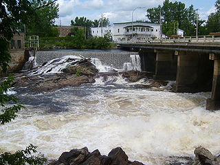
Amos is a town in northwestern Quebec, Canada, on the Harricana River. It is the seat of Abitibi Regional County Municipality.

<span class="mw-page-title-main">Roberval, Quebec</span> City in Quebec, Canada

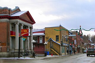
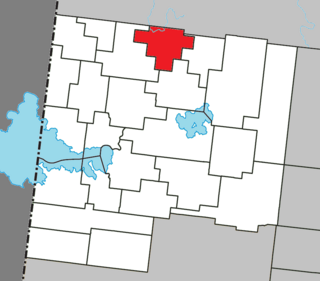
Roberval is a city on the south-western shore of Lac Saint-Jean in the Le Domaine-du-Roy Regional County Municipality of Quebec, Canada. With a population of 9,840 in the Canada 2021 Census, it is the fourth largest city on this lake after Alma, Dolbeau-Mistassini and Saint-Félicien. It is the seat of the Domaine-du-Roy RCM and the main service centre for the region with a hospital and some government services. It is also the seat of the judicial district of Roberval.

<span class="mw-page-title-main">Mont-Laurier</span> City in Quebec, Canada

Mont-Laurier is a town and incorporated municipality in western Quebec, Canada, located on the banks of the Lièvre River, a tributary of the Ottawa River. Known as the "Capital of the Haute-Laurentides", the motto of the town is Laurus elationis praemium, which translates to "Lift the laurels of reward". The demonym for its inhabitants is Lauriermontois.

<span class="mw-page-title-main">Coaticook</span> Town in southeastern Quebec, Canada

Coaticook is a town on the Coaticook River, located in southeastern Quebec, Canada. It resides in the region of Estrie, which is often referred to colloqually as the Eastern Townships. It is the seat of the Coaticook Regional County Municipality, and its southern border is also the Canada–United States border.

<span class="mw-page-title-main">Amqui</span> City in Quebec, Canada

Amqui is a town in eastern Quebec, Canada, at the base of the Gaspé peninsula in Bas-Saint-Laurent. Located at the confluence of the Humqui and Matapédia Rivers, it is the seat of La Matapédia Regional County Municipality. The main access road is Quebec Route 132.

<span class="mw-page-title-main">Malartic, Quebec</span> City in Quebec, Canada

Malartic is a town on the Malartic River in northwestern Quebec, Canada, in the La Vallée-de-l'Or Regional County Municipality. It is located about 80 kilometres (50 mi) east of the centre of Rouyn-Noranda along Quebec Route 117 and the Canadian National Railway.

<span class="mw-page-title-main">Senneterre</span> City in Quebec, Canada

Senneterre is a town in the Abitibi-Témiscamingue region of northwestern Quebec, Canada. It is in La Vallée-de-l'Or Regional County Municipality.

<span class="mw-page-title-main">Duparquet</span> City in Quebec, Canada

Duparquet is a city in northwestern Quebec, Canada, in the MRC d'Abitibi-Ouest of the Abitibi-Témiscamingue region. It covers 157.4 km2 (60.8 sq mi) and had a population of 716 as of the Canada 2021 Census.

<span class="mw-page-title-main">Macamic</span> City in Quebec, Canada

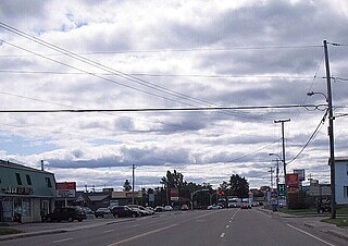
Macamic is a ville in northwestern Quebec, Canada, in the Abitibi-Ouest Regional County Municipality. It covers 202 km² and had a population of 2,744 in the 2021 Canadian census. It is located on the shores of the namesake Lake Macamic.

<span class="mw-page-title-main">Palmarolle</span> Municipality in Quebec, Canada

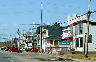
Palmarolle is a municipality in northwestern Quebec, Canada, in the Abitibi-Ouest Regional County Municipality. It covers 117.87 km2 and had a population of 1,386 as of the Canada 2021 Census. It is considered to have the best agricultural land of the entire Abitibi region.

<span class="mw-page-title-main">Roquemaure, Quebec</span> Municipality in Quebec, Canada

Roquemaure is a municipality in northwestern Quebec, Canada in the MRC d'Abitibi-Ouest. It covers 120.02 km2 and had a population of 409 as of the 2021 Canadian census.

<span class="mw-page-title-main">Sainte-Germaine-Boulé</span> Municipality in Quebec, Canada

Sainte-Germaine-Boulé is a municipality in northwestern Quebec, Canada, in the Abitibi-Ouest Regional County Municipality. It covers 110.04 square kilometres (42.49 sq mi) and had a population of 941 as of the 2021 Canadian census.

<span class="mw-page-title-main">Val-Saint-Gilles</span> Municipality in Quebec, Canada

Val-Saint-Gilles is a municipality in northwestern Quebec, Canada, in the Abitibi-Ouest Regional County Municipality about 24 kilometres (15 mi) north of La Sarre. It covers 109.39 km² and with a population of 169 in the 2021 Canadian census, it is the least populous incorporated municipality in the regional county.

<span class="mw-page-title-main">Saint-Alphonse, Quebec</span> Municipality in Quebec, Canada

Saint-Alphonse is a municipality in Quebec, Canada.

References

  1. 1 2 3 4 5 6 "La Sarre (Ville)" (in French). Commission de toponymie du Québec. Retrieved 4 January 2011.
  2. 1 2 "La Sarre". Répertoire des municipalités (in French). Ministère des Affaires municipales et de l'Habitation. Retrieved 29 June 2023.
  3. 1 2 3 "La Sarre (Code 2487090) Census Profile". 2021 census . Government of Canada - Statistics Canada.
  4. "Région 08: Abitibi—Témiscamingue (page 3)" (PDF). Archived from the original (PDF) on 20 May 2018. Retrieved 6 January 2011.
  5. 1 2 "Histoire de La Sarre" (in French). Ville de La Sarre. Archived from the original on 6 July 2011. Retrieved 4 January 2011.
  6. Environment Canada Canadian Climate Normals 1971-2000, accessed 23 July 2010
  7. "2021 Community Profiles". 2021 Canadian census . Statistics Canada. 4 February 2022. Retrieved 19 October 2023.
  8. "2016 Community Profiles". 2016 Canadian census . Statistics Canada. 12 August 2021. Retrieved 29 June 2023.
  9. "2011 Community Profiles". 2011 Canadian census . Statistics Canada. 21 March 2019. Retrieved 21 March 2014.
  10. 1 2 1996, 2001, 2006, 2011, 2016, 2021 census
  11. "Historique des maires" (in French). Ville de La Sarre. Archived from the original on 6 July 2011. Retrieved 5 January 2011.