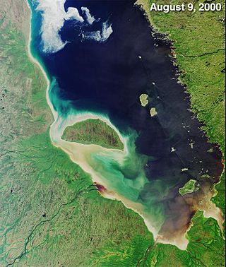
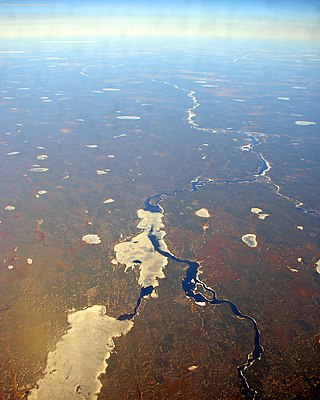
James Bay is a large body of water located on the southern end of Hudson Bay in Canada. It borders the provinces of Quebec and Ontario, and is politically part of Nunavut. Its largest island is Akimiski Island.

The Ottawa River is a river in the Canadian provinces of Ontario and Quebec. It is named after the Algonquin word 'to trade', as it was the major trade route of Eastern Canada at the time. For most of its length, it defines the border between these two provinces. It is a major tributary of the St. Lawrence River and the longest river in Quebec.

The Abitibi River is a river in northeastern Ontario, Canada, which flows northwest from Lake Abitibi to join the Moose River which empties into James Bay. This river is 540 kilometres (340 mi) long, and descends 265 metres (869 ft). It is the ninth longest river in Ontario, Behind the Ottawa River (1,271km), St. Lawrence River (1.197km), Severn River (982km), Albany River (982km), Winnipeg River (813km), Attawapiskat River (748km), English River (615km) and Moose River(547km).

Lake Nipigon is part of the Great Lakes drainage basin. It is the largest lake entirely within the boundaries of the Canadian province of Ontario.
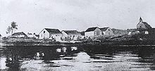
Moose Factory is a community in the Cochrane District, Ontario, Canada. It is located on Moose Factory Island, near the mouth of the Moose River, which is at the southern end of James Bay. It was the first English-speaking settlement in lands now making up Ontario and the second Hudson's Bay Company post to be set up in North America after Fort Rupert. On the mainland, across the Moose River, is the nearby community of Moosonee, which is accessible by water taxi in the summer, ice road in the winter, and chartered helicopter in the off-season.
The Albany River is a river in Northern Ontario, Canada, which flows northeast from Lake St. Joseph in Northwestern Ontario and empties into James Bay. It is 982 kilometres (610 mi) long to the head of the Cat River, tying it with the Severn River for the title of longest river entirely in Ontario. Major tributaries include the Kenogami River and Ogoki River.

Biscotasing, often referred to as simply Bisco, is a community in the Unorganized North Part of Sudbury District in Northeastern Ontario, Canada. It was founded on the shores of Lake Biscotasi on the Spanish River in 1884 by Canadian Pacific Railway as a railway construction town, and the first divisional point west of Sudbury. The rails of westward track laying gangs reached this area in October 1884.
Pierre de Troyes was a captain that led the French capture of Moose Factory, Rupert House, and Fort Albany on Hudson Bay 1686.

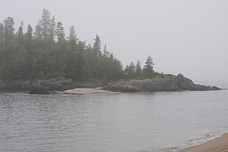
Batchawana Bay is a small bay in Algoma District in Northeastern Ontario, Canada. It is on the eastern shore of Lake Superior, approximately 50 kilometres (31 mi) north of Sault Ste. Marie.

The Harricana River is a river in western Quebec and northeastern Ontario, Canada. It is 533 kilometres (331 mi) long, has a drainage area of 29,300 square kilometres (11,300 sq mi), and has a mean discharge of 570 cubic metres per second (20,000 cu ft/s). While 80% of its drainage area is in Quebec, the river flows for a short distance through Ontario before it ends in Hannah Bay off James Bay.

Apitipi Anicinapek Nation, formerly known as Wahgoshig First Nation, is an Algonquin Anicinape community, located near Matheson in Cochrane District in northeastern Ontario, Canada. In January 2008, the First Nation had 270 people registered with the nation, of which their on-reserve population was 121.

The Frederick House River is a river in the James Bay and Moose River drainage basins in Cochrane District in northeastern Ontario, Canada. It flows 100 kilometres (62 mi) from Night Hawk Lake in the city of Timmins to its mouth at the Abitibi River in Cochrane, Unorganized, North Part. Both the river and the associated Hudson's Bay Company Frederick House post (1785–1821) are named for Prince Frederick, Duke of York and Albany, son of George III of the United Kingdom,
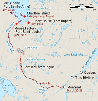
The Hudson Bay expedition of 1686 was one of the Anglo-French conflicts on Hudson Bay. It was the first of several expeditions sent from New France against the trading outposts of the Hudson's Bay Company in the southern reaches of Hudson Bay. Led by the Chevalier de Troyes, the expedition captured the outposts at Moose Factory, Rupert House, Fort Albany, and the company ship Craven.

The Groundhog River is a river in Cochrane District and Sudbury District in Northeastern Ontario, Canada. The river is in the James Bay drainage basin and is a left tributary of the Mattagami River.
The Mattawasaga River is a tributary of Abitibi Lake, flowing through the townships of Harker Township, Marriott Township and Stoughton Township, in the Cochrane District, in Ontario, in Canada.

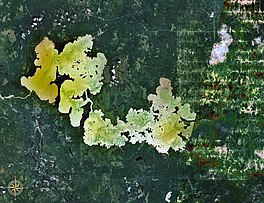
Turgeon Lake is a freshwater body located in the Northwest province of Quebec, in Canada. This body of water straddles the municipalities of:

La Cloche Provincial Park is a provincial park at the boundary of Algoma and Sudbury Districts in Ontario, Canada. The park consists of an unspoiled section of the La Cloche Mountains that stretch along the North Channel of Georgian Bay, as well as several islands in the channel.
Michipicoten Provincial Park is a park in Ontario, Canada, located at the mouth of the Michipicoten River. The park preserves the ruins of a French trading post that operated from the early 1700s until it was abandoned by the Hudson’s Bay Company in 1904.
Abitibi-De-Troyes Provincial Park is in Cochrane District of Northern Ontario, Canada. It was established in 1985 and provides backcountry canoeing, camping, hunting, fishing and nature viewing activities. The park is named after Pierre de Troyes who may have portaged across Long Point during his Hudson Bay expedition in 1686.

Kesagami Provincial Park is in Cochrane District of Northern Ontario, Canada. It was established in 1983 and provides backcountry canoeing, camping, and fishing opportunities. The bulk of the park consists of a large near-rectangular piece of land surrounding Kesagami Lake, as well as a linear park that protects a 200 metres (660 ft) wide strip of land on both sides of the Kesagami River from Kesagami Lake to its mouth at the Harricana River. Its name means "warm water".