Macamic

Last updated

Macamic
Macamic QC 1.JPG
Motto(s): 
Vois juste, probité engendre honneur ("Do right, integrity begets honour")
Macamic Quebec location diagram.png
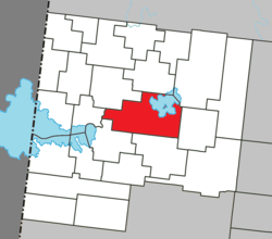
Location within Abitibi-Ouest RCM
Canada Western Quebec location map.png
Red pog.svg
Macamic
Location in western Quebec
Coordinates: 48°45′N79°00′W / 48.750°N 79.000°W / 48.750; -79.000 [1]
Country Canada
Province Quebec
Region Abitibi-Témiscamingue
RCM Abitibi-Ouest
Settled1913
ConstitutedMarch 6, 2002
Government
[2]
  MayorTony Boudreau
   Federal riding Abitibi—Témiscamingue
   Prov. riding Abitibi-Ouest
Area
  Total
240.62 km2 (92.90 sq mi)
  Land202.05 km2 (78.01 sq mi)
  Urban
[4]
2.00 km2 (0.77 sq mi)
Population
 (2021) [3]
  Total
2,744
  Density13.5/km2 (35/sq mi)
   Urban
[4]
1,352
  Urban density676.0/km2 (1,751/sq mi)
  Pop (2016-2021)
Decrease2.svg 0.3%
  Dwellings
1,188
Time zone UTC−5 (EST)
  Summer (DST) UTC−4 (EDT)
Postal code(s)
Area code 819
HighwaysQc101.svg R-101
Qc111.svg R-111
Qc393.svg R-393
Website www.villemacamic.qc.ca OOjs UI icon edit-ltr-progressive.svg
Rue Principale Macamic QC 2.JPG
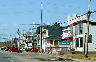
Rue Principale

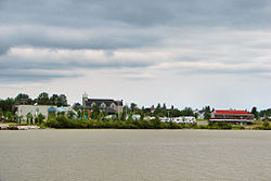
Macamic (French pronunciation: [makamik] ) is a ville in northwestern Quebec, Canada, in the Abitibi-Ouest Regional County Municipality. It covers 202 km² and had a population of 2,744 in the 2021 Canadian census. It is located on the shores of the namesake Lake Macamic.

Contents

In addition to Macamic itself, the town's territory also includes the community of Colombourg.

History

Colonization began at the time when the National Transcontinental Railway running through the Abitibi region was completed. The first pioneers, arriving circa 1913, were originally from Saint-Ignace-du-Lac, Pierreville, Stanfold, Nicolet, and Shawinigan. They settled south of Lake Macamic and the new settlement took the lake's name, often written also as Makamik. In the Algonquin language, the name Makamik means "limping beaver", from makis (crippled or disabled) and amik (beaver). [1]

In 1914, Makamik had 100 residents. In 1915, the year the post office opened, it had grown to 300, and the following year, when the Parish of Saint-Jean-l'Évangéliste-de-Macamic was formed, there were 500 persons. By 1918, the population had jumped to 1750 and the area was incorporated as the United Township Municipality of Royal-Roussillon-et-Poularies, named after the Royal-Roussillon Regiment of Montcalm's army and after lieutenant-colonel François-Médard de Poularies, commander of this regiment. [1] [5]

In 1919, the village itself separated from the united township and was incorporated as Village Municipality of Macamic, having a population of 2300 persons by 1920. In 1924, Poularies Township also separated from Royal-Roussillon-et-Poularies, which became the Parish Municipality of Royal-Roussillon-de-Macamic in 1952, and officially shortened to just Macamic in 1961. [1]

In 1955, the Village Municipality of Macamic changed its status to town (ville), and was regrouped with the Parish Municipality of Macamic on June 13, 2001, to form the new Town of Macamic. On March 2, 2002, the Municipality of Colombourg (incorporated in 1926) was merged into Macamic. [1]

Demographics

In the 2021 Census of Population conducted by Statistics Canada, Macamic had a population of 2,744 living in 1,142 of its 1,188 total private dwellings, a change of

Canada census – Macamic community profile
2021 2016 2011
Population2,744 (-0.3% from 2016)2,751 (+0.6% from 2011)2,734 (+0.3% from 2006)
Land area202.05 km2 (78.01 sq mi)202.70 km2 (78.26 sq mi)202.34 km2 (78.12 sq mi)
Population density13.6/km2 (35/sq mi)13.6/km2 (35/sq mi)13.5/km2 (35/sq mi)
Median age43.6 (M: 43.6, F: 43.6)45.8 (M: 44.6, F: 46.8)46.5 (M: 46.6, F: 46.3)
Private dwellings1,188 (total)  1,142 (occupied)1,179 (total) 1,148 (total) 
Median household income$73,500$62,763$60,961
References: 2021 [6] 2016 [7] 2011 [8] earlier [9] [10]
Historical census populations – Macamic
YearPop.±%
1921 1,104    
1931 821−25.6%
1941 645−21.4%
1951 1,123+74.1%
1956 1,388+23.6%
1961 1,614+16.3%
YearPop.±%
1966 1,770+9.7%
1971 1,705−3.7%
1976 1,733+1.6%
1981 1,791+3.3%
1986 1,821+1.7%
1991 1,833+0.7%
YearPop.±%
1996 1,711−6.7%
2001 1,519−11.2%
2006 2,726+79.5%
2011 2,734+0.3%
2016 2,751+0.6%
2021 2,744−0.3%
Between 2001 and 2006, the parish of Macamic and the municipality of Colombourg merged with the city of Macamic.
Source: [11]

Language

Canada Census Mother Tongue - Macamic, Quebec [11]
CensusTotal
French
English
French & English
Other
YearResponsesCountTrendPop %CountTrendPop %CountTrendPop %CountTrendPop %
2021
2,680
2,650Increase2.svg 1.5%98.9%15Steady2.svg 0.0%0.6%5Decrease2.svg 50.0%0.2%10Increase2.svg 100.0%0.4%
2016
2,645
2,610Increase2.svg 1.4%98.7%15Increase2.svg 50.0%0.6%10Increase2.svg 100.0%0.4%5Decrease2.svg 50.0%0.2%
2011
2,600
2,575Increase2.svg 1.6%99.0%10Increase2.svg n/a%0.4%5Decrease2.svg 50.0%0.2%10Increase2.svg n/a%0.4%
2006
2,550
2,535Increase2.svg 5.5%99.4%0Steady2.svg 0.0%0.0%10Increase2.svg n/a%0.4%0Steady2.svg 0.0%0.0%
2001
1,375
1,380Decrease2.svg 7.7%100.0%0Steady2.svg 0.0%0.0%0Steady2.svg 0.0%0.0%0Steady2.svg 0.0%0.0%
1996
1,500
1,495n/a99.7%0n/a0.0%0n/a0.0%0n/a0.0%

Government

Municipal council (as of 2024): [12]

List of former mayors (since formation of current municipality):

Political representation

Macamic federal election results [13]
Year Liberal Conservative Bloc Québécois New Democratic Green
2021 24%30316%20243%5386%742%27
2019 19%27230%43138%5567%1053%43
2015 28%2234%3322%17544%3492%14
2011 6%6010%10227%28456%5921%12
2008 22%20218%16847%43210%923%25
2006 12%11728%27948%48111%1092%24
2004 32%3086%6156%5332%203%30
Macamic provincial election results [14]
Year CAQ Liberal QC solidaire Parti Québécois
2022 42%3754%3318%15726%227
2018 43%66814%22016%24522%344
2014 17%26536%5417%10436%539
2012 21%22624%2626%6044%471

Federally, Macamic is part of the federal riding of Abitibi—Témiscamingue. In the 2021 Canadian federal election, the incumbent Sébastien Lemire of the Bloc Québécois was re-elected to represent the population Macamic in the House of Commons of Canada.

Provincially it is part of the riding of Abitibi-Ouest. In the 2022 Quebec general election the incumbent MNA Suzanne Blais, of the Coalition Avenir Québec, was re-elected to represent the population of Macamic in the National Assembly of Quebec.

Related Research Articles

<span class="mw-page-title-main">Abitibi-Ouest Regional County Municipality</span> Regional county municipality in Quebec, Canada

Abitibi-Ouest Regional County Municipality is a regional county municipality located in the Abitibi-Témiscamingue region of Quebec. Its seat is La Sarre.

<span class="mw-page-title-main">Abitibi—Témiscamingue (electoral district)</span> Federal electoral district in Quebec, Canada

Abitibi—Témiscamingue is a federal electoral district in Quebec, Canada, that has been represented in the House of Commons of Canada since 2004. The area was also represented by the electoral district of Témiscamingue from 1968 until 2004.

<span class="mw-page-title-main">Abitibi-Témiscamingue</span> Administrative region in Quebec, Canada

Abitibi-Témiscamingue is an administrative region located in western Québec, Canada, along the border with Ontario. It became part of the province in 1898. It has a land area of 57,736.50 square kilometres (22,292.19 sq mi) and its population was 147,082 people as of the 2021 census. The region is divided into five regional county municipalities and 79 municipalities. Its economy continues to be dominated by resource extraction industries. These include logging and mining all along the rich geologic Cadillac Fault between Val-d'Or and Rouyn-Noranda, as well as agriculture.

<span class="mw-page-title-main">Amos, Quebec</span> Town in Quebec, Canada

Amos is a town in northwestern Quebec, Canada, on the Harricana River. It is the seat of Abitibi Regional County Municipality.

<span class="mw-page-title-main">La Sarre</span> City in Quebec, Canada

La Sarre is a town in northwestern Quebec, Canada, and is the most populous town and seat of the Abitibi-Ouest Regional County Municipality. It is located at the intersection of Routes 111 and 393, on the La Sarre River, a tributary of Lake Abitibi.

<span class="mw-page-title-main">Senneterre</span> City in Quebec, Canada

Senneterre is a town in the Abitibi-Témiscamingue region of northwestern Quebec, Canada. It is in La Vallée-de-l'Or Regional County Municipality.

<span class="mw-page-title-main">Rochebaucourt</span> Former municipality in Quebec, Canada

Rochebaucourt is a former municipality in the Canadian province of Quebec, located in the Abitibi Regional County Municipality. In 2023, it was merged with La Morandière to from the new Municipality of La Morandière-Rochebaucourt.

<span class="mw-page-title-main">Launay, Quebec</span> Township municipality in Quebec, Canada

Launay is a township municipality in the Canadian province of Quebec, located in the Abitibi Regional County Municipality.

<span class="mw-page-title-main">Duparquet</span> City in Quebec, Canada

Duparquet is a city in northwestern Quebec, Canada, in the MRC d'Abitibi-Ouest of the Abitibi-Témiscamingue region. It covers 157.4 km2 (60.8 sq mi) and had a population of 716 as of the Canada 2021 Census.

<span class="mw-page-title-main">Authier-Nord</span> Municipality in Quebec, Canada

Authier-Nord is a municipality in northwestern Quebec, Canada, in the Abitibi-Ouest Regional County Municipality. It covers 278.05 km2 (107.36 sq mi) and had a population of 288 as of the 2021 Canadian census.

<span class="mw-page-title-main">Chazel</span> Municipality in Quebec, Canada

Chazel is a municipality in northwestern Quebec, Canada, in the Abitibi-Ouest Regional County Municipality. It had a population of 254 in the 2021 Canadian census.

<span class="mw-page-title-main">Dupuy, Quebec</span> Municipality in Quebec, Canada

Dupuy is a municipality in northwestern Quebec, Canada, in the Abitibi-Ouest Regional County Municipality. It covers 123.48 km2 and had a population of 940 as of the 2021 Canadian census.

<span class="mw-page-title-main">La Reine, Quebec</span> Municipality in Quebec, Canada

La Reine is a municipality in northwestern Quebec, Canada, on the La Reine River in the Abitibi-Ouest Regional County Municipality. It had a population of 307 in the Canada 2021 Census.

<span class="mw-page-title-main">Normétal</span> Municipality in Quebec, Canada

Normétal is a municipality in northwestern Quebec, Canada, in the Abitibi-Ouest Regional County Municipality. It had a population of 778 in the 2021 Canadian census.
<span class="mw-page-title-main">Palmarolle</span> Municipality in Quebec, Canada

Palmarolle is a municipality in northwestern Quebec, Canada, in the Abitibi-Ouest Regional County Municipality. It covers 117.87 km2 and had a population of 1,386 as of the Canada 2021 Census. It is considered to have the best agricultural land of the entire Abitibi region.

<span class="mw-page-title-main">Poularies</span> Municipality in Quebec, Canada

Poularies is a municipality in northwestern Quebec, Canada in the Abitibi-Ouest Regional County Municipality. It covers 168.19 square kilometres (64.94 sq mi) and had a population of 662 as of the 2021 Canadian census.

<span class="mw-page-title-main">Rapide-Danseur</span> Municipality in Quebec, Canada

Rapide-Danseur is a municipality in northwestern Quebec, Canada, in the Abitibi-Ouest Regional County Municipality. It covers 173.73 km2 and had a population of 380 as of the 2021 Canadian census.

<span class="mw-page-title-main">Sainte-Germaine-Boulé</span> Municipality in Quebec, Canada

Sainte-Germaine-Boulé is a municipality in northwestern Quebec, Canada, in the Abitibi-Ouest Regional County Municipality. It covers 110.04 square kilometres (42.49 sq mi) and had a population of 941 as of the 2021 Canadian census.

<span class="mw-page-title-main">Clermont, Abitibi-Témiscamingue</span> Township municipality in Quebec, Canada

Clermont is a township municipality in northwestern Quebec, Canada, in Abitibi-Ouest Regional County Municipality. It had a population of 484 in the 2021 Canadian census. The population centre itself is sometimes referred to as Saint-Vital-de-Clermont.

<span class="mw-page-title-main">Saint-Lambert, Abitibi-Témiscamingue</span> Parish municipality in Quebec, Canada

Saint-Lambert is a parish municipality in northwestern Quebec, Canada, in the Abitibi-Ouest Regional County Municipality. It had a population of 191 in the 2021 Canadian census. The municipality was incorporated on May 14, 1938.
References

  1. 1 2 3 4 5 "Macamic (Ville)" (in French). Commission de toponymie du Québec. Retrieved 2011-01-05.
  2. 1 2 "Macamic". Répertoire des municipalités (in French). Ministère des Affaires municipales et de l'Habitation. Retrieved 2023-06-29.
  3. 1 2 3 "Macamic (Code 2487058) Census Profile". 2021 census . Government of Canada - Statistics Canada.
  4. 1 2 "Macamic Quebec [Population centre] Census Profile, 2021 Census of Population". www12.statcan.gc.ca. Government of Canada - Statistics Canada. 9 February 2022. Retrieved 29 June 2023.
  5. "Les carillons" (in French). Ville de Macamic. Archived from the original on 2011-06-10. Retrieved 2011-01-06.
  6. "2021 Community Profiles". 2021 Canadian census . Statistics Canada. February 4, 2022. Retrieved 2023-10-19.
  7. "2016 Community Profiles". 2016 Canadian census . Statistics Canada. August 12, 2021. Retrieved 2023-06-29.
  8. "2011 Community Profiles". 2011 Canadian census . Statistics Canada. March 21, 2019. Retrieved 2024-10-09.
  9. "2006 Community Profiles". 2006 Canadian census . Statistics Canada. August 20, 2019.
  10. "2001 Community Profiles". 2001 Canadian census . Statistics Canada. July 18, 2021.
  11. 1 2 Statistics Canada: 1996, 2001, 2006, 2011, 2016, 2021 census
  12. "Ville de Macamic".
  13. "Official Voting Results Raw Data (poll by poll results in Macamic)". Elections Canada. Retrieved March 6, 2023.
  14. "Official Voting Results by polling station (poll by poll results in Macamic)". Elections Québec. 3 December 2021. Retrieved March 6, 2023.