Avery Township, Humboldt County, Iowa

Last updated

Avery Township
Avery Township, Humboldt County, Iowa.png
Location in Humboldt County
Map of Iowa highlighting Humboldt County.svg
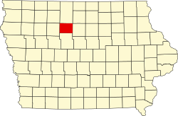
Humboldt County's location in Iowa
Coordinates: 42°56′49″N93°33′43″W / 42.947°N 93.562°W / 42.947; -93.562
Country Flag of the United States (23px).png  United States
State Flag of Iowa.svg Iowa
County Humboldt
Named after Oscar Fitzgalen Avery
Area
  Total
36.2 sq mi (94 km2)
  Land35.8 sq mi (93 km2)
  Water0.4 sq mi (1.0 km2)
Elevation
1,142 ft (348 m)
Population
 (2000)
  Total
316
Time zone UTC-6 (CST)
  Summer (DST) UTC-5 (CDT)
ZIP codes
50520 (Bradgate)
GNIS feature ID 0467405

Avery Township is one of twelve townships in Humboldt County, Iowa, United States. As of the 2000 census, its population was 316.

Contents

History

Avery Township was organized in 1873. It is named for O. F. Avery, a pioneer settler. [1]

Geography

According to the United States Census Bureau, Avery Township covers an area of 36.2 square miles (94 km2); of this, 35.8 square miles (93 km2) is land and 0.4 square miles (1.0 km2) is water.

Cities, towns, villages

Adjacent townships

Cemeteries

The township does not contain any cemeteries.

Political districts

References

  1. History of Kossuth and Humboldt Counties, Iowa. Union Publishing Company. 1884. pp.  718–721. Note that Google Books misspells "Humboldt".