Alanya, formerly Alaiye, is a beach resort city, a municipality and district of Antalya Province, Turkey. It is on the southern coast of Turkey, in the country's Mediterranean Region, 133 kilometres (83 mi) east of the city of Antalya. Its area is 1,577 km2, and its population is 364,180 (2022). The city proper has 189,222 inhabitants (2022).
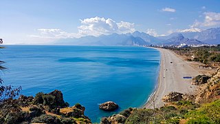
Antalya Province is a province and metropolitan municipality of Turkey. It is located on the Mediterranean coast of south-west Turkey, between the Taurus Mountains and the Mediterranean Sea. Its area is 20,177 km2, and its population is 2,688,004 (2022).

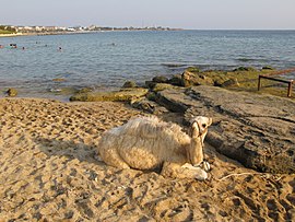
Mahmutlar is a neighbourhood of the municipality and district of Alanya, Antalya Province, Turkey. Its population is 53,034 (2022). It lies 10 km east of Alanya. Before the 2013 reorganisation, it was a town (belde). The town has been transformed by the building of holiday homes and apartments for European tourists. Roads and services have been improved to cater for the growing tourist industry.
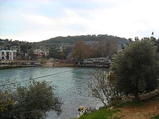
Narlıkuyu is a neighbourhood in the municipality and district of Silifke, Mersin Province, Turkey. Its population is 2,476 (2022). Before the 2013 reorganisation, it was a town (belde).
Yunusemre is a neighbourhood of the municipality and district of Mihalıççık, Eskişehir Province, Turkey. Its population was 621 in 2022. Before the 2013 reorganisation, it was a town (belde). It is named after the great Turkish poet Yunus Emre (1240–1321) whose tomb is in the town.
Cerrah is a neighbourhood of the municipality and district of İnegöl, Bursa Province, Turkey. Its population is 4,949 (2022). Before the 2013 reorganisation, it was a town (belde). It is 5 kilometres (3 mi) west of İnegöl and 45 kilometres (28 mi) east of Bursa.
Bayır is a neighbourhood of the municipality and district of Menteşe, Muğla Province, Turkey. Its population is 5,403 (2022). Before the 2013 reorganisation, it was a town (belde).
Oba is a neighbourhood in the municipality and district of Alanya, Antalya Province, Turkey. Its population is 28,864 (2022). Before the 2013 reorganisation, it was a town (belde). It is almost merged to Alanya. It is about 140 kilometres (87 mi) from Antalya.
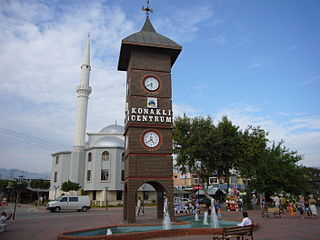
Konaklı is a neighbourhood in the municipality and district of Alanya, Antalya Province, Turkey. Its population is 17,966 (2022). Before the 2013 reorganisation, it was a town (belde).
Turunçova is a neighbourhood in the municipality and district of Finike, Antalya Province, Turkey. Its population is 7,690 (2022). Before the 2013 reorganisation, it was a town (belde). The village is inhabited by Tahtacı.
Karakese is a neighbourhood of the municipality and district of Dörtyol, Hatay Province, Turkey. Its population is 5,994 (2022). Before the 2013 reorganisation, it was a town (belde).
Cikcilli is a neighbourhood in the municipality and district of Alanya, Antalya Province, Turkey. Its population is 21,449 (2022). Before the 2013 reorganisation, it was a town (belde).
Demirtaş is a neighbourhood in the municipality and district of Alanya, Antalya Province, Turkey. Its population is 3,449 (2022). Before the 2013 reorganisation, it was a town (belde).
Emişbeleni is a neighbourhood in the municipality and district of Alanya, Antalya Province, Turkey. Its population is 1,492 (2022). Before the 2013 reorganisation, it was a town (belde).
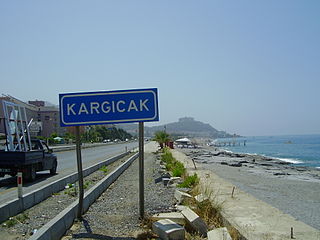
Kargıcak is a neighbourhood in the municipality and district of Alanya, Antalya Province, Turkey. Its population is 5,989 (2022). Before the 2013 reorganisation, it was a town (belde).
Kestel is a neighbourhood in the municipality and district of Alanya, Antalya Province, Turkey. Its population is 15,445 (2022). Before the 2013 reorganisation, it was a town (belde).
Tosmur is a neighbourhood in the municipality and district of Alanya, Antalya Province, Turkey. Its population is 11,712 (2022). Before the 2013 reorganisation, it was a town (belde).
Türkler is a neighbourhood in the municipality and district of Alanya, Antalya Province, Turkey. Its population is 4,798 (2022). Before the 2013 reorganisation, it was a town (belde).
İncekum is a neighbourhood in the municipality and district of Alanya, Antalya Province, Turkey. Its population is 3,345 (2022). Before the 2013 reorganisation, it was a town (belde).
İncekum Nature Park is a nature park in Turkey. It is in Avsallar town, on the Mediterranean Sea side between Antalya and Alanya to the south of the Turkish state highway D.400 connecting Antalya to Mersin. Its distance to Alanya is 24 kilometres (15 mi)