The Tel Aviv Light Rail, also known as Dankal is a mass transit system for the Tel Aviv metropolitan area in central Israel. The system will include different modes of mass transit, including rapid transit (metro), light rail transit (LRT), and bus rapid transit (BRT). Overseen by the government agency NTA, the project will complement the intercity and suburban rail network operated by Israel Railways.
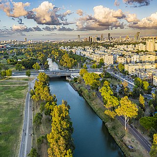
The Yarkon River, also Yarqon River or Jarkon River, is a river in central Israel. The source of the Yarkon is at Tel Afek (Antipatris), north of Petah Tikva. It flows west through Gush Dan and Tel Aviv's Yarkon Park into the Mediterranean Sea. Its Arabic name, al-Auja, means "the meandering". The Yarkon is the largest coastal river in Israel, at 27.5 km in length.

Highway 20, more commonly known as the Ayalon Highway, or simply Ayalon, is a major inter city freeway in Gush Dan, Israel. The road runs along the eastern border of central Tel Aviv from north to south and connects all of the major highways leading to the city—such as Highway 4 from Ashdod and the Southern regions, Highway 2 from Haifa and the Northern regions, Highway 5 from the East, and Highway 1 from Jerusalem and the Southeast. The Ayalon Highway is heavily used; on an average day, almost 600,000 vehicles enter the freeway. It consists of a multi-lane highway with a multi-track railway located between the opposite travel lanes. Some of the highway's route is along the Ayalon River, hence its name.

The Israel National Trail is a hiking trail that crosses the entire length of the country of Israel, with its northern end at Kibbutz Kfar Giladi, near the Lebanese border in the far north of the country, extending to Eilat at the southernmost tip of Israel on the Red Sea, with a total length of 1,040 km (650 mi). The trail was inaugurated in 1995.

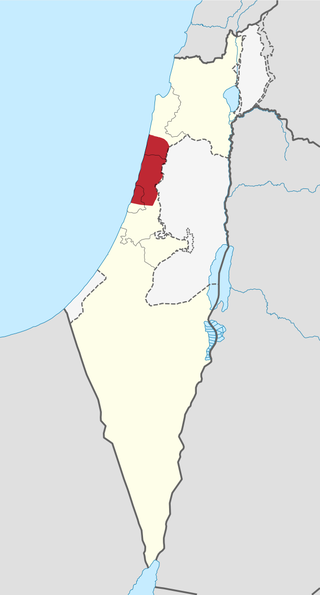
Israeli coastal plain is the coastal plain along Israel's Mediterranean Sea coast, extending 187 kilometres (116 mi) north to south. It is a geographical region defined morphologically by the sea, in terms of topography and soil, and also in its climate, flora and fauna. It is narrow in the north and broadens considerably towards the south, and is continuous, except the short section where Mount Carmel reaches almost all the way to the sea. The Coastal Plain is bordered to the east by – north to south – the topographically higher regions of the Galilee, the low and flat Jezreel Valley, the Carmel range, the mountains of Samaria, the hill country of Judea known as the Shephelah, and the Negev Mountains in the south. To the north it is separated from the coastal plain of Lebanon by the cliffs of Rosh HaNikra, which jut out into the sea from the Galilee mountains, but to the south it continues into the Egyptian Sinai Peninsula.

Highway 5 or the Trans-Samaria Highway, is one of Israel's main highways, connecting the Mediterranean coast immediately north of Tel Aviv with the central Sharon plain and eastwards to Ariel and other Israeli settlements in the northern West Bank.
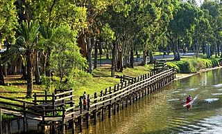
Yarkon Park is a large park in Tel Aviv, Israel, with about sixteen million visits annually. Named after the Yarkon River which flows through it, the park includes extensive lawns, sports facilities, botanical gardens, an aviary, a water park, two outdoor concert venues and lakes. The park covers an area of 3.5 km². At 375 hectares, it is slightly larger than Central Park in New York, and double the size of Hyde Park, London.

Highway 1 is the main highway in Israel, connecting Tel Aviv and Jerusalem, and continuing eastwards to the Jordan Valley in the West Bank.

Ariel Sharon Park is an environmental park along the lines of Ayalon river, in the area between Ben Gurion Airport and Highway 20. The area is 8.5 square kilometers big, and was intended to be the "green lung" of the southern part of Gush Dan metropolin. The park was established on the former Hiriya waste dump located southeast of Tel Aviv, Israel, the Shalem farm, Mikveh Israel village and the Menachem Begin Park. After accumulating 25 million tons of waste, the Hiriya facility was shut down in August 1998. Hiriya is visible on approach into Ben Gurion International Airport as a flat-topped hill. Three recycling facilities have been established at the foot of the mountain: a waste separation center, a green waste facility that produces mulch and a building materials recycling plant. The waste dump and its surrounding area have been renovated into a large park that is still under construction.

Highway 2 is an Israeli highway located on the coastal plain of the Mediterranean Sea. It begins as a major arterial road within Tel Aviv, becoming a freeway as it exits the city northward, continuing to Haifa. North of Tel Aviv, the highway is also called The Coastal Highway.
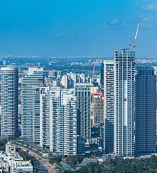
Tzamarot Ayalon is a neighborhood of Tel Aviv, Israel, on the east-central side of the city. It is ranked as the wealthiest neighborhood in Israel.

The Tel Aviv transportation system is seen as the hub of the Israeli transport network in terms of road, rail, and air transport. The Israeli road network partly centers on Tel Aviv, with some of the country's largest highways passing through or running to the city. The city forms a major part of the country's rail network, whilst Ben Gurion International Airport located near the city is the country's largest airport. There is also a strong public transport system within the city, based primarily on bus transportation.

Bnei Brak–Ramat HaHayal railway station is a suburban passenger railway station in Israel, operated by Israel Railways. It is located on the Yarkon Railway near the Bnei Brak–Ramat Gan and Bnei Brak–Tel Aviv borders next to the Ayalon Mall and Ramat Gan Stadium. In spite of its proximity to important industrial and commercial areas of Gush Dan as well as to residential areas of Tel Aviv, Bnei Brak is one of the less-popular stations of Israel Railways, possibly because of its misleading name and lack of awareness. As a result, in an effort to increase the public's awareness of the station, the name of the Ramat HaHayal neighborhood located to the north of the station was added to the station's name in 2016.

Route 531, is a suburban freeway in the southern Sharon region of Israel, just north of the Tel Aviv Metropolitan Area. The highway begins at Highway 6 and terminates at the Ayalon Highway with an extension to the Coastal Highway.

Bavli, or Shikun Bavli, is a neighborhood in central Tel Aviv, Israel, named after the Babylonian Talmud, and bounded by Hayarkon Park on the north, Ayalon highway to the east, Namir road to the west, and Park Tzameret to the south.
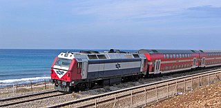
The Coastal railway line is a mainline railway in Israel, which begins just south of the Lebanon-Israel border on the Mediterranean coast, near the town of Nahariya in Northern Israel and stretches almost the entire Mediterranean coast of the country, to just north of the border with the Gaza Strip in the south.

Hadar Yosef is a residential neighborhood of Tel Aviv, Israel, in the northeastern part of the city. The neighborhood is located to the north of the Yarkon River and near the National Sport Center – Tel Aviv.
Sharon Railway is a 12 km double-track railroad in the Sharon plain area of Israel, located in the median of Highway 531. It serves as a connection between the Coastal Railway and the Eastern Railway and runs parallel to the Yarkon Railway which is located approximately 7km to the south. In the vicinity of Ra'anana South interchange, the Sharon Railway passes through a 1.8km long tunnel.
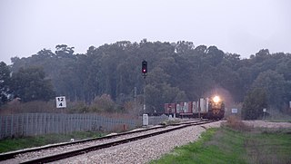
The Yarkon Railway is a double-track railroad following the course of the Yarkon River in the central area of Israel. It is about 15 km long, stretching from the Coastal Railway to the Eastern Railway.