Ayios Savvas, Nicosia

Last updated
Ayios Savvas
Άγιος Σάββας
Cyprus location map.svg
Red pog.svg
Ayios Savvas
Location in Cyprus
Coordinates: 35°10′17″N33°21′48″E / 35.17139°N 33.36333°E / 35.17139; 33.36333 Coordinates: 35°10′17″N33°21′48″E / 35.17139°N 33.36333°E / 35.17139; 33.36333
CountryFlag of Cyprus.svg  Cyprus
District Nicosia District
Municipality Nicosia
Population
(2011) [1]
  Total581
Time zone UTC+2 (EET)
  Summer (DST) UTC+3 (EEST)

Ayios Savvas is a neighbourhood, quarter, mahalla or parish of Nicosia, Cyprus [1] [2] [3] and the parish church thereof.

A parish is a territorial entity in many Christian denominations, constituting a division within a diocese. A parish is under the pastoral care and clerical jurisdiction of a parish priest, who might be assisted by one or more curates, and who operates from a parish church. Historically, a parish often covered the same geographical area as a manor. Its association with the parish church remains paramount.

Nicosia City

Nicosia is the largest city, capital, and seat of government of the island of Cyprus. It is located near the centre of the Mesaoria plain, on the banks of the River Pedieos.

Cyprus Island country in Mediterranean

Cyprus, officially the Republic of Cyprus, is an island country in the Eastern Mediterranean and the third largest and third most populous island in the Mediterranean, located south of Turkey, west of Syria and Lebanon, northwest of Israel, north of Egypt, and southeast of Greece.

Contents

At the last census (2011) it had a population of 581, [4] an increase from a population of 523 in 2001. [5] It covers 25 streets in the south of Nicosia within the walls. [6]

History

It is one of the 24 historic neighbourhoods of Nicosia within the walls. [2] In 1946 it had a population of 1,266 of which 1,211 were Greek Cypriot, 39 Turkish Cypriot and 16 others.

The church was built in 1850 and 1851. [7]

Parish church

The church stands on the corner of St. Savvas and Aeschylus streets.

It was built in 1850 and 1851 on the foundations of an earlier church, probably Byzantine. It is a two-aisled building with four entrances and a portico built most probably in 1900 when the belfry was built too. The south wall of the church most probably belongs to the previous church. Though the church has no architectural interest, nevertheless it contains some old portable icons as well as some old furniture. [7]

Ayios Savvas Church 2010-07-07 12-30-44 Cyprus Nicosia Nicosia.JPG
Ayios Savvas Church

The church is monotholus[ clarification needed ] built. At the west end is a narthex dividing, as is often the case, the west wall of the church from the boundary of the road.

Inside the building a few relics from the more ancient church on the site are still preserved. The modern iconostasis is of the usual character, but behind it is preserved the rood from an ancient screen dated 1659. A still more interesting fragment is a gilded panel about 1 m by 50 cm, on which is painted a remarkable portrait of a personage dressed in furred robes, and with a large cap of an Eastern type on his head. This personage is represented in a sitting or kneeling attitude, whilst the gilded background is covered with an inscription in elegant medieval lettering of considerable length. Unfortunately this inscription which seems to be an ascription to St. Savvas is too much defaced to allow of decipherment. The tablet is now clumsily nailed against the side of the iconostasis to fill up a lower panel, and is so little regarded that instead of occupying its original position, it is now placed on its side. This panel is an excellent example of the very rare, ex-voto intended to occupy a place alongside of the usual pictures of the saints on the iconostasis. It is painted on a gold leaf background in precisely the same way and apparently in egg-tempera. Another example of the same kind is the portrait of Maria di Molino at Ay. Chrysostomos Monastery (Kyrenia District). Other examples of the 16th century ex-voto with portraiture of donors may be seen on the iconostasis of Chrysaliniotissa church, Nicosia, but this one of St. Savvas is remarkable for the absence of any saintly figure on the panel. A chalice dated 1516 is said to have formerly been preserved in this church. In the centre of the church is a large gravestone without any trace of effigy or inscription, and strangely placed lengthwise north and south instead of in the more customary manner east and west. [8]

Related Research Articles

Aglandjia Place in Nicosia District, Cyprus

Aglandjia is a suburb and a municipality of Nicosia, Cyprus. The municipality has a population of 20,783 (2011) and is contiguous with Nicosia Municipality.

Engomi Place in Nicosia District, Cyprus

Engomi is a suburb and municipality of the Cypriot capital Nicosia. In 2011, it had a population of 18,010. Of these, 14,254 were citizens of Cyprus.

Omorfita in Nicosia District, Cyprus

Omorfita or Kuchuk Kaimakli is a northeastern quarter of Nicosia, Cyprus. Omorfita has been divided since 1974, its biggest chunk being under the de facto control of Northern Cyprus.

Panagia, Nicosia village in Nicosia District, Cyprus

Pallouriotissa is an area of Nicosia, Cyprus, formerly an independent village, which was annexed to the municipality in 1968. It was subsequently divided into the quarters of Panayia (Panagia) and Saints Constantine and Helen. As of 2011, their combined population was 15,607. Pallouriotissa is immediately south of Kaimakli.

Ayios Antonios, Nicosia in Nicosia District, Cyprus

Ayios Antonios is a Neighbourhood, Quarter, Mahalla or Parish of Nicosia, Cyprus and the parish church thereof.

Haydar Pasha, Nicosia in Nicosia District, Cyprus

Haydar Pasha is a Neighbourhood, Quarter or Mahalle of Nicosia, Cyprus and the mosque situated therein. Both are named after Haydar Pasha, said to be one of the 12 generals in command of divisions of the Ottoman army at the time of the Ottoman conquest of Nicosia. Each general being posted to a quarter, that quarter was known by his name.

Ayioi Omoloyites, Nicosia in Nicosia District, Cyprus

Ayioi Omoloyites is a Neighbourhood, Quarter, Mahalla or Parish of Nicosia, Cyprus and the parish church thereof. Its name in Greek is Άγιοι Ομολογητές, which means Holy Confessors and also has the name Ayii Omoloyitades used in older English language works and Turkish.

Tabakhane, Nicosia in Nicosia District, Cyprus

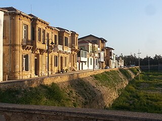
Tabakhane is a historic neighborhood, quarter, Mahalla, or parish of central Nicosia, Cyprus, named after the tannery which formerly existed just outside the city walls, near Paphos Gate. Its name is the Arabic and Turkish word for tannery.

Yeni Jami, Nicosia Place in Nicosia District, Cyprus

Yeni Jami is a Neighbourhood, Quarter, Mahalla or Parish of Nicosia, Cyprus and the mosque situated therein after which the Quarter is named. It is spelled Yenicami in Turkish and Γενί Τζαμί in Greek and means "new mosque" in Turkish.

Ayios Kassianos, Nicosia in Nicosia District, Cyprus

Ayios Kassianos is a Neighbourhood, Quarter, Mahalla or Parish of Nicosia, Cyprus and the church situated therein after which the Quarter is named. It is Άγιος Κασσιανός in Greek and Aykasyano in Turkish and also has the historic name Kafesli . At the last Census (2011) it had a population of 315,.

Taht-el-kale, Nicosia in Nicosia District, Cyprus

Taht-el-kale is a neighbourhood, quarter of Nicosia, Cyprus and the mosque situated therein.

Ayios Loukas, Nicosia in Nicosia District, Cyprus

Ayios Loukas is a Neighbourhood, Quarter, Mahalla or Parish of Nicosia, Cyprus and the parish church thereof. The church was dedicated to and named after St. Luke the Apostle and the parish or neighbourhood was named after the church. It is Άγιος Λουκάς in Greek and Ayluka or the new name Ayyıldız in Turkish.

Ak Kavuk, Nicosia in Nicosia District, Cyprus

Ak Kavuk is a Neighbourhood, Quarter, Mahalla or Parish of Nicosia, Cyprus and the mosque thereof. It is spelled as Akkavuk in Turkish and Ακ Καβούκ or Άμπου Καβούκ in Greek. Both alternative names appear in English. Jeffery uses both, while the Cyprus Gazette in 1923 uses the form "Abou Kavouk".

Arab Ahmet, Nicosia in Nicosia District Municipality, Cyprus

Arab Ahmet is a Neighbourhood, Quarter, Mahalla or Parish of Nicosia, Cyprus and the mosque situated therein. Both the Quarter and the mosque are named after Arab Ahmet Pasha, one of the Turkish commanders in the Ottoman conquest of Nicosia. It is spelled Arabahmet in Turkish and Άραπ Άχμετ in Greek.

Ayios Andreas (Tophane) Place in Nicosia District, Cyprus

Ayios Andreas or Tophane is a Neighbourhood, Quarter, Mahalla or Parish of Nicosia, Cyprus. In September 1945, the Ottoman name of Tophane was changed to Ayios Andreas, but there is no parish church of that name.

Iplik Bazar–Korkut Effendi in Nicosia District, Cyprus

Iplik Bazar–Korkut Effendi is a Neighbourhood, Quarter, Mahalla or Parish of Nicosia, Cyprus. It lies in the centre of the walled city.

Köşklüçiftlik in Nicosia District, Cyprus

Köşklüçiftlik is a quarter of North Nicosia in Northern Cyprus. In 2011, it had a population of 2,939.

Administrative divisions of Nicosia

Nicosia within the city limits is divided into 29 administrative units, according to the latest census. This unit is termed in English as quarter, neighbourhood, parish, enoria or mahalla. These units are: Ayios Andreas, Trypiotis, Nebethane, Tabakhane, Phaneromeni, Ayios Savvas, Omerie, Ayios Antonios, St. John, Taht-el-kale, Chrysaliniotissa, Ayios Kassianos (Kafesli), Kaïmakli, Panayia, St Constantine & Helen, Ayioi Omoloyites, Arab Ahmet, Yeni Jami, Omorfita, Ibrahim Pasha, Mahmut Pasha, Abu Kavouk, St. Luke, Abdi Chavush, Iplik Pazar and Korkut Effendi, Ayia Sophia, Haydar Pasha, Karamanzade, and Yenişehir/Neapolis. Some of these units were previously independent Communities. Ayioi Omoloyites was annexed in 1944, while Kaïmakli and Omorfita were annexed in 1968. Pallouriotissa, also annexed in 1968, was subsequently divided into the neighbourhoods of Panayia, and St Constantine & Helen.

Nebethane, Nicosia Place in Nicosia District, Cyprus

Nebethane is an historic neighbourhood, quarter, Mahalla, or parish of central Nicosia, Cyprus,. Its name inherited from the Ottoman period is Turkish for police station or the guard room of the Turkish patrol. Nebethane Mesjid in this quarter was the place where the police patrol of the city assembled for changing the guard each day, accompanied by drums and pipes.

References

  1. 1 2 "Census of Cyprus 2011". Archived from the original on 2013-12-02. Retrieved 2013-11-26.
  2. 1 2 Coexistence in the Disappeared Mixed Neighbourhoods of Nicosia by Ahmet An (Paper read at the conference: Nicosia: The Last Divided Capital in Europe, organized by the London Metropolitan University on 20th June 2011)
  3. 6th edition of the publication “Statistical Codes of Municipalities, Communities and Quarters of Cyprus” (publ. Statistical Service of Republic of Cyprus)
  4. "Population Enumerated by Sex, Age, District, Municipality/Community and Quarter, 2011 – (2011 Census of the Republic of Cyprus, Statistical Service)" (in Greek). Mof.gov.cy. Retrieved 2012-07-21.
  5. Census 2001
  6. Municipality/Community, Quarter and Street Index published by Ministry of Information (CILIS_streets_022011)
  7. 1 2 Exploring Nicosia by Marios Stylianou (publ Selas books 2002)
  8. A description of the historic monuments of Cyprus. Studies in the archaeology and architecture of the island, by George Jeffery, Nicosia, 1918