
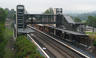
Homebush railway station is a heritage-listed railway station located on the Main Suburban line in Homebush in the Municipality of Strathfield local government area of New South Wales, Australia. It was designed and built by the New South Wales Government Railways and opened on 26 September 1855. In addition to being located on the Main Suburban line, the station is also located on the Main South and Main Western railway lines. The property was added to the New South Wales State Heritage Register on 2 April 1999.

Mittagong is a town located in the Southern Highlands of New South Wales, Australia, in Wingecarribee Shire. The town acts as the gateway to the Southern Highlands when coming from Sydney. Mittagong is situated at an elevation of 635 metres (2,083 ft). The town is close to Bowral, Berrima, Moss Vale and the Northern Villages such as Yerrinbool and Colo Vale. Moreover, Mittagong is home to many wineries of the Southern Highlands which has been a recent growing wine and cellar door region.

Moss Vale is a town in the Southern Highlands of New South Wales, Australia, in the Wingecarribee Shire. It is located on the Illawarra Highway, which connects to Wollongong and the Illawarra coast via Macquarie Pass.

Aylmerton is a Northern Village of the Southern Highlands of New South Wales, Australia in Wingecarribee Shire. It is located north-east of Mittagong. The only buildings in Aylmerton are a fire station and houses, many of which are on farms.

Menangle railway station is a heritage-listed railway station located on the Main Southern line in the south-western Sydney settlement of Menangle in the Wollondilly Shire local government area of New South Wales, Australia. It is also known as Menangle Railway Station group. The property was added to the New South Wales State Heritage Register on 2 April 1999. The station opened on 1 July 1863.
Picton railway station is a heritage-listed railway station located on the Main Southern line in the south-western Sydney suburb of Picton in the Wollondilly Shire local government area of New South Wales, Australia. It was built from 1863 to 1919. It is also known as the Picton Railway Station group. The property was added to the New South Wales State Heritage Register on 2 April 1999. The station opened on 1 July 1869. The station is unusually sited, with southbound journeys actually heading north out of the station before traversing a 225 degree horseshoe curve to again head south, and likewise northbound services heading south before rounding a number of curves to resume their true direction.

Yerrinbool railway station is located on the Main Southern line in New South Wales, Australia. It serves the town of Yerrinbool, opening on 13 July 1919 at the same time as a new alignment between Picton and Mittagong. In March 1991, the weatherboard building on Platform 1 was demolished.

The Rock is a town with a population of 1,347, in the Riverina region of southern New South Wales, Australia, in Lockhart Shire. It is 32 kilometres (20 mi) south-west of Wagga Wagga on the Olympic Highway.

Culcairn is a town in the south-east Murray region of New South Wales, Australia. Culcairn is located in the Greater Hume Shire local government area on the Olympic Highway between Albury and Wagga Wagga. The town is 514 kilometres (319 mi) south-west of the state capital, Sydney and at the 2016 census had a population of 1,473.

Sydney, the largest city in Australia, has an extensive network of passenger and goods railways. The passenger system includes an extensive suburban railway network, operated by Sydney Trains, a metro system and a light rail network. A dedicated goods network also exists.
Yerrinbool is one of the Northern Villages of the Southern Highlands of New South Wales, Australia, in the Wingecarribee Shire, and is accessible from the Hume Highway and is about a 12 km (7.5 mi) drive from nearby Mittagong. It is 7 km (4.3 mi) to Hill Top as the crow flies, accessible by foot via a fire trail. It is on the western edge of the Upper Nepean Nature Reserve, a vast area of forest, lakes and dams between Yerrinbool and the coastal communities around Wollongong. Yerrinbool was previously officially known as the Town of Yerrinbool. It is located on the historic Old Hume Highway.
The Illawarra Junction is a major railway junction located near the Eveleigh Railway Workshops, in Eveleigh, in the inner western suburbs of Sydney, New South Wales, Australia. This complex junction joins a number of different lines and yards. There are two pairs of tracks from the Illawarra railway line from the south and three pairs of tracks from the Main Suburban railway line from the west.

Colo Vale is a Northern Village of the Southern Highlands of New South Wales, Australia, in Wingecarribee Shire. Colo Vale is approximately 100 km south west on the Hume Highway from Sydney. It is situated 2 km north-west of Aylmerton, 5 km from the Hume Highway and 12 km drive to Mittagong. The surrounding area is part of the Parish of Colo which includes the villages of Aylmerton, Willow Vale, Alpine and Yerrinbool. Colo Vale has a mixed-business general store and many home-based businesses, including hairdressers, small manufacturing businesses and a large native plant nursery and a Public School on Wattle Street. A large sporting oval is located adjacent to the school with tennis courts, a community hall and a Rural Fire Service station.

NSW TrainLink is a train and coach operator in Australia, providing services throughout New South Wales and the Australian Capital Territory, along with limited interstate services into Victoria, Queensland and South Australia. Its primary intercity and regional services are spread throughout five major rail lines, operating out of Sydney's Central railway station.

Cessnock railway station was a railway station located on the South Maitland Railway (SMR), serving the city of Cessnock, New South Wales, Australia. During its existence, it was the main station that served the city.
Kenny Hill railway station was a railway station on the Camden railway line, serving the nearby area of Kenny Hill in modern-day Currans Hill, New South Wales, Australia.

Elderslie railway station was a railway station on the Camden railway line, serving the suburb of Elderslie, New South Wales, Australia.

Morangarell is a locality in Bland Shire in the Riverina region of New South Wales, Australia. There was once a village of the same name, now a ghost town. Morangarell lies between Temora and Grenfell, and Barmedman and Young. The locality is bisected by Bland Creek, a tributary of Lachlan River. The locality is rural, with the main economic activities being raising crops and grazing.
Metropolitan Meat Platform railway station was a railway station located on the Abattoirs line, serving the former State Abattoirs in Sydney, New South Wales.
Yanderra railway station was a railway station on the Main Southern railway line, serving the village of Yanderra in the Southern Highlands, New South Wales. The station provided passenger services between 1924 and 1975, and was demolished after closure. Yanderra is known for the murder of three railway workers that occurred during an attempted railway robbery in 1941.
