Related Research Articles

A bus stop is a place where buses stop for passengers to get on and off the bus. The construction of bus stops tends to reflect the level of usage, where stops at busy locations may have shelters, seating, and possibly electronic passenger information systems; less busy stops may use a simple pole and flag to mark the location. Bus stops are, in some locations, clustered together into transport hubs allowing interchange between routes from nearby stops and with other public transport modes to maximise convenience.

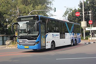
Bus rapid transit (BRT), also referred to as a busway or transitway, is a bus-based public transport system designed to have much more capacity, reliability, and other quality features than a conventional bus system. Typically, a BRT system includes roadways that are dedicated to buses, and gives priority to buses at intersections where buses may interact with other traffic; alongside design features to reduce delays caused by passengers boarding or leaving buses, or paying fares. BRT aims to combine the capacity and speed of a light rail transit (LRT) or mass rapid transit (MRT) system with the flexibility, lower cost and simplicity of a bus system.

A rush hour or peak hour is a part of the day during which traffic congestion on roads and crowding on public transport is at its highest. Normally, this happens twice every weekday: once in the morning and once in the afternoon or evening, the times during which most people commute. The term is often used for a period of peak congestion that may last for more than one hour.

The Transitway is a bus rapid transit (BRT) network operated by OC Transpo in Ottawa, Ontario, Canada. It comprises a series of bus-only roadways and reserved lanes on city streets and highways. The dedicated busways ensure that buses and emergency vehicles on the Transitway rarely intersect directly with the regular traffic, and make it possible for them to continue at full speed even during rush hour. OC Transpo operates a network of rapid routes which use the Transitway to connect communities with the O-Train light rail system. Additional bus routes also use segments of the Transitway.

Guided buses are buses capable of being steered by external means, usually on a dedicated track or roll way that excludes other traffic, permitting the maintenance of schedules even during rush hours. Unlike railbus, trolleybuses or rubber-tyred trams, for part of their routes guided buses are able to share road space with general traffic along conventional roads, or with conventional buses on standard bus lanes.

A bus lane or bus-only lane is a lane restricted to buses, often on certain days and times, and generally used to speed up public transport that would be otherwise held up by traffic congestion. The related term busway describes a roadway completely dedicated for use by buses, whilst bus gate describes a short bus lane often used as a short cut for public transport. Bus lanes are a key component of a high-quality bus rapid transit (BRT) network, improving bus travel speeds and reliability by reducing delay caused by other traffic.

Transport for Brisbane, previously called Brisbane Transport, is an organisational division of the Brisbane City Council, responsible through its related Council Committee for providing policy and advice to Brisbane City Council, and for delivering various public transport services across the City of Brisbane. The division does this as part of an agreement with Translink, an agency of the Department of Transport and Main Roads that operates public transport across South East Queensland.

The South East Busway is a grade separated bus-only road running south from the Brisbane central business district to Eight Mile Plains in Queensland, Australia. The busway was completed to Woolloongabba in September 2000 and to Eight Mile Plains in April 2001. An extension of the busway to School Road at Rochedale was completed in 2014 with no additional busway stations. The maximum capacity of the busway is 18,000 commuters an hour during peak periods. The busway carries an estimated 70 million passengers annually.
Traffic signal preemption is a system that allows an operator to override the normal operation of traffic lights. The most common use of these systems manipulates traffic signals in the path of an emergency vehicle, halting conflicting traffic and allowing the emergency vehicle right-of-way, thereby reducing response times and enhancing traffic safety. Signal preemption can also be used on tram, light-rail and bus rapid transit systems, to allow public transportation priority access through intersections, and by railroad systems at crossings to prevent collisions.

Transport in Brisbane, the capital and largest city of Queensland, Australia, is provided by road, rail, river and bay ferries, footpaths, bike paths, sea and air.
The Public Transport Information and Priority System, abbreviated PTIPS, is a computer-based system used in New South Wales, Australia, that brings together information about public transport entities, such as buses. Where applicable, PTIPS can also provide transport vehicles with priority at traffic signals.
Clyde Fastlink is a high frequency bus rapid transit system in Glasgow, Scotland. The system was designed to provide greater connectivity and faster journey times between Glasgow City Centre and the Queen Elizabeth University Hospital in Govan, as well as to several other key developments along the north and south banks of the Clyde Waterfront.

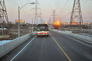
The York University Busway is a bus-only roadway in Toronto, Ontario, Canada, which stretches 1.8 kilometres (1.1 mi) from Finch West subway station to Dufferin Street. It is used by the Toronto Transit Commission's 939B Finch Express bus route.
Sidra Intersection is a software package used for intersection (junction), interchange and network capacity, level of service and performance analysis, and signalised intersection, interchange and network timing calculations by traffic design, operations and planning professionals.

Since the mid-1990s, a 27 kilometre bus rapid transit network has been developed in Brisbane, Australia. It comprises grade-separated bus-only corridors, complementing the Queensland Rail Citytrain network. Management of the busway network is the responsibility of Translink as coordinator of South East Queensland's integrated public transport system.

The Leigh-Salford-Manchester Bus Rapid Transit scheme in Greater Manchester, England provides transport connections between Leigh, Atherton, Tyldesley, Ellenbrook and Manchester city centre via Salford. The guided busway and bus rapid transit (BRT) scheme promoted by Transport for Greater Manchester (TfGM) opened on 3 April 2016. Built by Balfour Beatty at a total cost of £122 million to improve links from former Manchester Coalfield towns into Manchester city centre, the busway proposal encountered much opposition and a public enquiry in 2002 before construction finally started in 2013. A branch route from Atherton, and an extension to the Manchester Royal Infirmary have been added to the planned original scheme.

Bus rapid transit creep is a phenomenon where bus systems that fail to meet the requirements for being considered "true bus rapid transit" are designated as bus rapid transit regardless. These systems are often marketed as a fully realized bus rapid transit system, but end up being described as more of an improvement to regular bus service by proponents of the "BRT creep" term. The Institute for Transportation and Development Policy published several guidelines in an attempt to define what constitutes the term "true BRT", known as the BRT Standard, in an attempt to avert this phenomenon.

Rainbow BRTS is a bus rapid transit system in the city of Pune. The system is operated by the Pune Mahanagar Parivahan Mahamandal Limited (PMPML). The infrastructure has been developed by the Pune Municipal Corporation & Pimpri Chinchwad Municipal Corporation, Pune. The project currently envisages 113 km of dedicated bus corridors along with buses, bus stations, terminals and intelligent transit management system.

Brisbane Metro is a planned high-frequency bus rapid transit system that will service Brisbane, Queensland, Australia. It will consist of two routes that will run through the Brisbane central business district (CBD) every five minutes during peak times (12bph), transporting up to 1,800 passengers per hour in each direction. Services are expected to commence in 21st October 2024.
References
- ↑ Currie, Graham (2006). Assessing Australian transit signal priority against worlds best practice. 22nd ARRB Conference – Research into Practice. Canberra, Australia: ARRB Group Ltd. pp. 11–12.