BOS 400

Last updated

BOS 400 2006-02-05.JPG
BOS 400 wreck off Duiker Point, South Africa
History
NameBOS 400
FateRan aground, 26 June 1994
General characteristics
Type Derrick/lay barge
Displacement12,000 long tons (12,193 t)
Length100 m (330 ft)
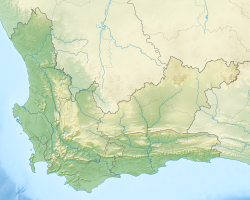
South Africa Western Cape relief location map.svg
Red pog.svg
BOS 400 wreck
Western Cape, South Africa

BOS 400 is a French derrick/lay barge that ran aground while being towed by the Russian tugboat Tigr on June 26, 1994. [1] [ unreliable source? ]

Tigr was chartered to tow BOS 400 from Pointe-Noire in the Republic of Congo to Cape Town, South Africa. The tow-rope broke loose during a huge storm and caused the vessel to run aground off Duiker Point near Sandy Bay, [2] [3] at the same place as the earlier wreck of the SS Oakburn.

Despite several towage attempts, the shipwreck was considered a total loss as salvors were able to recover little from the wreck. BOS 400 remains a wreck today, with a large crane and part of the superstructure visible above sea level. The wreck is slowly disintegrating.

Tigr was built in 1987 in Polish shipyards. Following the accident, she remained idle in the Cape Town docks from 1994 to 2000, when she was sold for $625,000. [4]

Related Research Articles

<span class="mw-page-title-main">Cape Agulhas</span> Headland in the Western Cape, South Africa

Cape Agulhas is a rocky headland in Western Cape, South Africa. It is the geographic southern tip of Africa and the beginning of the traditional dividing line between the Atlantic and Indian Oceans according to the International Hydrographic Organization. It is approximately half a degree of latitude, or 55 kilometres (34 mi), further south than the Cape of Good Hope.

<span class="mw-page-title-main">False Bay</span> Large bay of the Atlantic Ocean at Cape Town, South Africa

False Bay is a body of water in the Atlantic Ocean between the mountainous Cape Peninsula and the Hottentots Holland Mountains in the extreme south-west of South Africa. The mouth of the bay faces south and is demarcated by Cape Point to the west and Cape Hangklip to the east. The north side of the bay is the low-lying Cape Flats, and the east side is the foot of the Hottentots Holland Mountains to Cape Hangklip which is at nearly the same latitude as Cape Point. In plan the bay is approximately square, being roughly the same extent from north to south as east to west, with the southern side open to the ocean. The seabed slopes gradually down from north to south, and is mostly fairly flat unconsolidated sediments. Much of the bay is off the coast of the City of Cape Town, and it includes part of the Table Mountain National Park Marine Protected Area and the whole of the Helderberg Marine Protected Area. The name "False Bay" was applied at least three hundred years ago by sailors returning from the east who confused Cape Point and Cape Hangklip, which are somewhat similar in profile when approached from the southeast.

<span class="mw-page-title-main">Port Nolloth</span> Place in Northern Cape, South Africa

Port Nolloth is a town and small domestic seaport in the Namaqualand region on the northwestern coast of South Africa, 144 kilometres (89 mi) northwest of Springbok. It is the seat of the Richtersveld Local Municipality.

HMS <i>Somerset</i> (1748) Ship of the line of the Royal Navy

HMS Somerset was a 70-gun third-rate ship of the line of the Royal Navy, built at Chatham Dockyard to the draught specified by the 1745 Establishment, and launched on 18 July 1748. She was the third vessel of the Royal Navy to bear the name. Somerset was involved in several notable battles of the Seven Years' War and the American Revolutionary War. She was wrecked in a storm in 1778 when she ran aground off of Provincetown, on Cape Cod, Massachusetts.

MV <i>Sygna</i> Bulk carrier launched in 1967

MV Sygna was a Norwegian bulk carrier built by Austin & Pickersgill for J. Ludwig Mowinckels Rederi in 1967. It ran aground on Stockton Beach in Australia during a major storm in 1974. After its bow section was refloated, its stern remained beached and became an icon and landmark for the local area, until the visible remains of the wreck collapsed into the sea in 2016.

SS <i>Thomas T. Tucker</i> World War II Liberty ship of the United States

RMS <i>Dunottar Castle</i>

RMS Dunottar Castle was a Royal Mail Ship that went into service with the Castle Line in 1890 on the passenger and mail service between Britain and South Africa. In 1913 the ship was sold to the Royal Mail Steam Packet Company as the Caribbean. After the outbreak of the First World War she served as HMS Caribbean, first as a troop ship and then as an armed merchant cruiser, until she sank in a storm off the Scottish coast on 27 September 1915.

SS <i>James Longstreet</i> United States Liberty ship

SS James Longstreet was a Liberty ship built in the United States during World War II. Named after the Confederate general James Longstreet, she entered service in 1942, but was wrecked in a storm on 26 October 1943 and was subsequently used as a target hulk by the United States Navy.

Blackpool and the Fylde coast have become a ship graveyard for a number of vessels over the years. Most of the shipwrecks occurred at or near Blackpool, whilst a few happened a little further afield but have strong connections with the Blackpool area. For this article, Blackpool means the stretch of coast from Fleetwood to Lytham St Annes.

RMS <i>Empress of Canada</i> (1920)

RMS Empress of Canada was an ocean liner built in 1920 for the Canadian Pacific Steamships (CP) by Fairfield Shipbuilding & Engineering Company at Govan on the Clyde in Scotland. This ship—the first of three CP vessels to be named Empress of Canada—regularly traversed the trans-Pacific route between the west coast of Canada and the Asian waters until 1939.

Wreck of the <i>Grosvenor</i>

The wreck of the Grosvenor, an East Indiaman, occurred on 4 August 1782 on the Pondoland coast of South Africa, north of the fgof the Umzimvubu River. The shipwreck was close to the place where the Portuguese ship, São João, had gone down more than two centuries earlier on 8 June 1552. The Grosvenor was a three-masted ship of 729 tons on her return voyage to England when she was wrecked, carrying a crew of 132 and 18 passengers, and a cargo valued at £75,000. Of the 123 survivors, only 18 reached Cape Town and were repatriated, the remainder dying of their privations or joining with tribes. Four survivors, Robert Price, Thomas Lewis, John Warmington, and Barney Larey, eventually got back to England.

USS <i>Acushnet</i> Tugboat of the United States Navy

Acushnet – a steel-hulled revenue cutter – was launched on 16 May 1908 at Newport News, Virginia, by the Newport News Shipbuilding and Drydock Co.; sponsored by Miss Alayce Duff; and commissioned at Baltimore on 6 November 1908. She saw service as a United States Revenue Cutter Service cutter, a U.S. Navy fleet tug, and as a U.S. Coast Guard cutter. She was taken out of service 8 January 1946.

Hydrabad was an iron cargo and passenger sailing ship, built in Scotland and launched in 1865. She was owned by several successive companies, and served until being wrecked off the coast of New Zealand in 1878. There were attempts to salvage her, but they all failed, and the wreck was left to deteriorate on the shoreline.

Russian yacht <i>Livadia</i> (1873)

Livadia was an imperial yacht of the House of Romanov built in 1869–1873 by Leopold Schwede in Nikolaev. She served on the Black Sea. The Livadia was the only Russian imperial yacht that has seen active combat service during the Russo-Turkish war of 1877–1878. October 21–22, 1878 she ran aground near Cape Tarkhan-Kut in Crimea and sank.

MV <i>Canadian Miner</i>

MV Canadian Miner was a Canadian laker that was part of the fleet of Upper Lakes Shipping from 1994–2011. Initially constructed as Maplecliffe Hall in 1966, the ship was renamed Lemoyne in 1988 before becoming Canadian Miner in 1994. In 2011, the name was shortened to just Miner. In 2011 the vessel was taken out of service and sold for scrapping. While en route to the scrapyard in Turkey, the ship ran aground off Nova Scotia in 2011. The vessel was broken up in 2014 in Nova Scotia.

<i>Lady Kinnaird</i> (1877) Barque built in 1877 at Dundee, Scotland

Lady Kinnaird was a three masted barque which was built in 1877 at Dundee, Scotland by Brown & Simpson for W.B. Ritchie. She operated between the United Kingdom and the Australian colonies. She was lost after running aground in Spencer Gulf south of Cape Burr on the east coast of Eyre Peninsula in South Australia early on 21 January 1880. Her main anchor was recovered from her wreck site in 1979 and was placed on display in the nearby town of Port Neill in January 1880 as part of the commemoration of the centenary of her loss.

<i>Amboy</i> (ship) Wooden schooner-barge wrecked in the Mataafa Storm of 1905

The Amboy was a wooden schooner barge that sank along with her towing steamer, the George Spencer on Lake Superior off the coast of Schroeder, Cook County, Minnesota in the United States. In 1994 the remains of the Amboy were added to the National Register of Historic Places.

<span class="mw-page-title-main">Table Mountain National Park Marine Protected Area</span> Marine conservation area around the Cape Peninsula in South Africa

The Table Mountain National Park Marine Protected Area is an inshore marine protected area around the Cape Peninsula, in the vicinity of Cape Town, South Africa. It was proclaimed in Government Gazette No. 26431 of 4 June 2004 in terms of the Marine Living Resources Act, 18 of 1998.

Lord Hawkesbury was launched in the United States in 1781, probably under another name. She entered Lloyd's Register in 1787. She made six voyages as a whaler. On her second whaling voyage she "the first parcel of ambergris 'by any English whaler'". She was lost on the seventh after a squadron of French naval vessels had captured her. One of her original, British crew succeeded in regaining sufficient control from her prize crew to enable him to run her aground, wrecking her.

References

  1. "Bos 400". Underwater Explorers. Archived from the original on 27 June 2015. Retrieved 20 April 2013.
  2. "The Cape of Storms has claimed many victims over the years". University of Cape Town. Archived from the original on 29 April 2003.
  3. Robert Force; Martin Davies (2005). Jurisdiction and Forum Selection in International Maritime Law: Essays in Honor of Robert Force. Kluwer Law International. pp. 167–. ISBN   978-90-411-2330-5.
  4. "Appeal No: 472/96". High Court of South Africa Cape of Good Hope Division and South Eastern Cape Division. Archived from the original on 7 June 2009.

34°2′13.28″S18°18′31.18″E / 34.0370222°S 18.3086611°E / -34.0370222; 18.3086611