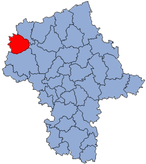
Chachersk is a city in the Gomel Region of Belarus, an administrative center of the Chachersk district. It is located in an area which is highly contaminated due to the fallout of the Chernobyl disaster.
Będzitowo is a village in the administrative district of Gmina Złotniki Kujawskie, within Inowrocław County, Kuyavian-Pomeranian Voivodeship, in north-central Poland.
Suchy Pies is a village in the administrative district of Gmina Szubin, within Nakło County, Kuyavian-Pomeranian Voivodeship, in north-central Poland.

Kiełpin-Wymysłowo is a village in the administrative district of Gmina Tuchola, within Tuchola County, Kuyavian-Pomeranian Voivodeship, in north-central Poland. It lies approximately 5 kilometres (3 mi) east of Tuchola and 55 km (34 mi) north of Bydgoszcz.

Wymysłów is a village in the administrative district of Gmina Annopol, within Kraśnik County, Lublin Voivodeship, in eastern Poland. It lies approximately 5 kilometres (3 mi) south-east of Annopol, 23 km (14 mi) west of Kraśnik, and 63 km (39 mi) south-west of the regional capital Lublin.

Giemzówek is a village in the administrative district of Gmina Brójce, within Łódź East County, Łódź Voivodeship, in central Poland. It lies approximately 5 kilometres (3 mi) west of Brójce and 14 km (9 mi) south-east of the regional capital Łódź.

Yuxarı Qolqəti is a village in the Agdash Rayon of Azerbaijan.

Sewerynów is a village in the administrative district of Gmina Nowy Kawęczyn, within Skierniewice County, Łódź Voivodeship, in central Poland. It lies approximately 5 kilometres (3 mi) north-east of Nowy Kawęczyn, 12 km (7 mi) east of Skierniewice, and 60 km (37 mi) east of the regional capital Łódź.

Sieniec is a village in the administrative district of Gmina Wieluń, within Wieluń County, Łódź Voivodeship, in central Poland. It lies approximately 8 kilometres (5 mi) east of Wieluń and 82 km (51 mi) south-west of the regional capital Łódź.
John O'Gaunt railway station was a railway station serving the villages of Twyford and Burrough on the Hill, Leicestershire on the Great Northern and London and North Western Joint Railway. It opened in 1879 as Burrow & Twyford and was renamed John O'Gaunt in 1883. It closed to regular traffic in 1953. To the south of the station was Marefield Junction.

Przełaj Czepiecki is a village in the administrative district of Gmina Sędziszów, within Jędrzejów County, Świętokrzyskie Voivodeship, in south-central Poland. It lies approximately 12 kilometres (7 mi) south-west of Sędziszów, 30 km (19 mi) west of Jędrzejów, and 63 km (39 mi) south-west of the regional capital Kielce.

Wlonice is a village in the administrative district of Gmina Ożarów, within Opatów County, Świętokrzyskie Voivodeship, in south-central Poland. It lies approximately 5 kilometres (3 mi) north-east of Ożarów, 25 km (16 mi) north-east of Opatów, and 78 km (48 mi) east of the regional capital Kielce.

Krobielice is a village in the administrative district of Gmina Klimontów, within Sandomierz County, Świętokrzyskie Voivodeship, in south-central Poland. It lies approximately 6 kilometres (4 mi) north-east of Klimontów, 16 km (10 mi) west of Sandomierz, and 68 km (42 mi) east of the regional capital Kielce.

Grabowo Gęsie is a village in the administrative district of Gmina Krasne, within Przasnysz County, Masovian Voivodeship, in east-central Poland. It lies approximately 12 kilometres (7 mi) south of Przasnysz and 79 km (49 mi) north of Warsaw.

Golejewo is a village in the administrative district of Gmina Gozdowo, within Sierpc County, Masovian Voivodeship, in east-central Poland. It lies approximately 4 kilometres (2 mi) south of Gozdowo, 22 km (14 mi) south of Sierpc, and 105 km (65 mi) north-west of Warsaw.
Korzkwy is a village in the administrative district of Gmina Pleszew, within Pleszew County, Greater Poland Voivodeship, in west-central Poland.
Grabowiec is a village in the administrative district of Gmina Susz, within Iława County, Warmian-Masurian Voivodeship, in northern Poland.
Dzikowo is a settlement in the administrative district of Gmina Polanów, within Koszalin County, West Pomeranian Voivodeship, in north-western Poland.
Jaromierz Polanowski is a settlement in the administrative district of Gmina Polanów, within Koszalin County, West Pomeranian Voivodeship, in north-western Poland.
Floradorp is a neighborhood of Amsterdam, Netherlands in the Dutch province of North Holland.


