The San Francisco Peninsula is a peninsula in the San Francisco Bay Area that separates San Francisco Bay from the Pacific Ocean. On its northern tip is the City and County of San Francisco. Its southern base is Los Altos, Mountain View, in Santa Clara County, south of Palo Alto and north of Sunnyvale and Los Altos. Most of the Peninsula is occupied by San Mateo County, between San Francisco and Santa Clara counties, and including the cities and towns of Atherton, Belmont, Brisbane, Burlingame, Colma, Daly City, East Palo Alto, El Granada, Foster City, Half Moon Bay, Hillsborough, La Honda, Loma Mar, Los Altos, Los Altos Hills, Menlo Park, Millbrae, Mountain View, Pacifica, Palo Alto, Pescadero, Portola Valley, Redwood City, Redwood Shores, San Bruno, San Carlos, San Mateo, South San Francisco, Sunnyvale, West Menlo Park and Woodside.
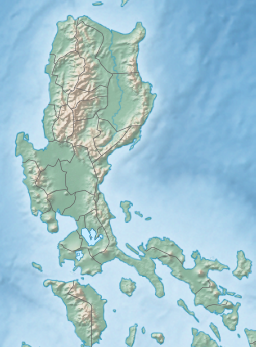
Cavite, officially the Province of Cavite, is a province in the Philippines located in the Calabarzon region in Luzon. Located on the southern shores of Manila Bay and southwest of Manila, it is one of the most industrialized and fastest-growing provinces in the Philippines. As of 2020, it has a population of 4,344,829, making it the most populated province in the country if the independent cities of Cebu are excluded from Cebu's population figure.

Calabarzon, sometimes referred to as Southern Tagalog and designated as Region IV‑A, is an administrative region in the Philippines. The region comprises five provinces: Batangas, Cavite, Laguna, Quezon, and Rizal; and one highly urbanized city, Lucena. It is the most populous region in the Philippines, according to the Philippine Statistics Authority (PSA), having over 16.1 million inhabitants in 2020, and is also the country's second most densely populated after the National Capital Region. It is situated southeast of Metro Manila, and is bordered by Manila Bay and South China Sea to the west, Lamon Bay and the Bicol Region to the east, Tayabas Bay and the Sibuyan Sea to the south, and Central Luzon to the north. It is home to places like Mount Makiling near Los Baños, Laguna, and Taal Volcano in Batangas. Calamba is the regional center while Antipolo is the most populous city in the region.

Korea(n) Bay, sometimes West Korea(n) Bay, is a bight and the northern extension of the Yellow Sea, between the southeastern coastline of China's Liaoning Province and the western coastline of North Korea's North Pyongan, South Pyongan and South Hwanghae provinces. It is separated from the Bohai Sea by the Liaodong Peninsula, with Dalian's Lüshunkou District marking its western end, and westernmost tip of North Korea's Ryongyon County as its eastern end.
Bacoor, officially the City of Bacoor, is a 1st class component city in the province of Cavite, Philippines. According to the 2020 census, it has a population of 664,625 people, making it the 15th most populous city in the Philippines and the second largest city in the province of Cavite after Dasmariñas.

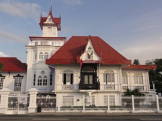
Cavite City, officially the City of Cavite, is a 2nd class component city in the Philippines. According to the 2020 census, it has a population of 100,674 people.

Dasmariñas, officially the City of Dasmariñas, is a 1st class component city in the province of Cavite, Philippines. With a land area of 90.1 square kilometers (34.8 sq mi) and a population of 703,141 people according to the 2020 census, it is the largest city both in terms of area and population in Cavite and the wealthiest Local Government Unit in terms of city in the province.

The Battery is a landmark defensive seawall and promenade in Charleston, South Carolina. Named for a pre-Civil War coastal defense artillery battery originally built by the British at the site, it stretches along the lower shores of the Charleston peninsula, bordered by the Ashley and Cooper Rivers, which meet here to form Charleston Harbor.

The Battle of Zapote River, also known as the Battle of Zapote Bridge, was fought on the 13 June 1899 between 1,200 Americans and between 4,000~5,000 Filipinos. It was the second largest battle of the Philippine–American War after the Battle of Manila five months before in February 1899. Zapote River separates the town of Las Piñas in what was then Manila province from Bacoor in the province of Cavite. The ruins of Zapote Bridge still stands next to its replacement bridge on Aguinaldo Highway.
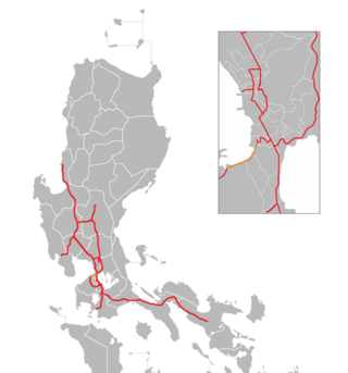
The Manila–Cavite Expressway, signed as E3 of the Philippine expressway network and R-1 of Metro Manila's arterial road network, is a 14-kilometer-long (8.7 mi) controlled-access highway linking Manila to the southern province of Cavite in the Philippines. At its north end, it feeds into and from Roxas Boulevard in the city of Parañaque in Metro Manila, also part of R-1. At the south end, it splits into two termini, both along the north coast in Kawit, Cavite. The first feeds into the intersection of Covelandia Road, Tirona Highway and Antero Soriano Highway. The second southern terminus is an exit-only to Tirona Highway in Barangay Marulas.
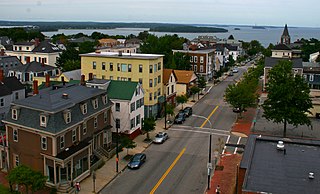
Munjoy Hill is a neighborhood and prominent geographical feature of Portland, Maine. It is located east of downtown and south of East Deering, the neighborhood via Tukey's Bridge. In the nineteenth and twentieth centuries, the neighborhood had a large Irish and Italian American population.

Mariano Gómes de los Ángeles, often known by his birth name Mariano Gómez y Custodio or Mariano Gomez in modern orthography, was a Filipino Catholic priest who was falsely accused of mutiny by the Spanish colonial authorities in the Philippines in the 19th century. He was placed in a mock trial and summarily executed in Manila along with two other clergymen collectively known as the Gomburza. Gomes was the oldest of the three priests and spent his life writing about abuses against Filipino priests.
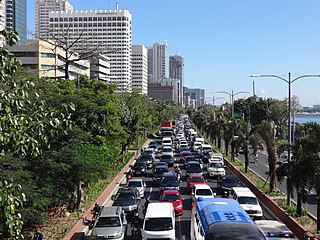
Roxas Boulevard is a popular waterfront promenade in Metro Manila in the Philippines. The boulevard, which runs along the shores of Manila Bay, is well known for its sunsets and stretch of coconut trees. The divided roadway has become a trademark of Philippine tourism, famed for its yacht club, hotels, restaurants, commercial buildings and parks.

Cañacao Bay is a small bay located within the larger Manila Bay in the Philippines.
The Cavite Peninsula is a peninsula extending northeast into Manila Bay from the coastal town of Noveleta in Cavite province in the Philippines. The northern tip of the peninsula is geographically the northernmost part of the province of Cavite.

Radial Road 1 (R-1), informally known as the R-1 Road, is a network of roads and bridges that all together form the first arterial road of Metro Manila in the Philippines. Spanning some 42.67 kilometers (26.51 mi), it connects the cities and municipalities of Bacoor, General Trias, Imus, Kawit, Las Piñas, Manila, Naic, Noveleta, Parañaque, Pasay, and Tanza in Cavite and Metro Manila.
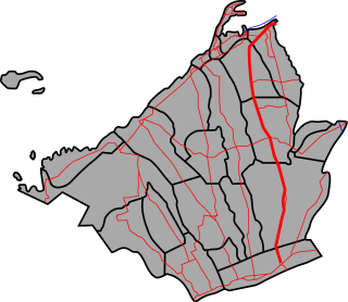
The Emilio Aguinaldo Highway,, alternatively known as Cavite–Batangas Road and Cavite-Manila South Road, is a four-to-six lane, 41.4-kilometer (25.7 mi), network of primary and secondary highways passing through the busiest towns and cities of Cavite, Philippines. It is the busiest and most congested of the three major highways located in the province, the others are Governor's Drive and Antero Soriano Highway.

The Battle of Binakayan–Dalahican was a simultaneous battle during the Philippine Revolution that was fought on November 9–11, 1896 that led to a decisive Filipino victory. The twin battle took place at the shores of Binakayan, in the town of Cavite Viejo ; Dalahican and Dagatan in Noveleta; and, to minimal extent, in Imus and Bacoor towns in Cavite, Philippines that lasted for two days before the Spanish army retreated demoralized and in disarray. The result of the battle was the first significant Filipino victory in the country's history.

National Route 62 (N62) forms part of the Philippine highway network. It runs south from Metro Manila to northeastern Cavite.