Dabola is a prefecture located in the Faranah Region of Guinea. The capital is Dabola. The prefecture covers an area of 6,350 km.² and has an estimated population of 182,951.

The Kindia Region is located in western Guinea. It is bordered by the country of Sierra Leone and the Guinean regions of Conakry, Labé, Mamou, and Boké.

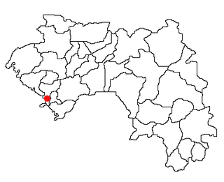
Douprou is a town and sub-prefecture in the Boffa Prefecture in the Boké Region of western Guinea. As of 2014 it had a population of 21,045 people.
Kindoyé is a town and sub-prefecture in the Dabola Prefecture in the Faranah Region of Guinea. As of 2014 it had a population of 6,495 people.
Kaback is a town and sub-prefecture in the Forécariah Prefecture in the Kindia Region of western Guinea.
Kassadou is a town and sub-prefecture in the Guéckédou Prefecture in the Nzérékoré Region of south-western Guinea.
Koumban is a town and sub-prefecture in the Kankan Prefecture in the Kankan Region of eastern Guinea. As of 2014 it had a population of 21,028 people.
Mamouroudou is a sub-prefecture in the Kankan Prefecture in the Kankan Region of eastern Guinea. As of 2014 it had a population of 14,609 people.
Gbangbadou is a town and sub-prefecture in the Kissidougou Prefecture in the Faranah Region of Guinea. As of 2014 it had a population of 13,861 people.
Daralabe is a town and sub-prefecture in the Labé Prefecture in the Labé Region of northern-central Guinea.
Djountou is a town and sub-prefecture in the Lélouma Prefecture in the Labé Region of northern-central Guinea.
Korbé is a town and sub-prefecture in the Lélouma Prefecture in the Labé Region of northern-central Guinea.
Lafou is a town and sub-prefecture in the Lélouma Prefecture in the Labé Region of northern-central Guinea.
Koyamah is a town and sub-prefecture in the Macenta Prefecture in the Nzérékoré Region of south-eastern Guinea.
Kantoumania is a town and sub-prefecture in the Mandiana Prefecture in the Kankan Region of eastern Guinea. As of 2014 it had a population of 11,522 people.
Konah is a town and sub-prefecture in the Tougué Prefecture in the Labé Region of northern-central Guinea.
Koba, Kindia is a town and sub-prefecture in the Télimélé Prefecture in the Kindia Region of western-central Guinea.
Kouramangui is a town and sub-prefecture in the Labé Prefecture in the Labé Region of northern-central Guinea.
Sannou is a town and sub-prefecture in the Labé Prefecture, located in the Labé Region of northern-central Guinea.