
The River Avon is an English river in the south west of the country. To distinguish it from a number of other rivers of the same name, this river is often also known as the Bristol Avon. The name 'Avon' is a cognate of the Welsh word afon, meaning 'river'.

The River Leam, anciently Leame, etc, is a river in England which rises at Hellidon Hill in Northamptonshire then flows through Warwickshire, including the town of Leamington Spa, named after it. It then flows into the River Avon near Warwick, and thence into the River Severn. The name is first recorded in 956 as Limenan, and derives from British Lemanā, meaning "elm-tree river".

The River Lugg rises near Llangynllo in Radnorshire, Wales. It flows through the border town of Presteigne and then through Herefordshire, England, where it meets its main tributary, the River Arrow, to the south of Leominster. It flows into the River Wye downstream of Hereford at Mordiford, around 63 miles (101 km) from its source. Its name comes from a Welsh root, and means "bright stream".

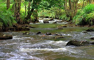
The River Clun runs mostly through Shropshire, England and joins the River Teme at Leintwardine, Herefordshire. The Clun Valley is part of the Shropshire Hills AONB.

The River Perry is a river in Shropshire, England. It rises near Oswestry and flows south to meet the River Severn above Shrewsbury. Along its 24 miles (39 km) length, its level drops by some 320 feet (95 m). The channel has been heavily engineered, both to enable water mills to be powered by it, and to improve the drainage of the surrounding land. There were at least seven corn mills in the 1880s, and the last one remained operational until 1966. The middle section of the river crosses Baggy Moor, where major improvements were made in 1777 to drain the moor. The scheme was one of the largest to enclose and improve land in North Shropshire, and the quality of the reclaimed land justified the high cost. A section of the river bed was lowered in the 1980s, to continue the process.

The River Anker is a river in England that flows through the centre of Nuneaton. It is a major tributary of the River Tame, which it joins in Tamworth. The name of the river derives from an old British term for winding river. From source to river mouth at Tamworth is 50 kilometres (31 mi).

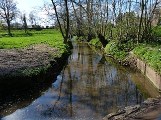
The River Salwarpe is a 20.4 miles (32.8 km) long river in Worcestershire, England. It is a left bank tributary of the River Severn, which it joins near Hawford.

The River Dun is a tributary of the River Kennet, flowing through Wiltshire and Berkshire in England. Its main source is in the parish of Great Bedwyn, Wiltshire and it flows 16 kilometres (10 mi) in a northeasterly direction into Berkshire. It discharges into the Kennet at Hungerford, which has a smaller average flow and width upstream of that point.

Monks Brook is a river in the English county of Hampshire. It is a tributary of the River Itchen, which it joins at a medieval salmon pool in Swaythling. The brook is formed from seven streams that rise in the chalky South Downs, with the official source of Monks Brook being known as Bucket's Corner. Monks Brook drains a clay catchment of 49 square kilometres (19 sq mi). The brook is designated a main river, which means the operating authority for managing it is the Environment Agency, not the local government authorities for the areas through which the river runs.

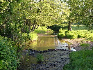
Quinny Brook is a tributary stream of the River Onny which flows through the Shropshire Hills Area of Outstanding Natural Beauty in England.

The River Isbourne is 14 mile (22 km) long tributary of the River Avon which flows through Gloucestershire and Worcestershire in the Midlands of England.
The River Tale is a small river that drains the southern slopes of the Blackdown Hills, in Devon, England. It is a tributary of the River Otter and 8.8 miles (14.2 km) in length. Its name is derived from getæl meaning "quick, active or swift"; however, the river is noted as being "sluggish". One theory is that its name was transferred from Tala Water, a tributary of the nearby River Tamar. The river is the site of ongoing efforts to reintroduce the water vole, which is thought to be extinct in Devon.

The Afon Dulas is a river in Powys, Wales. It is a headwater tributary of the River Severn, which it joins at Llanidloes opposite the confluence with the Afon Clywedog. Its principal tributary is the Afon Brochan. The total length of the Dulas and Brochan is 19.6 km. Other tributaries include Nant Cydros, the Rhydyclwydau Brook and Nant Gynwydd.

The Bow Brook is a substantial brook that flows for 28.8 miles (46.3 km) through Worcestershire, England. It is a lower tributary of the River Avon which it joins near Defford downstream of Eckington Bridge. Its principal tributaries include the Stoulton, Dean, and Seeley brooks.
Hodge Beck is a stream that flows through the North York Moors national park in North Yorkshire, England. It is a tributary of the River Dove which it joins near Welburn south of Kirkbymoorside. The beck is 14 miles (23 km) long and has a total catchment area of 58 square kilometres (22 sq mi).
The Finham Brook is a lower tributary of the River Sowe, it flows through Kenilworth and Warwickshire, England, to join the Sowe near Finham. Its principal tributaries include the Canley Brook, which drains the Tile Hill and Canley areas of Coventry, and the Inchford Brook which rises near Beausale, and then flows in an arc through the parish of Beausale, Haseley, Honiley and Wroxall. The length of the Finham and Inchford brooks is 15 miles (24 km), which have a total catchment area of 71 square kilometres (27 sq mi).

Roe Beck also known as the River Roe in its lower reaches, is a beck that flows through Cumbria, England. It is a lower tributary of the River Caldew which it joins near Gaitsgill south of Dalston. The total length of the beck including Peel Gill is 20.8 kilometres (12.9 mi) and it has a catchment of 69 square kilometres (27 sq mi), which includes the area of its major tributary the River Ive.

Bedburn Beck is a 16.8 kilometres (10.4 mi) long, upper tributary of the River Wear in County Durham, England. The beck and its tributaries, including the Euden, Harthorpe and South Grain becks, have a catchment of 76 square kilometres (29 sq mi), much of which is covered by the coniferous Hamsterley Forest.

Crimple Beck or the River Crimple is a beck which flows through North Yorkshire, England. It is a tributary of the River Nidd which it joins between Little Ribston and Walshford north of Wetherby. The beck is 15.5 miles (24.9 km) long, and has a total catchment area of 80 square kilometres (31 sq mi), which drains the area around Harrogate. Its tributaries include the Park Beck.

The River Strine is a 3.4-mile-long (5.4 km) tributary of the River Tern flowing through the Telford and Wrekin district of Shropshire in England. The river drains the Weald Moors a fenland area north of Telford, and also takes runoff from Newport and Lilleshall. Tributaries of the Strine include the Pipe Strine, Red Strine, and Wall Brook.

