This article needs additional citations for verification .(February 2021) |
Bai-Ka-Bagh | |
|---|---|
town | |
| Country | |
| State | Uttar Pradesh |
| Languages | |
| • Official | Hindi |
| Time zone | UTC+5:30 (IST) |
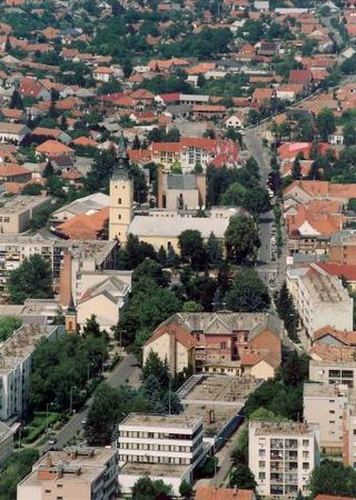
Bai-Ka-Bagh is a locality (township) of Prayagraj, Uttar Pradesh, India. [1]
This article needs additional citations for verification .(February 2021) |
Bai-Ka-Bagh | |
|---|---|
town | |
| Country | |
| State | Uttar Pradesh |
| Languages | |
| • Official | Hindi |
| Time zone | UTC+5:30 (IST) |
Bai-Ka-Bagh is a locality (township) of Prayagraj, Uttar Pradesh, India. [1]

The Arctic Archipelago, also known as the Canadian Arctic Archipelago, is an archipelago lying to the north of the Canadian continental mainland, excluding Greenland and Iceland.

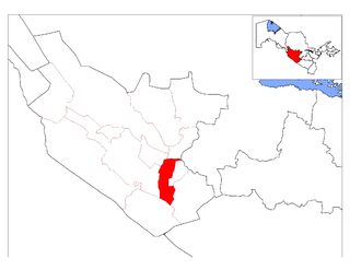
Prayagraj district, previously known as Allahabad district, is the most populous district in the Indian state of Uttar Pradesh. Prayagraj city is the district headquarters of this district. The District is divided into blocks within tehsils. As of 2011, there are 20 blocks in eight tehsils. The Prayagraj division includes the districts of Pratapgarh, Fatehpur, Kaushambi and Prayagraj, with some western parts that had previously part of Allahabad District becoming part of the new Kaushambi District. The administrative divisions are Phulpur, Koraon, Meja, Sadar, Soraon, Handia, Bara, Shringverpur and Karchana.

Grenadines is an administrative parish of Saint Vincent and the Grenadines, comprising the islands of the Grenadines other than those belonging to Grenada. The capital is Port Elizabeth.

Ballymagorry or Ballymagory is a small village and townland in County Tyrone, Northern Ireland. It is west of Artigarvan and 5 kilometres (3.1 mi) north of Strabane. In the 2001 Census it had a population of 565. It lies within the Strabane District Council area and lies on the River Glenmornan.
Hobølelva is a river rising in Sværsvann in Oslo, until joining Lake Vansjø in Østfold. Hobølelva is the largest of the four tributaries of Vansjø, and flows into Vansjø at an average of 5.4 cubic metres per second (190 cu ft/s).

Kecerovský Lipovec is a village and municipality in Košice-okolie District in the Kosice Region of eastern Slovakia.
Opiná is a village and municipality in Košice-okolie District in the Kosice Region of eastern Slovakia.
Hajdúnánás is a town in Hajdú-Bihar County, in the Northern Great Plain region of eastern Hungary.

Census Division No. 2 is a census division located within the Eastman Region in the Canadian province of Manitoba. Unlike in some other provinces, census divisions do not reflect the organization of local government in Manitoba. These areas exist solely for the purposes of statistical analysis and presentation; they have no government of their own.
Januszkowice is a village in the administrative district of Gmina Brzostek, within Dębica County, Subcarpathian Voivodeship, in south-eastern Poland. It lies approximately 5 kilometres (3 mi) south-east of Brzostek, 23 km (14 mi) south of Dębica, and 46 km (29 mi) south-west of the regional capital Rzeszów.
Bukhara District is a district of Bukhara Region in Uzbekistan. The capital lies at the city Galaosiyo. It has an area of 1,320 km2 (510 sq mi) and its population is 172,200 (2021).

Bluie was the United States military code name for Greenland during World War II. It is remembered by the numbered sequence of base locations identified by the 1941 United States Coast Guard South Greenland Survey Expedition, and subsequently used in radio communications by airmen unfamiliar with pronunciation of the Greenlandic Inuit and Danish names of those locations. These were typically spoken BLUIE (direction) (number), with direction being east or west along the Greenland coast from Cape Farewell.
Kagarol is a village in the Agra district of Uttar Pradesh state in India. It is situated at a distance of about 25 kilometers to the south-west of Agra city. This village finds mention in some of the earliest Archaeological Survey of India reports compiled by Alexander Cunningham and his assistants, J. D. Beglar and A. C. L. Carlleyle.
Rudina is a village in Ruen Municipality, in Burgas Province, in southeastern Bulgaria.
Donchovtsi is a village in Tryavna Municipality, in Gabrovo Province, in northern central Bulgaria.
Kashentsi is a village in Tryavna Municipality, in Gabrovo Province, in northern central Bulgaria.
Vapa is a village in the municipality of Čačak, Serbia. According to the 2011 census, the village has a population of 695 people.
Priozerny/Priozyorny, Priozernaya/Priozyornaya, or Priozernoye/Priozyornoye is the name of several rural localities in Russia.
Anbar is an administrative unit, known as Union council of Swabi District in the Khyber Pakhtunkhwa province of Pakistan.
25°26′N81°51′E / 25.433°N 81.850°E
| | This Prayagraj district location article is a stub. You can help Wikipedia by expanding it. |