Gahmar is a village in India, located near the Ganges river in the Ghazipur district in the state of Uttar Pradesh. The village is 38 km from Ghazipur. The village has two post offices, and one Panchayat Bhawan. Gahmar is also known as the "Village of Soldiers".
Fufuao or Rampur Phuphuaon is a village in Dildarnagar Kamsar in the Indian state of Uttar Pradesh.

Bhidauni is a village and Gram panchayat of two villages, Kewat Nagla and Bhidauni officially known as Bhidauni Bangar located between the Yamuna river and Yamuna Expressway in the Mat Tehsil of Mathura district, Uttar Pradesh, India. It is situated approximately 45 kilometers away from Mathura City, on the Raya Road connecting via Mant to Naujheel Road.

Agra Cantonment (a.k.a. Agra Cantt.) is one of the 403 constituencies of the Uttar Pradesh Legislative Assembly, India. It is a part of the Agra district and one of the five assembly constituencies in the Agra Lok Sabha constituency. First assembly elections in the Agra Cantonment assembly constituency were conducted in 1967, and the extant and serial number of this constituency was last defined in "Delimitation of Parliamentary and Assembly Constituencies Order, 2008". VVPAT facility with EVMs will arrive in the 2017 U.P assembly polls.

Sudhanshu Trivedi is an Indian politician and former professor. A leader of the Bharatiya Janata Party and Member of Parliament from its Upper House, the Rajya Sabha. Trivedi is the Senior National Spokesperson of the Bharatiya Janata Party.
Jahanabad Assembly constituency is one of the 403 assembly constituencies of Uttar Pradesh, India. It is part of Fatehpur district. It contains these parts of Fatehpur district- Amauli, Tappajar, Paprenda, Jahanabad, Khajuha & Kora Jahanabad (NP) of Bindki Tehsil. In 1952, the first Member of Legislative Assembly / MLA / Vidhayak for Jahanabad constituency Guru Prashad Pandey contested election with the support of Swargiya Satyapal Gupta (Lambardar) and all expenses of election were picked up by him.

Vishwanathganj is a constituency of the Uttar Pradesh Legislative Assembly covering the city of Vishwanathganj in the Pratapgarh district of Uttar Pradesh, India.

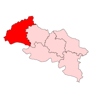
Ghorawal is a constituency of the Uttar Pradesh Legislative Assembly covering the city of Ghorawal in the Sonbhadra district of Uttar Pradesh, India.
Kadar Chowk is an administrative Block and Nagar panchayat in Budaun Tehsil and Budaun district, Uttar Pradesh, India. Its block code is 0183. The village is administrated by Gram Panchayat. According to Census 2011 India the total population is 1,66,578 out of 89,303 are males and 77,275 are females.
Bairi Alipur is a village and Gram panchayat in Bilhaur Tehsil, Kanpur Nagar district, Uttar Pradesh, India. It is located 55 km away from Kanpur City. Village code is 149951.
Bakothi is a village and Gram panchayat in Bilhaur Tehsil, Kanpur Nagar district, Uttar Pradesh, India.According to census 2011 total Population of the village is 787 which has 392 males and 395 females. It is located 66 km away from Kanpur City. Village code is 149927.
Chaukhandi is a village in Barauli Gram panchayat in Bilhaur Tehsil, Kanpur Nagar district, Uttar Pradesh, India. Village code is 149943.
Garh is a village in Bedipur Gram panchayat in Bilhaur Tehsil, Kanpur Nagar district, Uttar Pradesh, India. Village Code is 149974.
Chaubi Gahi Shikohabad is a village and Gram panchayat in Bilhaur Tehsil, Kanpur Nagar district, Uttar Pradesh, India. It is located 60 KM away from Kanpur City.
Bilhaur Dehat is a village and Gram panchayat in Bilhaur Tehsil, Kanpur Nagar district, Uttar Pradesh, India. Its village code is 149954. According to 2011 Census of India the total population of the village is 6,100 in which 3,189 is males and 2,911 are females.
Kati Kui is a village in Birthi Haveli Gram panchayat in Bilhaur Tehsil, Kanpur Nagar district, Uttar Pradesh, India. Its village code is 149915.
Salarpur is a Block & village panchayat in Budaun district, Uttar Pradesh, India. Its block code is 0180. 67 panchayat of Budaun district comes under Salarpur block. According to 2011 Census of India, the total houses in Salarpur is 27,767 and total population is 1,68,197 out of 90,637 are males and 77,560 are females.
Halpura (Hindi:हलपुरा) is a village and Gram panchayat in Bilhaur Tehsil, Kanpur Nagar district, Uttar Pradesh, India. Its village code is 209202. As per 2011 Census of India report the population of the village is 1924 where 1042 are men and 882 are women.
Nausana is a medium size village and also a Gram Panchayat located in Salarpur, Budaun block, tehsil in Budaun district in the northern Indian state of Uttar Pradesh. It is approximately 27 kilometres (17 mi) from Budaun city, district headquarter.The Village 286 kilometres (178 mi) north of the state capital, Lucknow, and 250 kilometres (155 mi) east of the national capital, New Delhi. The village has population of 1418 of which 1000 are males while 900 are females as per Population Census 2023.


