Manakpur | |
|---|---|
 Manakpur | |
| Coordinates: 32°27′N72°26′E / 32.45°N 72.43°E | |
| Country | |
| Province | Punjab |
| Elevation | 726 m (2,382 ft) |
| Time zone | UTC+5 (PST) |
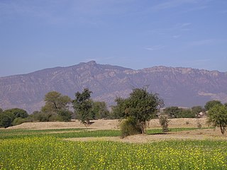
Manakpur is a village in the Punjab province of Pakistan.
Manakpur | |
|---|---|
| Manakpur | |
| Coordinates: 32°27′N72°26′E / 32.45°N 72.43°E | |
| Country | |
| Province | Punjab |
| Elevation | 726 m (2,382 ft) |
| Time zone | UTC+5 (PST) |
Manakpur is a village in the Punjab province of Pakistan.
It is located at 32°45'0N 72°43'0E with an altitude of 726 metres (2385 feet). [1]
Khukha is a village in Jhelum District, Punjab, Pakistan. It is a Union Council, an administrative subdivision, of Jhelum Tehsil and is a "model" village. It lies 7 km west of Dina, 1 km east of Gaggar Khurd, 5 km north of Rohtas and 10 km north east of Tilla Jogian. Neighbouring villages of khukha include Natain, Khojki and Mota Gharbi.

Batken Region is a region (oblus) of Kyrgyzstan. Its capital is Batken. It is bounded on the east by Osh Region, on the south, west and north by Tajikistan, and on the northeast by Uzbekistan. The northern part of the region is part of the flat, agricultural Ferghana Valley. The land rises southward to the mountains on the southern border: the Alay Mountains in the east, and the Turkestan Range in the west. Its total area is 17,048 km2 (6,582 sq mi). The resident population of the region was 548,247 as of January 2021. The region has sizeable Uzbek and Tajik minorities.

Bligh Island Marine Provincial Park is a provincial park in British Columbia, Canada.
Garden Bay Marine Provincial Park is a provincial park in British Columbia, Canada at the northwest end of the Sechelt Peninsula on the lower Sunshine Coast, near the community of Madeira Park. Established in 1969, it is approximately 163 ha.
Kickininee Provincial Park is a provincial park in British Columbia, Canada, located just south of the town of Summerland in that province's Okanagan region. Originally established in 1970 with approximately 7 acres (28,000 m2) of upland and 113.5 acres (0.459 km2) of foreshore, the park today comprises approximately 48.76 ha.

Elbow Pass is the mountain pass between the Highwood and Elbow areas in Kananaskis Country, Alberta, Canada. It contains Elbow Lake which is the headwaters of the Elbow River.
The Lytton First Nation, a First Nations band government, has its headquarters at Lytton in the Fraser Canyon region of the Canadian province of British Columbia. While it is the largest of all Nlaka'pamux bands, unlike all other governments of the Nlaka'pamux (Thompson) people, it is not a member of any of the three Nlaka'pamux tribal councils, which are the Nicola Tribal Association, the Fraser Canyon Indian Administration and the Nlaka'pamux Nation Tribal Council.

Acehúche is a municipality located in the province of Cáceres, Extremadura, Spain. According to the 2006 census (INE), the municipality has a population of 866 inhabitants.
Cabañas Raras is a village and municipality located in the region of El Bierzo. According to the 2010 census (INE), the municipality has a population of 1,329 inhabitants.

Jacobo Hunter District is one of the 29 districts of the Arequipa Province in Peru.
CILA-FM is a Canadian radio station that broadcasts religious programming at 88.1 FM in Cookshire-Eaton, Quebec. The station was licensed in 1995 and is owned by the Roman Catholic Archdiocese of Sherbrooke through la Fabrique de la Paroisse Saint-Camille-de-Cookshire.
Serere is a town in Eastern Uganda. It is the chief political, administrative and commercial town in Serere District, and the district headquarters are located there. The district is named after the town.

Lachin District is one of the 66 districts of Azerbaijan. It is located in the west of the country, belonging to the East Zangezur Economic Region. The district borders the districts of Kalbajar, Khojaly, Shusha, Khojavend, Qubadli, and the Syunik Province of Armenia. Its capital and largest city is Lachin. As of 2020, the district had a nominal population of 78,600.
The Tulsequah River, formerly the Talsekwe River, is a tributary of the Taku River in northwestern British Columbia, located south of the Atlin District and inland from Juneau, Alaska. The unincorporated settlement of Tulsequah is located at the confluence.
Shindand is a village in the Federally Administered Tribal Areas of Pakistan. It is located at 33°33'0N 71°38'0E with an altitude of 493 metres (1,617 ft).
The Cadwallader Range, originally named the Cadwallader Mountains, is a sub-range of the Pacific Ranges of the Coast Mountains in the Bridge River-Lillooet Country of the South-Central Interior of British Columbia, Canada, located between the south end of Anderson Lake (E) and the Hurley River. According to the provincial basemap, the precise alpine boundaries of the range are McGilliray Pass, at its eastern extremity and beyond which is the Bendor Range, and the pass between Noel and Sockeye Creeks on its west, which is immediately north of the lower end of Birkenhead Lake. The officially unnamed range west of that has been called the Noel Range, after its main peak Mount Noel. At the foot of the range along its northeast flank is Cadwallader Creek, scene of the historic and once-rich Bralorne and Pioneer Mines and the ghost town of Bralorne.
The Tseycum First Nation is a First Nations government located on Vancouver Island. In the 1850s, they were signatories to the Douglas Treaties.
Dzongkhul Monastery or Zongkhul Gompa is located 30 km northwest of Padum in the Stod Valley of Zanskar in Ladakh, northern India. Like the Sani Monastery, it belongs to the Drukpa school of Tibetan Buddhism
Partido is a town in the Dajabón province of the Dominican Republic.
The Arcadia Management Area is a protected area in Richmond, Exeter, Hopkinton, and West Greenwich, Rhode Island. With an area of 14,000 acres, it is the state's largest recreational area. AMA is home to an extensive network of logging roads and single track trails - ideal for picnicking, hiking, running, mountain biking, fishing, horseback riding, and boating. During the winter some of the roads going through the forest close and are only accessible by foot traffic. In 2011, part of the film Moonrise Kingdom was filmed at the park. The former Pine Top Ski Area on Escoheag Hill is located within Arcadia.
33°33′0″N71°38′0″E / 33.55000°N 71.63333°E
| | This Punjab, Pakistan location article is a stub. You can help Wikipedia by expanding it. |