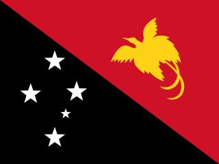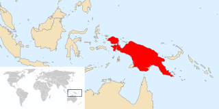
Papua New Guinea, officially the Independent State of Papua New Guinea, is a country in Oceania that occupies the eastern half of the island of New Guinea and its offshore islands in Melanesia, a region of the southwestern Pacific Ocean north of Australia. Its capital, located along its southeastern coast, is Port Moresby. The western half of New Guinea forms the Indonesian provinces of Papua and West Papua. It is the world's third largest island country with 462,840 km2 (178,700 sq mi).

The Bismarck Archipelago is a group of islands off the northeastern coast of New Guinea in the western Pacific Ocean and is part of the Islands Region of Papua New Guinea. Its area is about 50,000 square km.

New Ireland Province, formerly New Mecklenburg, is the most northeastern province of Papua New Guinea.

The Territory of Papua comprised the southeastern quarter of the island of New Guinea from 1883 to 1975. In 1883, the Government of Queensland annexed this territory for the British Empire. The United Kingdom Government refused to ratify the annexation but in 1884 a Protectorate was proclaimed over the territory, then called "British New Guinea". There is a certain ambiguity about the exact date on which the entire territory was annexed by the British. The Papua Act 1905 recites that this happened "on or about" 4 September 1888. On 18 March 1902, the Territory was placed under the authority of the Commonwealth of Australia. Resolutions of acceptance were passed by the Commonwealth Parliament, who accepted the territory under the name of Papua.

The Bismarck Sea lies in the southwestern Pacific Ocean within the nation of Papua New Guinea. It is located northeast of the island of New Guinea and south of the Bismarck Archipelago. It has coastlines in districts of the Islands Region, Momase Region, and Papua Region.
The Lihir language is an Austronesian language spoken in the Lihir island group, in New Ireland Province, Papua New Guinea. It is notable for having 5 levels of grammatical number: singular, dual, trial, paucal and plural. It is questionable whether the trial is indeed trial or whether it is paucal, leaving there being a paucal and a greater paucal. Either way, this is the highest number of levels of grammatical number in any language. This distinction appears in both independent pronouns and possessor suffixes. There is some variation in pronunciation and orthography between the main island Niolam, and some of the smaller islands in the group.

The culture of Papua New Guinea is many-sided and complex. It is estimated that more than 7000 different cultural groups exist in Papua New Guinea, and most groups have their own language. Because of this diversity, in which they take pride, many different styles of cultural expression have emerged; each group has created its own expressive forms in art, dance, weaponry, costumes, singing, music, architecture and much more. To unify the nation, the language Tok Pisin, once called Neo-Melanesian has evolved as the lingua franca — the medium through which diverse language groups are able to communicate with one another in Parliament, in the news media, and elsewhere. People typically live in villages or dispersed hamlets which rely on the subsistence farming of yams and taro. The principal livestock in traditional Papua New Guinea is the oceanic pig.

The Papua New Guinea national cricket team, nicknamed the Barramundis, is the team that represents the country of Papua New Guinea in international cricket. The team is organised by Cricket PNG, which has been an Associate Member of the International Cricket Council (ICC) since 1973. Papua New Guinea previously had One-Day International (ODI) status, which it gained by finishing fourth in 2014 World Cup Qualifier. Papua New Guinea lost both their ODI and T20I status in March 2018 after losing a playoff match against Nepal during the 2018 Cricket World Cup Qualifier, a result that earned ODI and T20I status for their opponents. On 26 April 2019, at the final World Cricket League 2 fixture; PNG defeated Oman to finish at the fourth position and reclaim their ODI status.

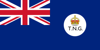
The Territory of New Guinea was an Australian administered territory on the island of New Guinea from 1914 until 1975. In 1949, the Territory and the Territory of Papua were established in an administrative union by the name of the Territory of Papua and New Guinea. That administrative union was renamed as Papua New Guinea in 1971. Notwithstanding that it was part of an administrative union, the Territory of New Guinea at all times retained a distinct legal status and identity until the advent of the Independent State of Papua New Guinea.

The Kuot language, or Panaras, is a language isolate, the only non-Austronesian language spoken on the island of New Ireland, Papua New Guinea. Lindström estimates that there are 1,500 fluent speakers of Kuot. Perhaps due to the small speaker base, there are no significant dialects present within Kuot. It is spoken in 10 villages, including Panaras village of Sentral Niu Ailan Rural LLG in New Ireland Province.

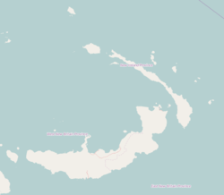
New Ireland or Latangai, is a large island in Papua New Guinea, approximately 7,404 km2 (2,859 sq mi) in area with c. 120,000 people. It is named after the island of Ireland. It is the largest island of New Ireland Province, lying northeast of the island of New Britain. Both islands are part of the Bismarck Archipelago, named after Otto von Bismarck, and they are separated by Saint George's Channel. The administrative centre of the island and of New Ireland province is the town of Kavieng located at the northern end of the island. While the island was part of German New Guinea, it was named Neumecklenburg.

Papua New Guinea, a sovereign state in Oceania, is the most linguistically diverse country in the world. According to Ethnologue, there are 839 living languages spoken in the country. In 2006, Papua New Guinea Prime Minister Sir Michael Somare stated that "Papua New Guinea has 832 living languages ," Languages with statutory recognition are Tok Pisin, English, Hiri Motu, and Papua New Guinean Sign Language. Tok Pisin, an English-based creole, is the most widely spoken, serving as the country's lingua franca. Papua New Guinean Sign Language became the fourth officially recognised language in May 2015, and is used by the deaf population throughout the country.
The angulate pipistrelle, also known as the New Guinea pipistrelle, is a species of vesper bat found in Papua New Guinea and the Solomon Islands.

The New Guinea Islands Region is one of four regions of Papua New Guinea (PNG), comprising the Bismarck Archipelago and north-western Solomon Islands (archipelago), located north-east of New Guinea island.

New Guinea is the world's second-largest island and, with an area of 785,753 km2 (303,381 sq mi), the largest island in the Southern Hemisphere. Located in Melanesia in the southwestern Pacific Ocean, it is separated by the 150-kilometre wide Torres Strait from the Australian continent. Numerous smaller islands are located to the west and east. The eastern half of the island is the major land mass of the independent state of Papua New Guinea. The western half, known as Western New Guinea or West Papua, forms a part of Indonesia and is organized as the provinces of Papua and West Papua.
The Tiang language also known as Djaul is a language spoken in Papua New Guinea.
Barok is an Austronesian language spoken in New Ireland, Papua New Guinea.
Siar, also known as Lak, Lamassa, or Likkilikki, is an Austronesian language spoken in New Ireland Province in the southern island point of Papua New Guinea. Lak is in the Patpatar-Tolai sub-group, which then falls under the New Ireland-Tolai group in the Western Oceanic language, a sub-group within the Austronesian family. The Siar people keep themselves sustained and nourished by fishing and gardening. The native people call their language ep warwar anun dat, which means "our language".
The Irish cricket team toured Australia to play Papua New Guinea from 24 January to 9 February 2016. The tour consisted of a first-class match, three Twenty20 Internationals (T20Is) and a tour match. The first-class match was part of the 2015–17 ICC Intercontinental Cup and the tour match was in preparation of the Intercontinental Cup match. Ireland won the T20I series 2–1.


