Bakossi National Park

Last updated

Bakossi National Park
Cameroon physical map.svg
Red pog.svg
Location in Cameroon
LocationFlag of Cameroon.svg  Cameroon
Coordinates 5°03′00″N9°34′04″E / 5.049907°N 9.567719°E / 5.049907; 9.567719
Area293.2 km²
Established2008

The Bakossi National Park (BNP) is a protected area within the Bakossi Forest Reserve, created by a decree in early 2008. The park covers 29,320 hectares (72,500 acres), and was justified on the basis of preserving plant diversification. [1]

Contents

Location

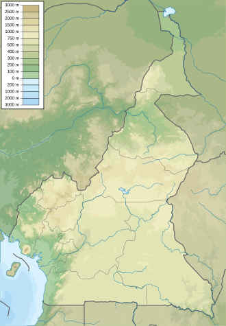
The Bakossi Mountains are part of the Cameroon Line, running inland in a northeasterly direction from Mount Cameroon. The mountains have an area of about 230,000 square kilometres (89,000 sq mi) and typical elevation of 800 metres (2,600 ft) to 1,900 metres (6,200 ft). The highest peak is Mount Kupe at 2,064 metres (6,772 ft). The mountains contain what may be the largest area of cloud or submontane forest in West-Central Africa. [2] The area includes the national park and the proposed Muanenguba ecological reserve to the east and Kupe ecological reserve to the south of the park.

The climate has a dry season between November and March, and a rainy season from April until October. The hottest month is January and the wettest month is August. The temperature ranges from 22 °C (72 °F) to 32 °C (90 °F), Rainfall is between 3 metres (9.8 ft) and 4 metres (13 ft) annually. [2] Humidity is between 70% and 85%. The mountain slopes are mainly covered by fertile volcanic soil in which crops grow easily.

Biodiversity

The Bakossi Landscape Area is part of the Cameroon Highlands ecoregion. [3] The Bakossi landscape area includes a wide range of habitats at different heights. Staff from Kew Gardens and the IRAD-National Herbarium of Cameroon worked on preparing an inventory of plants in the Kupe-Bakossi region between 1995 and 2005. The area had not been known to have particularly rich diversity of plant life. The botanists found 2,440 plant species, a huge number. Of these, one in 10 species was new to science. 82 were strictly restricted to the area and 232 were threatened with extinction according to International Union for Conservation of Nature (IUCN) 2001 criteria. [1]

One of the most interesting of the newly discovered species is Kupea martinetugei (Triuridaceae), a new species of saprophyte that completely lacks photosynthetic tissue. The species is part of a new genus and a new tribe. It is critically endangered, so far found only in two sites, each just a few square metres in area. [2]

The area is home to important large mammals that include the drill, African forest elephant, chimpanzee, and Preuss's red colobus. The World Wide Fund for Nature (WWF), which facilitated creation of the park, has engaged in geospatial mapping of the distribution of key large mammals in the park. [4] They are concentrated in the north and south of the park, perhaps due to greater availability of food and shelter and lower levels of hunting and farmland encroachment.

Organization

A field consultation program for gazettement of Bakossi National Park was completed in 2004, jointly supported by the World Wildlife Fund's Coastal Forests Programme and the San Diego Zoo's Center for Conservation and Research for Endangered Species. The local communities were involved in the process, and over eighty villages signed the legislative support for the Park's creation. Some boundary changes were recommended, as were rules to define and preserve the legal rights of the communities. It was expected that sacred forest areas would be incorporated into the park, expected to be legally created in 2005. [5]

After some delays, the Bakossi National Park was created in 2007 and officially inaugurated early in 2008 by a decree signed by Prime Minister Ephraim Inoni and Minister of Forests Elvis Ngollengolle. [1] The signature followed shortly after the December 2007 release of the film "The Mists of Mwanenguba", which documents the importance of conservation in the Bakossi mountains. The film was viewed by the Minister of Forests and the Paramount Chief of Bakossi in January 2008. [6] Unusually for national parks in the region, the main justification was to conserve plant diversity. [1]

Creation of the park resulted in an improvement of the funding level of the area by WWF Sweden in mid 2008. The WWF-CFP announced a strategy for introducing conservation-based income generating activities. This was handicapped by lack of organization and record-keeping in the local communities, inappropriate agricultural activities, lack of proper benefit sharing, gender insensitivity and other issues. [7] Nevertheless, there were hopes that the Village Forest Management Committees would come to play an essential role in initiating and maintaining sustainable forestry management practices in the park as long as the needs of the villagers were respected. [8]

A 2011 report noted that outstanding tasks included completing the establishment process, demarcating boundaries and finalizing the management plan. Eco-guards had to be recruited, trained and equipped, and the community educated in conservation and involved in ape surveys. [9]

Threats

The region is mainly inhabited by the Bakossi people but the population also includes Mbo, Manehas, Bakem, Baneka and immigrant Bamiliki people. [10] In the last few decades there has been rapid growth in the human population. The indigenous people practice logging on a small scale, with the wood used for construction of homes and for making furniture, and harvest forest plants. This has minimal impact on the environment. They cultivate cocoa and coffee as cash crops and grow plantain, cocoyam, cassava, beans and pepper for their own consumption and for sale. Encroachment on wildlife habitats is a concern. Most of the people hunt for bushmeat, which is an important source of protein. A 2003 report said this activity had reached unsustainable levels and was putting large mammals at stake.

More than 200 of the plant species in the park at risk of extinction. [11] Kew Gardens has worked with the community to help them understand the value of conservation. The local people have taken the lead in preserving the forest from illegal logging and clearance for farming. [1] Traditional beliefs have played a part in helping preserve the ecosystem. Sacred forests and groves in the national park have significantly higher plant species diversity than in nearby Mount Cameroon.[ citation needed ] However, most of the people of the area are poor subsistence farmers. Falls in the price of their coffee and cocoa cash crops have caused them to increase use of nontimber forest products to earn money, creating huge pressure on the forest. [11]

As of 2011 a project was being planned to convert over 70,000 hectares (270 sq mi) of unprotected land in the region into oil palm plantations. The project has been justified as providing a sustainable source of income for the people of the region. Concerns are that clearance of forests to make way for the plantations will seriously affect the livelihood of the local people who depend on forest products, and that a massive influx of low-paid plantation workers will result in a sharp and unsustainable rise in illegal logging and hunting in protected areas such as the Bakossi National Park. [12] Conservation groups identified the Blackstone Group as one of the main investors in what they call the "Cameroon deforestation drive", which they say will be an ecological disaster [13] In fact, the US-based Herakles Farms acquired 100% of Blackstone's SG Sustainable Oils affiliate in Cameroon, and Blackstone is no longer involved. [14] Herakles Farms is moving forward with the project, which originally included 132 hectares (330 acres) of the national park itself. [15] Herakles has said "the plantations will follow the highest environmental and social standards, complying fully with Roundtable on Sustainable Palm Oil (RSPO) Principles & Criteria". [14]

Related Research Articles

<span class="mw-page-title-main">Palm oil</span> Edible vegetable oil from fruit of oil palms

Palm oil is an edible vegetable oil derived from the mesocarp of the fruit of the oil palms. The oil is used in food manufacturing, in beauty products, and as biofuel. Palm oil accounted for about 33% of global oils produced from oil crops in 2014. Palm oils are easier to stabilize and maintain quality of flavor and consistency in processed foods, so are frequently favored by food manufacturers. On average globally, humans consumed 7.7 kg (17 lb) of palm oil per person in 2015. Demand has also increased for other uses, such as cosmetics and biofuels, creating more demand on the supply encouraging the growth of palm oil plantations in tropical countries.

<span class="mw-page-title-main">Mount Cameroon</span> Active volcano in Cameroon near the Gulf of Guinea

Mount Cameroon is an active volcano in the South West region of Cameroon next to the city of Buea near the Gulf of Guinea. Mount Cameroon is also known as Cameroon Mountain or Fako or by its indigenous name Mongo ma Ndemi.

<span class="mw-page-title-main">Korup National Park</span> National park in Cameroon

Korup National Park is in the Southwest Province of Cameroon and extends over 1,260 km2 of mostly undisturbed primary forest. It is reputedly one of Africa’s oldest and richest tropical forests in terms of floral and faunal diversity. It is the most accessible rainforest national park in Cameroon with basic lodging infrastructure and a large network of trails open to visitors. The park is a popular birdwatching destination and famous for primate viewing. Researchers from various disciplines have been conducting biological studies in Korup for over three decades, generating a wealth of information on rainforest ecosystems.

<span class="mw-page-title-main">Tesso Nilo National Park</span> National park in Riau Province, Sumatra, Indonesia

Tesso Nilo National Park is a national park in Riau Province, Sumatra, Indonesia. It was declared a national park by the Indonesian government in 2004. The original area of the park was 385.76 km2, but the decision has been made to expand it to 1000 km2. Tesso Nilo National Park houses some of the largest coherent lowland rainforests remaining on Sumatra. The Center for Biodiversity Management has surveyed over 1,800 plots in tropical forests around the world. They found that no other plot has as many vascular plants as in Tesso Nilo. Indonesian Institute of Sciences (LIPI) surveyed forests throughout Sumatra, and also found that Tesso Nilo housed by far the most species.

<span class="mw-page-title-main">Cameroonian Highlands forests</span>

The Cameroonian Highlands forests, also known as the Cameroon Highlands forests, are a montane tropical moist broadleaf forest ecoregion located on the range of mountains that runs inland from the Gulf of Guinea and forms the border between Cameroon and Nigeria. This is an area of forest and grassland which has become more populous as land is cleared for agriculture.

<span class="mw-page-title-main">Olam International</span> Singaporean agriculture company

Olam International is a major food and agri-business company, operating in 60 countries and supplying food and industrial raw materials to over 20,900 customers worldwide. Its value chain includes farming, origination, processing and distribution operations.

Hyperolius dintelmanni is a species of frogs in the family Hyperoliidae. It is endemic to Cameroon and found in the montane southwestern part of the country. Specifically, it has been recorded from the Bakossi Mountains, including the Edib Hills and Mount Kupe. The specific name, dintelmanni, honors Mr. Horst Dintelmann from Germany in recognition of "his support of taxonomic research and forthcoming conservation projects in Cameroon".

<span class="mw-page-title-main">Campo Ma'an National Park</span> National park in Cameroon

Campo Ma'an National Park is a 2,680 square kilometer National Park in Cameroon, located in the South Region in the Océan division. It borders with Equatorial Guinea on the south, the Atlantic Ocean to its west, the Vallée-du-Ntem and the Mvila to the east. Total area of the park and buffer zone measure approximately 700, 000 hectares. The climate has two dry seasons, November to March and July to August, and two rainy seasons, April to June and August to October. Average temperature is 25°C.

<span class="mw-page-title-main">Ndian</span> Department in Southwest Region, Cameroon

Ndian is a department of Southwest Region in Cameroon. It is located in the humid tropical rainforest zone about 650 km (400 mi) southeast of Yaoundé, the capital.

Palm oil, produced from the oil palm, is a basic source of income for many farmers in South East Asia, Central and West Africa, and Central America. It is locally used as cooking oil, exported for use in much commercial food and personal care products and is converted into biofuel. It produces up to 10 times more oil per unit area than soybeans, rapeseed or sunflowers.

<span class="mw-page-title-main">Roundtable on Sustainable Palm Oil</span> Agreement on palm oil supply

The Roundtable on Sustainable Palm Oil (RSPO) was established in 2004 with the objective of promoting the growth and use of sustainable palm oil products through global standards and multistakeholder governance. The seat of the association is in Zurich, Switzerland, while the secretariat is currently based in Kuala Lumpur, with a satellite office in Jakarta. RSPO currently has 4,706 members from 94 countries.

<span class="mw-page-title-main">Cross River National Park</span>

The Cross River National Park is a national park of Nigeria, located in Cross River State, Nigeria. There are two separate sections, Okwangwo and Oban . The park has a total area of about 4,000 km2, most of which consists of primary moist tropical rainforests in the North and Central parts, with mangrove swamps on the coastal zones. Parts of the park belong to the Guinea-Congolian region, with a closed canopy and scattered emergent trees reaching 40 or 50 meters in height.

Mount Kupe or Mont Koupé is a plutonic mountain in the Western High Plateau of Cameroon, part of the Cameroon line of volcanoes. It is the highest of the Bakossi mountains, rising to 2,064 metres (6,772 ft).

The Bakossi Mountains are a mountain range that forms part of the Cameroon line of active and extinct volcanoes in western Cameroon, covering about 230,000 square kilometres (89,000 sq mi). The mountains lie in the regions of Littoral and the Southwest. The highest peak in this range is Mount Kupe at 2,064 metres (6,772 ft). They contain a large area of cloud forest, and have considerable ecological interest. The mountains are home to the Bakossi people.

<span class="mw-page-title-main">Bakossi people</span>

The Bakossi people are a Bantu ethnic group that live on the western and eastern slopes of Mount Mwanenguba and Mount Kupe in the Bakossi Mountains of Cameroon. They number about 200,000, mostly engaged in subsistence farming but also producing some coffee and cocoa.

Mbule or Mbulle is a small community in Cameroon, to the north of Tombel in the Southwest Region, on the slopes of Mount Kupe.

<span class="mw-page-title-main">Rumpi Hills</span> Mountain range in Cameroon

The Rumpi Hills are an undulating mountain range with its highest peak, Mount Rata about 1,800 m (5,900 ft) located between the villages of Dikome Balue and Mofako Balue, Ndian division in the Southwest region of Cameroon. The hills are situated at 4°50’N 9°07’E, cutting across four local councils, with the eastern slopes in Dikome Balue, southern slopes in Ekondo Titi, western slopes in Mundemba, and northern slopes in Toko local councils respectively. These hills are located about 80 km (50 mi) north of Mount Cameroon; about 50 km (31 mi) west of the Bakossi Mountains and some 15 km (9.3 mi) southeast of the Korup National Park.

<span class="mw-page-title-main">Bakossi Forest Reserve</span>

The Bakossi Forest Reserve is a 5,517 square kilometres (2,130 sq mi) reserve within the Bakossi Mountains in Cameroon, home to many rare species of plants, animals and birds. The Forest Reserve in turn contains the Bakossi National Park, created by a decree in early 2008. The park covers 29,320 hectares, and was justified on the basis of preserving plant diversification.

<span class="mw-page-title-main">Luba Crater Scientific Reserve</span>

The Gran Caldera de Luba Scientific Reserve is a protected area of 51,000 hectares on the volcanic island of Bioko, a part of Equatorial Guinea. The dense rainforest is rich in plant and animal species including a high population of primates, some endemic to the reserve. Much of the reserve consists of pristine forest. However, the primate population is under threat due to growing demand for bushmeat coupled with lack of enforcement of the ban on hunting in the reserve.

References

  1. 1 2 3 4 5 "A National Park – The Bakossi National Park in Cameroon" (PDF). Kew Gardens. September 2010. Archived from the original (PDF) on 18 November 2011. Retrieved 25 August 2011.
  2. 1 2 3 "Western Cameroon Projects: Mount Kupe & the Bakossi Mountains". Royal Botanic Gardens, Kew. Retrieved 25 August 2011.
  3. "Livelihood initiatives for the Mbororo". Voices of Africa. Archived from the original on 5 October 2011. Retrieved 25 August 2011.
  4. "WWF Coastal Forest Programme - Project achievements". WWF. Archived from the original on 3 October 2012. Retrieved 25 August 2011.
  5. "Gran Chaco Conservation Program" (PDF). CRES (San Diego Zoo). 2004. Retrieved 25 August 2011.
  6. Martin Cheek (6 May 2008). "Darwin Initiative Annual Report" (PDF). Archived from the original (PDF) on 18 March 2012. Retrieved 25 August 2011.
  7. Janet Molisa Mbella (28 October 2008). "Cameroon: Promoting conservation-based income generating act". Africa News. Archived from the original on 28 September 2012. Retrieved 25 August 2011.
  8. Walter Wilson Nana (4 November 2009). "Cameroon: Locals welcome forest strategy". Africa News. Archived from the original on 28 September 2012. Retrieved 25 August 2011.
  9. Morgan, B.J.; et al. (2011). "Regional Action Plan for the Conservation of the Nigeria-Cameroon Chimpanzee (Pan troglodytes ellioti)" (PDF). Primate Specialist Group and Zoological Society of San Diego, CA, USA. Archived from the original (PDF) on 12 August 2011. Retrieved 25 August 2011.
  10. Ekpe Inyang (2011). Environmental Problems in the Bakossi Landscape. African Books Collective. p. 2ff. ISBN   9956-717-29-0.
  11. 1 2 "Sustainable Management of Non-Timber Forest Products". Chede International Development Network. 2011. Retrieved 25 August 2011.
  12. "Stop Blackstone Deforestation in Cameroon". African Conservation Foundation. 30 June 2011. Archived from the original on 28 September 2011. Retrieved 25 August 2011.
  13. "US Investors Want A 72,000 Hectare Palm Oil Plantation in the Middle of the Rainforest". Intercontinental Cry. 9 July 2011. Retrieved 25 August 2011.
  14. 1 2 "Herakles Farms Develops Sustainable Palm Oil Plantations in Cameroon and Ghana" (PDF). Herakles Farms. 17 June 2011. Retrieved 30 January 2012.[ permanent dead link ]
  15. "Cameroon: peoples territories being targeted for oil palm plantations". World Rainforest Movement. April 2011. Archived from the original on 26 August 2011. Retrieved 25 August 2011.