Balgoij | |
|---|---|
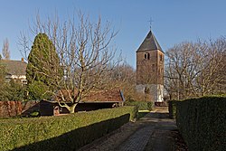 Tower of the former village church | |
 Balgoij Location in the Netherlands  Balgoij Balgoij (Netherlands) | |
| Coordinates: 51°46′49″N5°42′50″E / 51.78028°N 5.71389°E | |
| Country | Netherlands |
| Province | Gelderland |
| Municipality | Wijchen |
| Area | |
• Total | 4.71 km2 (1.82 sq mi) |
| Elevation | 8 m (26 ft) |
| Population (2021) [1] | |
• Total | 725 |
| • Density | 150/km2 (400/sq mi) |
| Time zone | UTC+1 (CET) |
| • Summer (DST) | UTC+2 (CEST) |
| Postal code | 6613 [1] |
| Dialing code | 024 |
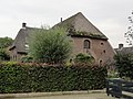
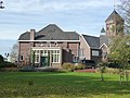
Balgoij or Balgoy is a village in Gelderland, Netherlands, near the river Meuse. It belongs to the Wijchen municipality.
Until 1923, Balgoij was a separate municipality. In 1958, the hamlet of Keent was transferred to Oss in North Brabant due to the canalisation of the Maas. [3]
The village was first mentioned in 1172 as Balgoie, and means swelling of land near water. [4] In 1840, it was home to 406 people. [3]