Culture
Temples include Shiv mandir, Baba mohan ram mandir Devi mandir, Balmikhi mandir, Ravidas mandir, and Mata mandir.

Bali, Baghpat district | |
|---|---|
| Coordinates: 28°58′12″N77°17′10″E / 28.970°N 77.286°E |
Bali is a village in the Indian state of Uttar Pradesh. [1] It is located in the Baghpat block of the Baghpat district. [2]
The village is administered by a Panchayat. [3] In 2021 the Sarpanch (village chief) at present smt Poonam Devi. He has served from 2016-2021
Agriculture is the main occupation. Major crops include sugarcane, wheat and rice. Vegetables including gourds, pumpkins, potatoes, ladyfinger, spinach, radish and carrots are cultivated. Some villagers work at Baghpat Cooperative Sugar Mills, one-half km from Baghpat city.
The village has four schools: Sardar Vallabhbhai Patel School, Shaeedh Manveer National School and two Govt. schools. Sunil coaching classes are there. The nearest colleges are located in neighbouring towns Agarwal mandi tatiri, Baghpat and Baraut, and Baghpat.
The village has a small hospital; neighbouring Baraut is home to Aastha Multi-speciality hospital. Several bigger hospitals are located in Baghpat. Sarvodaya hospital ks located in Tatari village.
Baghpat road Railway Station is 2 km from the village.
Temples include Shiv mandir, Baba mohan ram mandir Devi mandir, Balmikhi mandir, Ravidas mandir, and Mata mandir.
As of the 2011 India census, Bali had a population of 5,005 including 2,670 males and 2,335 females. Its literacy rate of 76.74% was above the state average. The literacy is higher among males (87.84%) than females (64.16%). [4] Mandaar clan of Gurjars form the majority of the population.

Bagpat district is one of the 75 districts of the Indian state of Uttar Pradesh with headquarters at the town of Baghpat.
Baghpat is a city in the Indian state of Uttar Pradesh. It is the administrative headquarters of Bagpat district, which was established in 1997. It is part of the National Capital Region, surrounding New Delhi.

Baraut is a city and municipal board, near the city of Baghpat in Baghpat district, Uttar Pradesh, India.
Tatiri is a town and a nagar panchayat in Baghpat district in the Indian state of Uttar Pradesh. The distance between Aggarwal Mandi Tatiri and Baghpat is 5 km. Tatiri is connected to two districts : Baghpat and Meerut, by road, via (NH-334B).Towards 5 km west SH-57 road which connects New Delhi- Baghpat - Baraut -Shamli - Saharanpur.
Aminagar Sarai is a town and a nagar panchayat in Baghpat district in the state of Uttar Pradesh, India. It is the oldest town in the Meerut commissionary area.
Pharenda, or Anandnagar, is a city in the Maharajganj district of the province of Uttar Pradesh in northern India. It is located approximately 44 kilometres north of Gorakhpur near the border with Nepal. District of Pharenda is Maharajganj. This is situated on the Buddhist Circuit which is built from Sarnath to Lumbini. It lies on NH-24 and near NH 29. It is about 45 km from Gorakhpur, 40 km from Siddharthnagar, 30 km from Maharajganj and 55 km from Sonauli Indo-Nepal Border. This place is named after Seth Anandram Jaypuriya. There is closed sugar Mill which was started in about 1935 and closed in 1995. Near Anand Nagar there is a temple is Durga devi mandir, popularly known as Lehara Devi mandir.
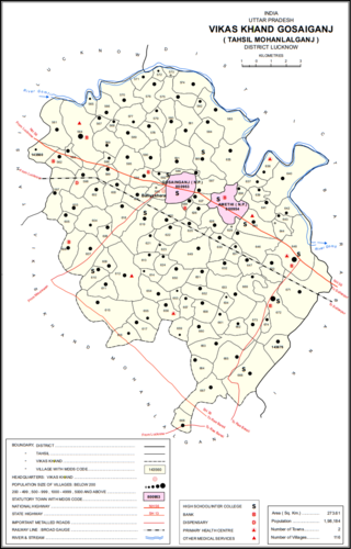
Gosainganj, also spelled Goshainganj or Gosaiganj is a town and nagar panchayat in Lucknow district of Uttar Pradesh, India. It is the seat of a community development block, which is included in the tehsil of Mohanlalganj. As of 2011, its population is 9,649, in 1,685 households. The starting point of the Purvanchal Expressway i.e. Chand Saray village is situated 2.5 km away from Gosainganj.
Kandhla is a town, near Shamli City and municipal board in Shamli District in the Indian state of Uttar Pradesh.
Nichlaul is a town and a nagar panchayat in Maharajganj district in the Indian state of Uttar Pradesh. It is situated 25 km from district headquarter Maharajganj and 80 km from Gorakhpur. It is situated near the Indo-Nepal border.
Saurikh is a nagar panchayat in Kannauj district in the Indian state of Uttar Pradesh. Its old name was Sau-Rishi.It is located near main industrial and educational hub of Dibiyapur which is around at a distance of 55 km from the town.
Tikri is a town and a nagar panchayat in Baghpat in the Indian state of Uttar Pradesh.
Ahirauli Baghel is an Indian village located in Uttar Pradesh, India. Ahirauli Baghel comes under Bankata Block of Deoria district. It belongs to Gorakhpur division. It is located 47 KM towards East from district headquarter Deoria. It distance is 374 KM from State capital Lucknow. Bhojpuri and Hindi is the primary language spoken in this village.
Kakripur is a village in Baghpat district of the Indian state of Uttar Pradesh.
Chamrawal is a village in Bagpat district, Uttar Pradesh, India. Chamrawal is located at a distance of 6.556 km from Pilana town, and 16.25 km from Baghpat town.
Sarurpur Kalan, or Saroorpur Kalan, is a large village located about 10 km (6.2 mi) north of Baghpat, in Baghpat district, Uttar Pradesh state, India. It is located halfway between Baghpat and Baraut. Towns nearby include Murthal and Rai to the west, Kutana to the north, and Daula to the east. The closest airport and railway stations are Baraut Railway Station located approximately 11 km (6.8 mi) away, Sujra Railway Station located approximately 5 km (3.1 mi) away, and Indira Gandhi International Airport.
Binauli is a small town in Baghpat district in Uttar Pradesh, India. Binauli is between Baraut and Barnava on Meerut road. Binauli is a religious Village, with many Hindu Jain's temples. It is under in NCR PLAN. It has one block, with one Police Station, Government Hospital, and a post office. Binauli is about 13 km from Baraut, 42 km from Meerut and 70 km from Delhi.
Baoli is a village in Baraut Tehsil of District Baghpat, India. It is located 25 KM towards North from District head quarters Bagpat. 3 KM from Baraut. 517 KM from State capital Lucknow.Baoli is a largest village in Baghpat District. In Baoli village population of children with age 0-6 is 1195 which makes up 12.09 % of total population of village. Average Sex Ratio of Baoli village is 825 which is lower than Uttar Pradesh state average of 912. Child Sex Ratio for the Baoli as per census is 850, lower than Uttar Pradesh average of 902.
Gopalpur Khadana is a village in Baraut tehsil, Baghpat district, Uttar Pradesh, India. The village is administrated by a Sarpanch who is an elected representative.
Jani Khurd is a large village in Meerut Tehsil and district in the Indian State of Uttar Pradesh. It is located on the bank of Ganga Canal. It is 8 km from Meerut City, which is the district city of Jani.
Nangla Rawa is a village in Baraut Tahsil and Baghpat in the Indian State of Uttar Pradesh. It is 26 km from Bagpat.