
Blue Earth County is a county in the State of Minnesota. As of the 2010 United States Census, the population was 64,013. Its county seat is Mankato. The county is named for the Blue Earth River and for the deposits of blue-green clay once evident along the banks of the Blue Earth River.

Jamestown Township is a township in Blue Earth County, Minnesota, United States. The population was 628 as of the 2000 census.

Lake Itasca is a small glacial lake approximately 1.8 square miles in area. It is notable for being the headwaters of the Mississippi River, and is located in southeastern Clearwater County, in the Headwaters area of north central Minnesota. The lake is within Itasca State Park and has an average depth of 20 to 35 feet (6–11 m), and is 1,475 ft (450 m) above sea level.
Brimson is an unincorporated community in Ault Township, Saint Louis County, Minnesota, United States.
Bde Maka Ska is the largest lake in Minneapolis, Minnesota, United States, and part of the city's Chain of Lakes. Surrounded by city park land and circled by bike and walking trails, it is popular for many outdoor activities. The lake has an area of 401 acres (1.62 km2) and a maximum depth of 87 feet (27 m).
Bachelor Lake is a lake in Brown County, Minnesota in the northeastern part of Stark township. Covering 79.80 acres, it is an officially protected water of the State of Minnesota. The lake is within the Cottonwood River Major Watershed. The lake’s elevation is 1,004 feet (306 m), and it is zoned as a shoreland area which is regulated as a shoreland management water.

Temperance River State Park is a state park of Minnesota, USA, located between the communities of Schroeder and Tofte on Highway 61 on the North Shore of Lake Superior. It has campsites, picnic areas, and hiking trails on both sides of the Temperance River.
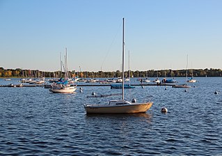
Lake Carlos State Park is a state park about 10 miles north of Alexandria, Minnesota, USA. The park was established in 1937 to provide a public recreational facility in one of Minnesota's summer resort centers, and attracts tourists from Minnesota and bordering states.
Fairbanks is an unincorporated community in Fairbanks Township, Saint Louis County, Minnesota, United States; located within the Superior National Forest.
Central Lakes is an unincorporated community in Saint Louis County, Minnesota, United States.
Greaney is an unincorporated community in Saint Louis County, Minnesota, United States. Greaney is located within ZIP code 55771 based in Orr.
Crane Lake is an unincorporated community in Crane Lake Township, Saint Louis County, Minnesota, United States; located within the Kabetogama State Forest.
Skibo is an unincorporated community in Bassett Township, Saint Louis County, Minnesota, United States.
Peter Ballantyne Cree Nation is an Asinīskāwiyiniwak First Nation band government in northern Saskatchewan consisting of nine communities: Amisk Lake, Deschambeault Lake, Kinoosao, Pelican Narrows, Prince Albert, Sandy Bay, Southend and Sturgeon Landing and a newer Reserve west of Prince Albert called Kiskaciwan. The administrative centre of the Peter Ballantyne Cree Nation is Pelican Narrows. They are a Woodland Cree First Nation.
The Insula Lake State Forest is a state forest located in Lake County, Minnesota. The forest is entirely within the limits of the Boundary Waters Canoe Area Wilderness of the Superior National Forest, and as such falls under the jurisdiction and management of the United States Forest Service.

The Northwest Angle State Forest is a state forest located in Lake of the Woods County, Minnesota. The name of the forest is derived from its location near the Northwest Angle, the northernmost point of the contiguous United States. The forest borders the Canadian provinces of Manitoba and Ontario, and the Red Lake Indian Reservation. The forest is managed by the Minnesota Department of Natural Resources.
Wall Lake is an unincorporated community in Otter Tail County, in the U.S. state of Minnesota.

