
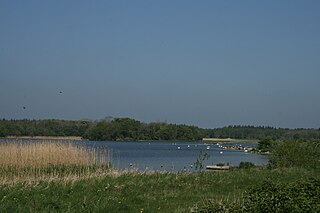
Castle Espie is a wetland reserve managed by the Wildfowl and Wetlands Trust (WWT) on the banks of Strangford Lough, three miles south of Comber, County Down, Northern Ireland, in the townland of the same name. It is part of the Strangford Lough Ramsar Site. It provides an early wintering site for almost the entire Nearctic population of pale-bellied brent geese. The Castle which gave the reserve its name no longer exists.

Lough Owel is a mesotrophic lough in the Midlands of Ireland, situated north of Mullingar, the county town of Westmeath. It has a maximum depth of 21 metres (69 ft). Water from Lough Owel feeds the Royal Canal, a canal crossing Ireland from Dublin to the River Shannon. The lake is close to the N4 primary road.
Lough Ennell is a lake near the town of Mullingar, County Westmeath, Ireland. It is situated beside the N52 road, off the Mullingar/Kilbeggan road. The lake is part of the Lough Ennell Special Protection Area. It is 6.5 km (4.0 mi) long by 2 km (1.2 mi) wide, with an area of about 12 km2 (4.6 sq mi). Lough Ennell has a large area of shallow water with nearly two-thirds of its area being less than 25 feet and almost half of it being under 10 ft (3.0 m) deep. The lake produced Ireland's largest ever lake brown trout at 26 lbs (11.8 kg). Lough Ennell is dotted with islands, many of which have now become attached to the shoreline as the levels of the lake have changed.
Coole Park is a nature reserve of approximately 1,000 acres (4 km2) located a few miles west of Gort, County Galway, Ireland. It is managed by the Irish National Parks & Wildlife Service, part of the Department of Arts, Heritage and the Gaeltacht. The park is in a low–lying karstic limestone area characterised by seasonal lakes, known as turloughs, which are almost unique to Ireland. It has extensive woodlands. There are 6 kilometres of signposted nature trails plus a formal late 18th century walled garden.
Loch of Skene is a large lowland, freshwater loch in Aberdeenshire, Scotland. It lies approximately 1 mi (1.6 km) to the west of the village of Kirkton of Skene and 9 mi (14 km) west of Aberdeen.
Lough Derravaragh is a lake in County Westmeath, Ireland, north of Mullingar between Castlepollard, Crookedwood and Multyfarnham.

Last Mountain Lake, also known as Long Lake, is a prairie lake formed from glaciation 11,000 years ago. It is located in south central Saskatchewan, Canada, about 40 km (25 mi) northwest of the city of Regina. It flows into the Qu'Appelle River via Last Mountain Creek which flows past Craven. It is approximately 93 km long, and 3 km wide at its widest point.

Lough Oughter is a lake, or complex of lakes, in County Cavan covering more than 8,900 hectares. The complex of lakes lies on the River Erne, and forms the southern part of the Lough Erne complex. The lakes are bounded roughly by Belturbet in the north, Cavan town to the east, Crossdoney to the south and Killeshandra to the west.

The North Slob is an area of mud-flats at the estuary of the River Slaney at Wexford Harbour, Ireland. The North Slob is an area of 10 km2 that was reclaimed in the mid-19th century by the building of a sea wall. It is the lowest geographical point in the Republic of Ireland

The Lough is the name of a suburb of Cork City, the electoral division in which it lies, the body of water that gives the area its name and a Roman Catholic parish of the same name. It lies on the south side of the city. The Lough is part of the Cork South-Central Dáil constituency.

Amwell Quarry or Amwell Nature Reserve is a 37 hectare biological Site of Special Scientific Interest in Amwell in Hertfordshire. The planning authority is East Hertfordshire District Council. It is also part of the Lee Valley Ramsar Site and Special Protection Area, and is owned and managed by the Hertfordshire and Middlesex Wildlife Trust.

Lough Arrow is a freshwater lake in the northwest of Ireland. This large, scenic lake covers an area of 12.47 square kilometres (4.8 sq mi) and lies mostly in County Sligo with a smaller part in County Roscommon. It is a popular trout fishing lake.

Lough Kinale is a freshwater lake in the north midlands of Ireland. It is located on the borders of Counties Longford, Westmeath and Cavan. Lough Kinale forms part of the River Inny. The lake's inflow is from Lough Sheelin and the outflow is to Lough Derravaragh. The neighbouring Derragh Lough is also connected by a river to Lough Kinale.

Lough Bunny is a freshwater lake in The Burren, County Clare, Ireland.

Annaghmore Lough is a freshwater lake in the west of Ireland. It is located in County Roscommon in the catchment of the upper River Shannon.
Nandur Madhmeshwar Bird Sanctuary is located at Niphad Tehsil of Nashik District, known as the Bharatpur of Maharashtra.
Grantstown Wood and Grantstown Lough is a national nature reserve of approximately 120 acres (0.49 km2) located in County Laois, Ireland. It is managed by the Irish National Parks & Wildlife Service.

The Raven Nature Reserve is a Ramsar site and national nature reserve of approximately 1,455.5 acres (5.890 km2) located in County Wexford, Ireland. It is managed by the Irish National Parks & Wildlife Service.
Lough Barra Bog is a blanket bog, Ramsar site and national nature reserve of approximately 436 acres (1.76 km2) in County Donegal.
Pettigo Plateau is a blanket bog and wet heath, Ramsar site, protected area and national nature reserve of approximately 224 acres (0.91 km2) in County Donegal.
