Bambaia | |
|---|---|
Village | |
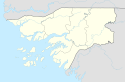 Bambaia Location in Guinea-Bissau | |
| Coordinates: 12°21′56″N15°4′1″W / 12.36556°N 15.06694°W Coordinates: 12°21′56″N15°4′1″W / 12.36556°N 15.06694°W | |
| Country | |
| Region | Oio Region |
| Sector | Mansaba |
| Time zone | UTC+0 (GMT) |
Bambaia is a village in the Oio Region of northern Guinea-Bissau. It is located west of Casa Nova and northeast of Mansaba.[ citation needed ]
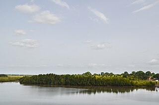
Oio is a region in Guinea-Bissau. Its capital is Farim. Other major cities and towns include Nhacra, Mansôa, Bissorã and Cumeré. The region borders Senegal to the north, the Guinea-Bissau regions of Bafatá, Bissau and Biombo to the east, the Rio Geba/Guinea-Bissau region of Quinara to the south and the Guinea-Bissau region of Cacheu to the west. There has not been any local administration since the civil war of 1998-99 and all the social services are done by organs of civil society and other government agencies. It is a coastal region covered with Mangrove swamps, rain forest and tangled forest and receives an annual rainfall of more than 1,000 mm (39 in), while the inland has Savannah woodlands.

Guinea-Bissau, officially the Republic of Guinea-Bissau, is a country in West Africa that covers 36,125 square kilometres (13,948 sq mi) with an estimated population of 1,815,698.
Mansaba is a Sector in the Oio Region of Guinea-Bissau.