Muzhappilangad (മുഴപ്പിലങ്ങാട്) is a coastal census town near Thalassery in Kannur district in the Indian state of Kerala. It is a suburb of kannur city

Kamrup Rural district, or simply Kamrup district, is an administrative district in the state of Assam in India formed by dividing the old Kamrup district into two in the year 2003; other being Kamrup Metropolitan district, named after the region it constitutes. This district, along with Nalbari, Barpeta, Kamrup Metropolitan, Bajali and Baksa districts has been created from the Undivided Kamrup district. Rangiya is the Sub-District of Kamrup.

Puthunagaram is a town and gram panchayat in the Palakkad district, state of Kerala, India. It is about 10 km south of Palakkad and 8 Km from Kollengode. Palakkad-Pollachi railway line passes through this town.
Athipattu is a census town in Chennai in Thiruvallur district in the state of Tamil Nadu, India. The neighbourhood is served by Athipattu railway station of the Chennai Suburban Railway network. It is a suburb in northern part of Chennai.

Birwadi is a census town in Raigad district in the state of Maharashtra, India.

Bommasandra is a census town located in Bangalore Urban district in the state of Karnataka, India.
Chinnasekkadu is a neighbourhood of Chennai in Chennai district in the state of Tamil Nadu, India. Chinnasekkadu used to be a town panchayat in Thiruvallur district. In 2011, the Chinnasekkadu town Panchayat was merged with Chennai Corporation. Chinnasekkadu comes under ward 29 in Zone 3 (Madhavaram) of Chennai Corporation.
Dergaon is a town and a municipality in the Golaghat district of Assam, India. It is 282 km from the state capital Guwahati.

Desur is a Town panchayat in Tiruvanamalai district in the Indian state of Tamil Nadu.
Ezhudesam is a town in Kanniyakumari district in the state of Tamil Nadu, India.
Herohalli is a census town in Bangalore district in the Indian state of Karnataka.
Kothnur is a census town in Bangalore district in the Indian state of Karnataka.
Naravarikuppam is a town in Thiruvallur district in the Indian state of Tamil Nadu.
Peerkankaranai is a neighborhood in the city of Tambaram, situated within the Chennai Metropolitan Area, Tamil Nadu, India.
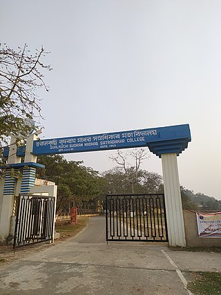
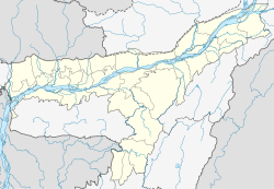
Sualkuchi is a census town in Kamrup district in the Indian state of Assam. It is situated on the north bank of the river Brahmaputra, about 35 km from Guwahati, Sualkuchi is a block of Kamrup District. It has large number of cottage industry engaged in handloom, for which it is also known as the "Manchester of Assam".
Thevaram is a town in Theni district in the Indian state of Tamil Nadu. Thevaram is located in Tamil Nadu near the border of Kerala at the Eastern side foot-hill of the Western Ghats. It is connected with State Highway SH100.
Vengathur is a census town in Thiruvallur district in the Indian state of Tamil Nadu.
Jafarabad is a town and nagar panchayat in Jaunpur district in the Indian state of Uttar Pradesh.
Assam silk denotes the three major types of indigenous wild silks produced in Assam—golden muga, white pat and warm eri silk. The Assam silk industry, now centered in Sualkuchi, is a labor-intensive industry.
Kerur is a town in Bagalkot district in Karnataka, which located on NH 218. It has an average elevation of 617 meters (2024 feet). It's the birthplace of Jagadish Shettar, a former chief minister of Karnataka. Kerur is a Town Panchayat city in the district of Bagalkot, Karnataka. The Kerur city is divided into 16 wards for which elections are held every five years. The Kerur Town Panchayat has a population of 19,731 of which 9,929 are males while 9,802 are females as per report released by Census India 2011.



 India
India 