Related Research Articles

Victoria Island is a large island in the Canadian Arctic Archipelago that straddles the boundary between Nunavut and the Northwest Territories of Canada. It is the eighth largest island in the world, and at 217,291 km2 (83,897 sq mi) in area, it is Canada's second largest island. It is nearly double the size of Newfoundland (111,390 km2 [43,008 sq mi]), and is slightly larger than the island of Great Britain (209,331 km2 [80,823 sq mi]) but smaller than Honshu (225,800 km2 [87,182 sq mi]). It contains the world's largest island within an island within an island. The western third of the island belongs to the Inuvik Region in the Northwest Territories; the remainder is part of Nunavut's Kitikmeot Region.

Sakon Nakhon is a city in Thailand within the Isan region, and capital city of Sakon Nakhon Province as well as Mueang Sakon Nakhon District, with a population of approximately 76,000. Sakon Nakhon covers the whole tambon of That Choeng Chum and parts of tambons Ngio Don, Huai Yang, Dong Mafai, That Na Weng and Hang Hong. Sakon Nakhon is 651 km north-east of Bangkok by road.

Algoa Bay is a bay in the Eastern Cape, South Africa. It is located in the east coast, 425 miles east of the Cape of Good Hope.

Poum is a commune in the North Province of New Caledonia, an overseas territory of France in the Pacific Ocean. The small town of Poum is located in the far northwest, located on the southern part of Banare Bay, with Mouac Island just offshore. Aside from French, the native language of the Kanak inhabitants is nêlêmwa-nixumwak, an Austronesian language spoken by about 1,100 people. British fishermen came to the islands in 1855 seeking sea cucumbers, and settled and intermarried, and this is reflected in the last names of some clan members and on gravestones. In the 1850s, a hundred Europeans lived on Mouac Island and John Henry Williams established a presence on Néba island

Padilla Bay is bay located in the U.S. state of Washington, between the San Juan Islands and the mainland. Fidalgo Island and Guemes Island lie to the west of Padilla Bay. Guemes Channel, between the islands, connects Padilla Bay to Rosario Strait. Samish Island lies to the north of Padilla Bay, beyond which is Samish Bay and Bellingham Bay.

Egg Island is a small island in the Fox Islands subgroup of the Aleutian Islands in the U.S. state of Alaska. It lies off the eastern end of Unalaska Island and just off the northeastern tip of Sedanka Island. It is the easternmost island in the Aleutians West Census Area of Alaska. The island has a land area of 311.12 acres (1.259 km²) and is uninhabited. It is 19.3 kilometres (12.0 mi) long and 12 kilometres (7.5 mi) wide.
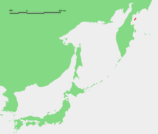
Karaginsky Island or Karaginskiy Island is an island in the Karaginsky Gulf of the Bering Sea. The 40 km-wide strait between the Kamchatka Peninsula and this island is called Litke Strait. Karaginsky Island is a Ramsar site.

The Coco Islands are a small group of islands in the northeastern Bay of Bengal. They are part of the Yangon Region of Myanmar. The islands are located 414 km (257 mi) south of the city of Yangon. Cocos Island group consists of 5 islands, 4 islands on Great Coco Reef and another solitary island on the Little Coco Reef. To the north of this island group lies Preparis Island also belonging to Myanmar, and to the south lies the Landfall Island belonging to India.
Banchory-Devenick is a village approximately two kilometres south of the city of Aberdeen, Scotland in the Lower Deeside area of Aberdeenshire. The village should not be confused with the historic civil parish of the same name which spanned the River Dee until 1891, its northern part lying in Aberdeenshire and its southern part in Kincardineshire. In that year the northern part became part of the neighbouring parish of Peterculter, the southern part remaining as the parish of Banchory-Devenick. The village of Banchory-Devenick lies slightly west of the A90 road, and the ancient Causey Mounth passes directly through the village. An historic graveyard dating to 1157 AD is present at the village of Banchory-Devenick. Other historic features in the vicinity include Saint Ternan's Church, Muchalls Castle and the Lairhillock Inn.

Wólka is a village in the administrative district of Gmina Bakałarzewo, within Suwałki County, Podlaskie Voivodeship, in north-eastern Poland. It lies approximately 8 kilometres (5 mi) south-east of Bakałarzewo, 14 km (9 mi) west of Suwałki, and 107 km (66 mi) north of the regional capital Białystok.
Rawałowice is a village in the administrative district of Gmina Kocmyrzów-Luborzyca, within Kraków County, Lesser Poland Voivodeship, in southern Poland. It lies approximately 20 km (12 mi) north-east of the regional capital Kraków.
Wołowiec is a village in the administrative district of Gmina Nowogard, within Goleniów County, West Pomeranian Voivodeship, in north-western Poland. It lies approximately 12 kilometres (7 mi) north of Nowogard, 33 km (21 mi) north-east of Goleniów, and 55 km (34 mi) north-east of the regional capital Szczecin.

Transfer Station is the name of a section of Hudson County, New Jersey, which radiates from the intersection where Paterson Plank Road crosses Summit Avenue at 7th Street. It is near the tripoint where the borders of Jersey City Heights, North Bergen, and Union City intersect, which is a few blocks to the southwest of the station, at the intersection of Secaucus Road and Kennedy Boulevard.
Nunatakassak is a nunatak in the Qaasuitsup municipality in northwestern Greenland. It is one of several nunataks in the Melville Bay region of Greenland, where the Greenland ice sheet drains into the bay alongside its entire length apart from an occasional nunatak.
Nekoro Bay or Baie Nekoro is a bay in southwestern New Caledonia. It lies just northwest of Porwi Bay. The town of Nepoui and Nepoui Airport lie on the coast at Nekoro Bay.The bay contains Grimault Island and Hiyé Hiyé Island. Blancbe Bay lies just to the northwest.
Gomen Bay or Baie Gomen is a bay in northwestern New Caledonia. It lies northwest of Chasseloup Bay and southeast of Ohland Bay.The village of Kaala Gomen lies near the bay.
Ohland Bay or Baie Ohland Bay is a bay in northwestern New Caledonia. It lies northwest of Gomen Bay and just southeast of Nehoue Bay.The village of Paagoumene lies on the bay.
Nehoue Bay or Baie de Nehoue is a bay in northwestern New Caledonia. It lies just northwest of Ohland Bay and just southeast of Tanle Bay. The village of Malabou lies on the bay which contains the Malabou Beach Hotel. This resort lies 45 kilometres northwest of Koumac and is noted for its white sands. The bay contains numerous islands, the largest of which is Boh Island. Tanle Island lies just to the west in front of the channel of Tanle Bay. Other islands include Neangambo Island, Ti Island and Ti-Ac Island.
Tanle Bay or Baie de Tanle is a bay in northwestern New Caledonia. It lies just northwest of Nehoue Bay, separated only by Tanle Island and Boh Island. Banare Bay lies to the northwest.
The Shag Islands are a small group of islands in the southern part of Coppett Harbour, off the south coast of Newfoundland, Canada. They lie to the east of Bonalds Island. The southernmost island, Shag Island, is described as "a conspicuous white rock, 12.8m high".
References
- ↑ Google Maps (Map). Google. Retrieved 9 June 2011.
| This New Caledonian location article is a stub. You can help Wikipedia by expanding it. |