Banghak-dong

Last updated
Banghak-dong
Neighbourhood
Korean transcription(s)
   Hangul 방학동
   Hanja
   Revised Romanization Banghak-dong
   McCune–Reischauer Panghak-tong

Banghakjei-dong Comunity Service Center 20140203 142411.jpg

Banghakjei-dong Community Service Center
Banghak-dong.GIF
Country South Korea
Area
  Total 4.07 km2 (1.57 sq mi)
Population (2010) [1]
  Total 89,855
  Density 22,000/km2 (57,000/sq mi)

Banghak-dong is a dong , neighbourhood of Dobong-gu in Seoul, South Korea. [1] [2]

Seoul Special City in Seoul Capital Area, South Korea

Seoul, officially the Seoul Special City, is the capital and largest metropolis of South Korea. With surrounding Incheon metropolis and Gyeonggi province, Seoul forms the heart of the Seoul Capital Area. Seoul is ranked as the fourth largest metropolitan economy in the world and is larger than London and Paris.

South Korea Republic in East Asia

South Korea, officially the Republic of Korea (ROK), is a country in East Asia, constituting the southern part of the Korean Peninsula and lying to the east of the Asian mainland. The name Korea is derived from Goguryeo which was one of the great powers in East Asia during its time, ruling most of the Korean Peninsula, Manchuria, parts of the Russian Far East and Inner Mongolia, under Gwanggaeto the Great. South Korea lies in the north temperate zone and has a predominantly mountainous terrain. It comprises an estimated 51.4 million residents distributed over 100,363 km2 (38,750 sq mi). Its capital and largest city is Seoul, with a population of around 10 million.

Related Research Articles

Gangbuk District Autonomous District in Sudogwon, South Korea

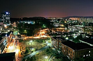
Gangbuk District (Gangbuk-gu) is one of the 25 gu which make up the city of Seoul, South Korea. Its name is derived from the fact that it is located at the north of Han river. It was created from neighbouring Dobong District (도봉구) in 1995. The current mayor is Park Gyeom-su(박겸수).

Nowon District Autonomous District in Sudogwon, South Korea

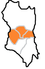
Nowon District (Nowon-gu) is a residential district of Seoul, South Korea, Located in the northeastern part of the metropolitan city. It has the highest population density in Seoul, with 619,509 people living in the area of 35.44 km².

Jungnang District Autonomous District in Sudogwon, South Korea

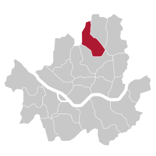
Jungnang District (Jungnang-gu) is one of the 25 gu, or districts, of Seoul, South Korea. It is located on the north side of the Han River.

Chang-dong station train station in South Korea

Chang-dong Station is a station on Seoul Subway Line 1 and Line 4. It is located in Chang-dong, Dobong-gu, Seoul. A shopping center was planned for this site, but the empty lot has never been developed due to the bankruptcy of the contractor behind said project. The station is, however, home to a cluster of pojangmacha stalls.

Chang-dong Neighbourhood in South Korea

Chang-dong is a dong, neighbourhood of Dobong-gu in Seoul, South Korea

Dobong-dong Neighbourhood in South Korea

Dobong-dong is a dong, a neighbourhood of Dobong-gu in Seoul, South Korea. The dong is one of the four located in the Dobong District. According to the Köppen–Geiger climate classification system, the region is Dwa, or a humid continental climate. The average temperature is 11.1°C and approximately 147.5 cm of precipitation falls annually. The postal code for Dobong-bong is 132-010. The region is also referred to as Tobong-dong.

Ssangmun-dong Neighbourhood in South Korea

Ssangmun-dong is a dong, neighbourhood of Dobong-gu in Seoul, South Korea.

Beon-dong Place in South Korea

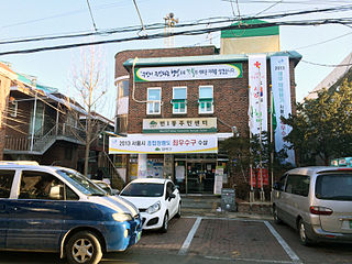
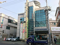
Beon-dong is a dong, neighbourhood of Gangbuk-gu in Seoul, South Korea.

Amsa-dong Place in South Korea

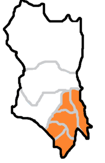
Amsa-dong is a dong (neighbourhood) of Gangdong-gu in Seoul, South Korea. The dong is well known for the Amsa-dong Prehistoric Settlement Site, in which Neolithic remains were excavated after a large amount of diagonal-line patterned earthenware was exposed by a flood in 1925.

Siheung-dong is a dong, neighbourhood of Geumcheon-gu in Seoul, South Korea.

Bogwang-dong Place in South Korea

Bogwang-dong is a dong, neighbourhood of Yongsan-gu in Seoul, South Korea.

Cheongun-dong is a dong, neighbourhood of Jongno-gu in Seoul, South Korea.

Hyoja-dong is a dong, neighbourhood of Jongno-gu in Seoul, South Korea.

Ihwa-dong, Seoul Place in South Korea

Ihwa-dong is a dong, neighbourhood of Jongno-gu in Seoul, South Korea.

Hyehwa-dong Place in South Korea

Hyehwa-dong is a dong, neighbourhood of Jongno-gu in Seoul, South Korea.

Changsin-dong Place in South Korea

Changsin-dong is a dong, neighbourhood of Jongno-gu in Seoul, South Korea.

Anguk-dong Place in South Korea

Anguk-dong is a dong, neighbourhood of Jongno-gu in Seoul, South Korea. It is a legal dong administered under its administrative dong, Samcheong-dong.

Anam-dong Place in South Korea

Anam-dong is a dong, neighbourhood of Seongbuk-gu in Seoul, South Korea.

Bomun-dong Place in South Korea

Bomun-dong is a dong, neighbourhood of Seongbuk-gu in Seoul, South Korea.

Bangsan-dong is a legal dong, or neighbourhood of the Jung-gu district in Seoul, South Korea and governed by its administrative dong, Euljiro 3, 4, 5ga-dong.

References

  1. 1 2 동별 인구현황 (in Korean). Dobong-gu official site. Retrieved 2011-02-20.[ permanent dead link ]
  2. Kim Il-woo (2007-10-13). "The origin of the dongs in Dobong-gu" (in Korean). Dobong-gu official site. Retrieved 2008-04-17.[ permanent dead link ]

Coordinates: 37°40′01″N127°02′02″E / 37.667°N 127.034°E / 37.667; 127.034

Geographic coordinate system Coordinate system

A geographic coordinate system is a coordinate system that enables every location on Earth to be specified by a set of numbers, letters or symbols. The coordinates are often chosen such that one of the numbers represents a vertical position and two or three of the numbers represent a horizontal position; alternatively, a geographic position may be expressed in a combined three-dimensional Cartesian vector. A common choice of coordinates is latitude, longitude and elevation. To specify a location on a plane requires a map projection.