Bangor, Iowa | |
|---|---|
 Bangor  Bangor | |
| Coordinates: 42°10′24″N93°05′37″W / 42.17333°N 93.09361°W | |
| Country | |
| State | |
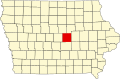
| County | Marshall County |
| Time zone | UTC-6 (Central (CST)) |
| • Summer (DST) | UTC-5 (CDT) |
| US | 50051 |
Bangor is an unincorporated community in Marshall County, Iowa, United States. It is located at the intersections of County Highway E18 and S62, five miles southwest of Liscomb and six miles south of Union. It is located near the west bank of the Iowa River, at 42.172838N, -93.089073W. [1]