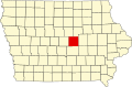
Quarry, Iowa

Last updated
Quarry, Iowa
USA Iowa location map.svg
Red pog.svg
Quarry
Usa edcp location map.svg
Red pog.svg
Quarry
Coordinates: 42°01′5″N92°48′22″W / 42.01806°N 92.80611°W / 42.01806; -92.80611
Country Flag of the United States.svg  United States
State Flag of Iowa.svg  Iowa
County Marshall
Established1868
Elevation
892 ft (272 m)
Time zone UTC-6 (Central (CST))
  Summer (DST) UTC-5 (CDT)
ZIP code
50158
Area code 641

Quarry is a rural unincorporated community in Marshall County, Iowa, United States.

History

Quarry was laid out by the Le Grand Quarry Company in 1868. [1] The mining community took its name from the nearby quarry. [2] A post office was established at Quarry in 1869, and remained in operation until it was discontinued in 1909. [3]

Quarry was the site of several limestone quarries. A railroad depot (on the North Western Railroad line), a schoolhouse, a general store, and a few houses were located in Quarry in 1912. During its heyday, between 60 and 150 laborers worked in the Quarry quarries. [4]

Quarry's population in 1940 was 144. [5]

Related Research Articles

<span class="mw-page-title-main">Chicago and North Western Transportation Company</span> Rail transport company

The Chicago and North Western was a Class I railroad in the Midwestern United States. It was also known as the "North Western". The railroad operated more than 5,000 miles (8,000 km) of track at the turn of the 20th century, and over 12,000 miles (19,000 km) of track in seven states before retrenchment in the late 1970s. Until 1972, when the employees purchased the company, it was named the Chicago and North Western Railway.

Buckingham is an unincorporated community located near the intersections of Hwy D-65 and U.S. Highway 63 in Buckingham Township, Tama County, Iowa, United States. It lies 5.5 miles north of Traer and 11 miles south of Hudson. Buckingham is located at 42°15′45″N92°26′52″W.

LaMoille is a rural unincorporated community in Marshall County, Iowa, United States, lying halfway between Marshalltown and State Center.

<span class="mw-page-title-main">Newton Township, Buchanan County, Iowa</span> Township in Iowa, United States

Newton Township is one of sixteen townships in Buchanan County, Iowa, USA. As of the 2000 census, its population was 423.

Green Mountain is a rural unincorporated community and census-designated place (CDP) in Marshall County, Iowa, United States. It is located in Marion Township. As of the 2020 census the population of Green Mountain was 113.

Avery is an unincorporated community in Monroe County, Iowa, United States.

Bangor is an unincorporated community in Marshall County, Iowa, United States. It is located at the intersections of County Highway E18 and S62, five miles southwest of Liscomb and six miles south of Union. It is located near the west bank of the Iowa River, at 42.172838N, -93.089073W.

Zaneta is an unincorporated community in Grundy County, Iowa, United States.

Dunbar is an unincorporated community and former railroad depot village in Green Castle Township, Marshall County, Iowa, United States.

Thatcher is an unincorporated community. It is located in Cherry County, Nebraska, United States.

Hughes is a ghost town in Hardin County, in the U.S. state of Iowa.

Nashville is an unincorporated community in Jackson County, in the U.S. state of Iowa.

Ontario is a community within the corporate limits of the city of Ames, in Story County, Iowa, United States.

Secor, previously known as Xenia and Delanti, is a ghost town in Hardin County, Iowa, United States. The community was 3.5 miles (5.6 km) south-southeast of Eldora. In its early years, the community was the site of one of the few bridges across the Iowa River in Hardin County. By the mid-20th century, however, the community had lost its school, mill, post office, and businesses, and Secor was considered a ghost town.

James is an unincorporated community in Plymouth County, in the U.S. state of Iowa.

Thorpe is an unincorporated community in Honey Creek Township, Delaware County, Iowa, United States.

Bailey was a community in Wayne Township, Mitchell County, Iowa, United States. Founded in 1886 as a whistle stop, it was briefly known as Wapsie. The community lay north of the Wapsipinicon River.

Benson was an unincorporated community in Black Hawk County, in the U.S. state of Iowa.

Bromley is a former village in Minerva Township, Marshall County, Iowa, United States.

Juniata was an unincorporated community in Buena Vista County, located in the U.S. state of Iowa.

References

  1. The History of Marshall County, Iowa: Containing a History of the County, Its Cities, Towns, &c. Western Historical Co. 1878. pp.  541.
  2. Chicago and North Western Railway Company (1908). A History of the Origin of the Place Names Connected with the Chicago & North Western and Chicago, St. Paul, Minneapolis & Omaha Railways. p. 116.
  3. "Marshall County". Jim Forte Postal History. Retrieved 26 March 2015.
  4. Battin, William; Moscrip, Frank A. (1912). Past and Present of Marshall County, Iowa. Brookhaven Press. p. 176. ISBN   978-1-58103-897-2.
  5. The Attorneys List. United States Fidelity and Guaranty Company, Attorney List Department. 1940. p. 310.

Coordinates: 42°01′05″N92°48′22″W / 42.01806°N 92.80611°W / 42.01806; -92.80611