
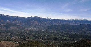
Himachal Pradesh is a state in the northern part of India. Situated in the Western Himalayas, it is one of the thirteen mountain states and is characterised by an extreme landscape featuring several peaks and extensive river systems. Himachal Pradesh is the northernmost state of India and shares borders with the union territories of Jammu and Kashmir and Ladakh to the north, and the states of Punjab to the west, Haryana to the southwest, Uttarakhand to the southeast and a very narrow border with Uttar Pradesh to the south. The state also shares an international border to the east with the Tibet Autonomous Region in China. Himachal Pradesh is also known as Dev Bhoomi or Dev Bhumi, meaning 'Land of Gods' and Veer Bhoomi which means 'Land of the Brave'.

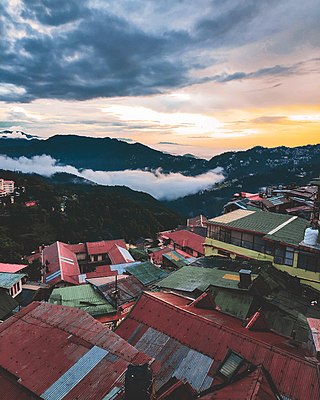
Shimla is the capital and the largest city of the northern Indian state of Himachal Pradesh. In 1864, Shimla was declared as the summer capital of British India. After independence, the city became the capital of East Punjab and was later made the capital city of Himachal Pradesh. It is the principal commercial, cultural and educational centre of the state.

Solan is a city in the Indian state of Himachal Pradesh and the district headquarters of Solan district. It is located 45.5 kilometres (28 mi) south of the state capital, Shimla. Solan has an average elevation of 1,550 metres (5,090 ft). The city is situated between Chandigarh and Shimla on the Kalka-Shimla National Highway-5. The narrow-gauge Kalka-Shimla railway passes through Solan. Located on the Punjab-Himachal Border, Solan is nestled in the Shivalik hills of the Himalayas.

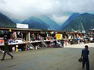
Kullu is a district in Himachal Pradesh, India. It borders Shimla district to the south, Mandi and Kangra districts to the west, Kinnaur to the east and the Lahaul and Spiti district to the north and east. The largest valley in this mountainous district is the Kullu Valley. The Kullu valley follows the course of the Beas River, and ranges from an elevation of 833 m above sea level at Aut to 3330 m above sea level at the Atal Tunnel South Portal, below the Rohtang Pass. The town of Kullu, located on the right side of the Beas River, serves as the administrative headquarters of the Kullu district. The Kullu district also incorporates several riverine tributary valleys of the Beas, including those of the Parvati, Sainj, and Tirthan rivers, and thus some regions somewhat distant from the Kullu valley. The economy of the district relies mainly on horticulture, agriculture, tourism, and traditional handicrafts.

Mandi district is one of the central districts of Himachal Pradesh state in northern India. The town of Mandi is the headquarters of the district.

Manali is a town, near Kullu town in Kullu district in the Indian state of Himachal Pradesh. It is situated in the northern end of the Kullu Valley, formed by the Beas River. The town is located in the Kullu district, approximately 270 kilometres (170 mi) north of the state capital of Shimla and 544 kilometres (338 mi) northeast of the national capital of New Delhi. With a population of 8,096 people recorded in the 2011 Indian census Manali is the beginning of an ancient trade route through Lahaul (H.P.) and Ladakh, over the Karakoram Pass and onto Yarkand and Hotan in the Tarim Basin of China. Manali is a popular tourist destination in India and serves as the gateway to the Lahaul and Spiti district as well as the city of Leh in Ladakh.
Reckong Peo, also spelled Rekong Peo or simply known as Peo by the local inhabitants, is headquarters of Kinnaur district, one of the twelve administrative districts of the Indian state of Himachal Pradesh.

Kullu is a municipal council town that serves as the administrative headquarters of the Kullu district of the Indian state of Himachal Pradesh. It is located on the banks of the Beas River in the Kullu Valley about 10 kilometres (6.2 mi) north of the airport at Bhuntar, Kullu.

The Great Himalayan National Park (GHNP) is a national park in India, located in Banjar sub-division of Kullu in the state of Himachal Pradesh. The park was established in 1984 and is spread over an area of 1171 km2; elevations within the park range between 1500 and 6000 m. The Great Himalayan National Park is a habitat to numerous flora and more than 375 fauna species, including approximately 31 mammals, 181 birds, 3 reptiles, 9 amphibians, 11 annelids, 17 mollusks and 127 insects. They are protected under the strict guidelines of the Wildlife Protection Act of 1972; hence any sort of hunting is not permitted.

Situated on the left bank of river Beas at an altitude of 1,800 meters, Naggar is an ancient town in Kullu district of Himachal Pradesh, India. It was once capital of the Kullu kingdom.

The state of Himachal Pradesh is spread over an area 55,673 km2 (21,495 sq mi) and is bordered by Jammu and Kashmir and Ladakh on the north, Punjab on the southwest, Haryana on the south, Uttarakhand on the southeast, a small border with Uttar Pradesh in the south, and Tibet on the east. Entire Himachal Pradesh lies in the mountainous Himalaya region, rich in natural resources
Ghumarwin is a town and a municipal council, near the town of Bilaspur in Bilaspur district in the North Indian State of Himachal Pradesh and is the second largest town of the entire district. The town is an anchor point for commuters between Bilaspur and Hamirpur and other parts of the state. Situated primarily between the Hills of Lower Central Himalayas, Ghumarwin is situated at an average elevation of 700 metres or about 2300 ft. above sea level. It is one of the biggest commercial centres of Bilaspur District and one can find all kinds of shops, stores, services etc. here.
Jogindernagar, or Jogindar Nagar, is a municipality, and a sub district in Mandi district in the Indian state of Himachal Pradesh. Named after Raja Joginder Sen, the hill station is the terminus of the 163-kilometre-long (101 mi) Kangra Valley narrow-gauge railway. Jogindernagar is the third-largest city in the Mandi district. The only city in Asia with three hydro-electric power stations, its nickname is "The City of Powerhouses".

Spiti is a high-altitude region of the Himalayas, located in the north-eastern part of the northern Indian state of Himachal Pradesh. The name "Spiti" means "The middle land", i.e. the land between Tibet and India. Spiti incorporates mainly the valley of the Spiti River, and the valleys of several rivers that feed into the Spiti River. Some of the prominent side-valleys in Spiti are the Pin valley and the Lingti valley. Spiti is bordered on the east by Tibet, on the north by Ladakh, on the west and southwest by Lahaul, on the south by Kullu, and on the southeast by Kinnaur. Spiti has a cold desert environment. The valley and its surrounding regions are among the least populated regions of India. The Bhoti-speaking local population follows Tibetan Buddhism.

Mandi is a major city and a municipal corporation in Mandi District in the Indian state of Himachal Pradesh. It is situated 145 kilometres (90 mi) north of state capital, Shimla in the north-west Himalayas at an average altitude of 880 m (2,890 ft) Mandi is connected to the Pathankot through National Highway 20 and to Manali and Chandigarh through National Highway 21. Mandi is approximately 184.6 km (114.7 mi) from Chandigarh, the nearest major city, and 440.9 km (274.0 mi) from New Delhi, the national capital. In the 2011 Indian census, Mandi city had a population of 26,422. Mandi district is currently the 4th largest economy in the state. Mandi has the second highest sex ratio of 1013 females per thousand males, in the state.

Karsog is a town and municipal area in the state of Himachal Pradesh in northern India.
The Western Himalayas refers to the western half of the Himalayas, in northwestern India and northern Pakistan. Four of the five tributaries of the Indus River in Punjab rise in the Western Himalayas; while the fifth, the Sutlej cuts through the range after rising in Tibet.
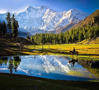
Tourism in Himachal Pradesh relates to tourism in the Indian state of Himachal Pradesh. This is popularly renowned for its Himalayan landscapes and popular hill-stations. Many outdoor activities such as rock climbing, mountain biking, paragliding, ice-skating, trekking, rafting, and heli-skiing are popular tourist attractions in Himachal Pradesh.

Mud is a small village in the cold desert region of Spiti in Himachal Pradesh, India. Located at an altitude of 3,810 m (12,500 ft) on the left bank of the Pin River, a right bank tributary of the Spiti River, the village is nestled at the base of the Parbati range that towers almost vertically 1,600 m (5,200 ft) above. Mud is near the boundary of the Pin Valley National Park and is a convenient base for treks in the park, and to the neighbouring districts of Kullu and Kinnaur. It is the last village on the Spiti side of the Pin Parbati trek to Kullu and the Pin Bhaba trek to Kinnaur.
Tirthan Wildlife Sanctuary is located in Himachal Pradesh, India. It is situated near the banks of the Tirthan river. The sanctuary has densely forested areas and various varieties of fauna living there. Tirthan Wildlife Sanctuary was ranked as the Best Managed Protected Areas of India as per the Management Effectiveness Evaluation.


