
Baileys Harbor is a town in Door County, Wisconsin, United States. The population was 1,003 at the 2000 census. The unincorporated community of Peninsula Center is located in the town. The census-designated place of Baileys Harbor is also located with the town.
Fort Edmonton was the name of a series of trading posts of the Hudson's Bay Company (HBC) from 1795 to 1914, all of which were located on the north banks of the North Saskatchewan River in what is now central Alberta, Canada. It was one of the last points on the Carlton Trail, the main overland route for Metis freighters between the Red River Colony and the points west and was an important stop on the York Factory Express route between London, via Hudson Bay, and Fort Vancouver in the Columbia District. It also was a connection to the Great Northland, as it was situated relatively close to the Athabasca River whose waters flow into the Mackenzie River and the Arctic Ocean. Located on the farthest north of the major rivers flowing to the Hudson Bay and the HBC's shipping posts there, Edmonton was for a time the southernmost of the HBC's forts.
Pakan was a provincial electoral district in Alberta, Canada, mandated to return a single member to the Legislative Assembly of Alberta using first-past-the-post balloting from 1909 to 1913.
Victoria was one of the original 25 provincial electoral districts in Alberta, named for Fort Victoria on the North Saskatchewan River. It was mandated to return a single member to the Legislative Assembly of Alberta by the first past the post method until 1917, and by instant-runoff voting from 1926 until it was abolished in 1940.
Duchess is a village in southern Alberta, Canada that is surrounded by the County of Newell. It is north of Brooks and the Trans-Canada Highway.
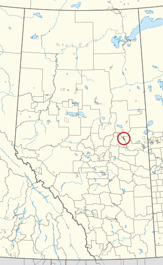
St. Paul was a provincial electoral district in Alberta, Canada, mandated to return a single member to the Legislative Assembly of Alberta from 1913 to 1993.

Beaver River is a large river in east-central Alberta and central Saskatchewan, Canada. It flows east through Alberta and Saskatchewan and then turns sharply north to flow into Lac Île-à-la-Crosse on the Churchill River which flows into Hudson Bay.

Etzikom is a hamlet in Alberta, Canada within the County of Forty Mile No. 8. It is approximately 20 kilometres (12 mi) east of Foremost on Highway 61.
Horseshoe Bay is a summer village in Alberta, Canada. It is located on the northern shore of Vincent Lake, in the County of St. Paul No. 19.
Meeks Bay is an unincorporated community in El Dorado County, California. It lies on Lake Tahoe at the mouth of Meeks Creek, at an elevation of 6240 feet. The place is named for John Meeks, who owned the land. The Meeks brothers baled 25 tons of wild hay in the meadows at the mouth of Meeks Creek in 1862.
Flat Lake is an unincorporated community in central Alberta in the Municipal District of Bonnyville No. 87, located 6 kilometres (3.7 mi) south of Highway 28, 74 kilometres (46 mi) southwest of Cold Lake.
Franchere is an unincorporated community in central Alberta in the Municipal District of Bonnyville No. 87, located 10 kilometres (6.2 mi) east of Highway 28A, 59 kilometres (37 mi) west of Cold Lake.

Allison Bay 219 is an Indian reserve of the Mikisew Cree First Nation in Alberta, located within Regional Municipality of Wood Buffalo. It is 3 kilometers northeast of Fort Chipewyan. In the 2016 Canadian Census, it recorded a population of 127 living in 38 of its 46 total private dwellings.

Heart Lake 167 is an Indian reserve of the Heart Lake First Nation in Alberta. It is located 104 kilometres (65 mi) northwest of Cold Lake. It is at an elevation of 599 metres (1,965 ft).
Beaver River is an unincorporated area in central Alberta, Canada within the Municipal District of Bonnyville No. 87. It is named after the Beaver River that flows from Alberta to Saskatchewan.
Big Meadow is an unincorporated area in central Alberta, Canada within the Municipal District of Bonnyville No. 87. It is located near the Alberta Highway 28.
Durlingville is an unincorporated area in central Alberta, Canada within the Municipal District of Bonnyville No. 87. It is located between Alberta Highway 28 and Alberta Highway 659.

Chipewyan 201F is an Indian reserve of the Athabasca Chipewyan First Nation in Alberta, located within the Regional Municipality of Wood Buffalo.

Chipewyan 201G is an Indian reserve of the Athabasca Chipewyan First Nation in Alberta, located within the Regional Municipality of Wood Buffalo. It is on the east bank of the Athabasca River, 37 miles south of Embarras Portage.
Whitefish Lake 128 is an Indian reserve of the Saddle Lake Cree Nation in Alberta, located between Smoky Lake County and the County of St. Paul No. 19. It is 68 kilometres west of Bonnyville. In the 2016 Canadian Census, it recorded a population of 1310 living in 291 of its 319 total private dwellings.
