![Banyule House. Heidelberg. The residence of Joseph Haw[don Esq.] by G.A.Gilbert. State Library Victoria, H6638. Banyule Homestead.jpg](http://upload.wikimedia.org/wikipedia/commons/thumb/d/df/Banyule_Homestead.jpg/220px-Banyule_Homestead.jpg)
Banyule Homestead is a heritage-listed house at 60 Buckingham Drive, Heidelberg, Victoria, Australia. [1] It is listed in the Victorian Heritage Database and has local heritage protection. [2]
Banyule Homestead is a heritage-listed house at 60 Buckingham Drive, Heidelberg, Victoria, Australia. [1] It is listed in the Victorian Heritage Database and has local heritage protection. [2]
The house was built in 1846 for Port Phillip pioneer Joseph Hawdon and designed in the Elizabethan style by the architect John Gill. Banyule Homestead is a rare pre-goldrush house that has survived into current times. [2]
Former residents of the house have included prominent Victorian settlers such as James Graham, William Mitchell and Dr Robert Martin. [3]
From 1975 to 1977, the house was altered to provide a gallery space for the National Gallery of Victoria's Heidelberg School Collection. [2] The property was subsequently sold and returned into private hands in 1995. [4]
A 2017 application to Banyule City Council to convert the property into a function centre was contested by the community, Banyule Estate Residents Group and the Heidelberg Historical Society. [5] This application was rejected, as was a later appeal. [6]

The Shire of Nillumbik is a local government area in Victoria, Australia. It contains outer northern suburbs of Melbourne and rural localities beyond the urban area. It has an area of 432 square kilometres and at the 2021 census, the Shire had a population of 62,895. It was formed in 1994 from the merger of parts of the Shires of Eltham, Diamond Valley, Healesville and the City of Whittlesea. The Shire uses the tag-line The Green Wedge Shire. The Nillumbik Council offices are located in Civic Drive, Greensborough.

The City of Whittlesea is a local government area located in the outer northern suburbs of Melbourne, the state capital of Victoria, Australia. The city covers an area of 490 square kilometres (189.2 sq mi), and in June 2018, it had a population of 223,322.

The City of Darebin is a local government area in Victoria, Australia, in the northern suburbs of Melbourne. It has an area of 54 square kilometres (20.8 sq mi) and in June 2018 Darebin had a population of 161,609. Municipal offices are located at 350 High Street, Preston.

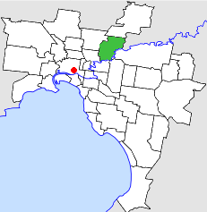
The City of Banyule is a local government area in Victoria, Australia in the north-eastern suburbs of Melbourne. It was created under the Local Government Act 1989 and established in 1994 as an amalgamation of former councils. It has an area of 63 square kilometres (24.3 sq mi) and lies between 7 and 21 km from central Melbourne. In 1994 it had a population of 116,000. In June 2018 Banyule had a population of 130,237. The Yarra River runs along the City's southern border while its western border is defined by Darebin Creek.

Bundoora is a suburb in Melbourne, Victoria, Australia, 15 km (9.3 mi) north-east of Melbourne's Central Business District, located within the Cities of Banyule, Darebin and Whittlesea local government areas. Bundoora recorded a population of 28,068 at the 2021 census.

Greensborough is a suburb of Melbourne, Victoria, Australia, 17 km (11 mi) north-east from Melbourne's Central Business District, located within the City of Banyule and Shire of Nillumbik local government areas. Greensborough recorded a population of 21,070 at the 2021 census.

Heidelberg is a suburb of Melbourne, Victoria, Australia, 11 kilometres (7 mi) northeast of Melbourne's central business district, located within the City of Banyule local government area. Heidelberg recorded a population of 7,360 at the 2021 census.
Ivanhoe East is a suburb of Melbourne, Victoria, Australia, 10 km north-east from Melbourne's Central Business District, located within the City of Banyule local government area. Ivanhoe East recorded a population of 3,762 at the 2021 census.
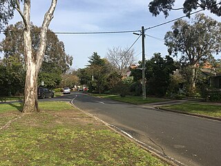
Viewbank is a suburb of Melbourne, Victoria, Australia, 14 km north-east of Melbourne's Central Business District, located within the City of Banyule local government area. Viewbank recorded a population of 7,030 at the 2021 census.

The Division of Jagajaga is an Australian Electoral Division in the state of Victoria. It is located in the north-eastern suburbs of Melbourne, and lies north of the Yarra River. It covers an area of approximately 104 square kilometres and comprises the suburbs of Bellfield, Briar Hill, Diamond Creek, Eaglemont, Greensborough, Heidelberg, Heidelberg Heights, Heidelberg West, Ivanhoe, Ivanhoe East, Lower Plenty, Montmorency, Plenty, Rosanna, St Helena, Viewbank, Yallambie, Watsonia and Watsonia North; and parts of Bundoora, Eltham, Eltham North, Hurstbridge, Macleod, Wattle Glen and Yarrambat.

Eaglemont is an established suburb of Melbourne, Victoria, Australia, 10 km north-east of Melbourne's Central Business District, located within the City of Banyule local government area. Eaglemont recorded a population of 3,960 at the 2021 census.

Heidelberg Town Hall is a civic building located on Upper Heidelberg Road in Ivanhoe, a suburb of Melbourne, Australia. It is now more commonly known as The Centre Ivanhoe
Yarra Plenty Regional Library (YPRL) provides a public library service to the local government municipalities of the City of Banyule, Shire of Nillumbik and City of Whittlesea in the northeast of Melbourne Australia and located on the lands of the Woiworung. It is an independent legal entity with an executive management team which is responsible for day-to-day operations of the organisation. It is managed by the Yarra Plenty Regional Library Board made of two representatives (councillors) of the three municipalities that constitute the service. Its role is to set the policy and direction for the regional library service. The library service covers an area of 988.4 km² including metropolitan, urban fringe and rural populations. The organisation is administered from its Library Support Services (LSS) located at Daniher Drive, Sth Morang.YPRL also provides computer services to Murrindindi Library Service, including full access to the library's database.

Ivanhoe is a suburb of Melbourne, Victoria, Australia, 9 kilometres (5.6 mi) north-east of Melbourne's Central Business District, located within the City of Banyule local government area. Ivanhoe recorded a population of 13,374 at the 2021 census.

The Shire of Diamond Valley was a local government area about 20 kilometres (12 mi) northeast of Melbourne, the state capital of Victoria, Australia. The shire covered an area of 74.38 square kilometres (28.72 sq mi), and existed from 1964 until 1994.
The City of Heidelberg was a local government area about 10 kilometres (6 mi) northeast of Melbourne, the state capital of Victoria, Australia. The city covered an area of 34.08 square kilometres (13.16 sq mi), and existed from 1840 until 1994.
The North East Link is an under construction 26–kilometre tolled motorway scheme in Melbourne, Australia, to connect the Metropolitan Ring Road at Greensborough with the Eastern Freeway at Bulleen, where the freeway would be upgraded from Hoddle Street to Springvale Road at Nunawading, as well as the construction of a new dedicated busway. On 11 December 2016, Victorian Premier Daniel Andrews announced that a re-elected Labor government would build the North East Link at a cost of $10 billion and construction would commence in late 2020, with an expected completion in 2027/2028.

Harold Desbrowe-Annear was an influential Australian architect who was at the forefront of the development of the Arts and Crafts movement in the country. During the 1890s he was an instructor in architecture at the Working Men's College where he founded the T-Square in 1900. The club acted as a meeting point for Melbourne's architects, artists and craft workers and helped to develop a strong Arts and Crafts culture in the city. Desbrowe-Annear was also a supporter of the Victorian Arts and Crafts Society, founded in 1908.
Heidelberg Historical Society is a museum and research organisation devoted to the local and community history of Heidelberg and surrounding areas in the north-eastern suburbs of Melbourne, Victoria, Australia.
Heidelberg Road is a major arterial road through the north-eastern suburbs of Melbourne. It was the first road in Victoria outside the township of Melbourne. Heidelberg Road was the main route for people travelling to Heidelberg, from the mid to late 1800s.