Barclayville

Last updated

Barclayville
Barclayville.jpg
View from Catholic and Evangelical compounds at the edge of Wakpeken looking towards Topor
Liberia location map.svg
Red pog.svg
Barclayville
Location in Liberia
Coordinates: 4°40′47″N8°14′2″W / 4.67972°N 8.23389°W / 4.67972; -8.23389 Coordinates: 4°40′47″N8°14′2″W / 4.67972°N 8.23389°W / 4.67972; -8.23389
Country Flag of Liberia.svg Liberia
County Grand Kru County
Population
 (2008)
  Total2,733
Climate Af

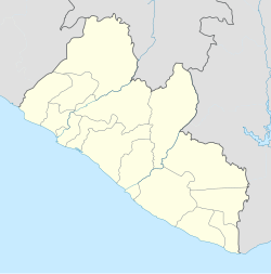
Barclayville is the capital and most populous settlement in Grand Kru County, located in southeastern Liberia about 10 miles inland from Picinicess. As of the 2008 national census, the population stood at 2,733. [1] The Barclayville township straddles the banks of the Na River. Roads from Kanweaken to the northwest, Pleebo to the southeast, and to Picinicess and Grand Cess to the southeast, all intersect at Barclayville.

Contents

In March 2006 the United Nations reported completion of the Na River bridge at Barclayville, connecting the Kanweaken and Pleebo roads for the first time. [2]

History

The modern jurisdiction of Barclayville was created by the administration of President Edwin Barclay in response to the last Kru Wars in the 1930s. As part of the effort to exert central government authority and diminish intertribal conflicts, which had produced devastation, he had four separate villages combined into one township. Until the creation of Barclayville, the constituent villages of Seetor and Kayken, which are occupied by rival chiefdoms, were in periodic conflict. The villages of Seetor, Kayeken and Wakpeken and their "suburbs" are on the northwest side of the Na river, while Topor is on the opposite south bank across from Wakpekan.

Despite the town's large size, most structures are traditional mud-and-stick homes. As of the mid-1980s, when the township was organized, few had running water or electricity. Kplio (a dialect of Grebo) is the primary language of the residents, but English is the official language of instruction in the schools.

The regional high school is in Barclayville, along with several public and private (Christian) schools for grades K-8. Many Christian religious denominations have churches and/or missions in Barclayville including Catholic, Methodist, Baptist, and a variety of other evangelical congregations. Most of population also follows local animist practices.

Prior to the Liberian Civil War, much of the male adult population were on government payroll employed as teachers, employees of the courts, or serving as government officials or civil service staff. Upland rice farming is the primary occupation of most adults.

Each village lays claim to large areas of communal land that extend several miles inland from the town. They carry out slash and burn farming, rotating to a new section of land every year in order to allow the soil to recover its fertility. Because of the distance from the villages to these outlying farms, it is common for the women and younger children to live on the farms during the growing season. There the women also establish vegetable gardens and plant cassava. Farming within Barclayville is limited as crops serve as fodder for the freely roaming livestock and fowl, including cows, sheep, goats and chickens.

In June 2005 the UN Integrated Regional Information Regional Network reported that the roads leading to Barclayville had decayed during the years of civil war and become overgrown by dense bush. They were impassable except by foot.

See also

Related Research Articles

Liberia Country on the Atlantic coast of West Africa

Liberia, officially the Republic of Liberia, is a country on the West African coast. It is bordered by Sierra Leone to its northwest, Guinea to its north, Ivory Coast to its east, and the Atlantic Ocean to its south and southwest. It has a population of around 5 million and covers an area of 111,369 square kilometers (43,000 sq mi). English is the official language, but over 20 indigenous languages are spoken, reflecting the country's ethnic and cultural diversity. The country's capital and largest city is Monrovia.

Demographics of Liberia Overview of the demographics of Liberia

As of 2006, Liberia has the highest population growth rate in the world. 43.5% of Liberians were below the age of 15 in 2010. With recent civil wars being fought along ethnic lines, Liberia is a multiethnic and multicultural country.

Kru languages Language family of Liberia and Ivory Coast

The Kru languages are spoken by the Kru people from the southeast of Liberia to the west of Ivory Coast.

The Krahn are an ethnic group of Liberia and Ivory Coast. This group belongs to the Kru language family and its people are sometimes referred to as the Wee, Guéré, Sapo, or Wobe. It is likely that Western contact with the Kru language is the primary reason for the development of these different names.

Monrovia Capital, chief port, and the largest city of Liberia

Monrovia is the capital city of the West African country of Liberia. Founded in 1822, it is located on Cape Mesurado on the Atlantic coast, and is the country's most populous city. As of the 2008 census, with 1,010,970 residents, it was home to 29% of Liberia’s total population. Monrovia is also the country’s economic, financial and cultural center. Its economy is primarily centered on its harbor and its role as the seat of Liberia's government.

Montserrado County County in Liberia

Montserrado County is a county in the northwestern portion of the West African nation of Liberia containing its national capital, Monrovia. One of 15 counties that comprise the first-level of administrative division in the nation, it is composed of four districts. As of the 2008 Census, it had a population of 1,118,241, making it the most populous county in Liberia. The area of the county measures 1,912.7 square kilometres (738.5 sq mi), the smallest in the country. Bensonville serves as the capital.

Maryland County County of Liberia

Maryland County is a county in the southeastern portion of Liberia. One of 15 counties that comprise the first-level of administrative division in the nation, it has two districts. Harper serves as the capital with the area of the county measuring 2,297 square kilometres (887 sq mi). As of the 2008 Census, it had a population of 136,404, making it the seventh most populous county in Liberia.

Gbarpolu County County of Liberia

Gbarpolu is a county in the northern portion of Liberia. One of 15 counties that comprise the first-level of administrative division in the nation, it has six districts. Bopulu serves as the capital with the area of the county measuring 9,689 square kilometres (3,741 sq mi). As of the 2008 Census, it had a population of 83,758, making it the eleventh-most populous county in Liberia.

Grand Kru County County of Liberia

Grand Kru County is a county in the southeastern portion of Liberia. One of 15 counties that comprise the first-level of administrative division in the nation, it has eighteen districts. Organized in 1984, its capital is Barclayville. The area of the county measures 3,895 square kilometres (1,504 sq mi). As of the 2008 Census, it had a population of 57,106, making it the least populous county in Liberia.

River Gee County County of Liberia

River Gee is a county in the southern portion of Liberia. One of 15 counties that constitute the first-level of administrative division in the nation, it has six districts. Fish Town serves as the capital with the area of the county measuring 5,113 square kilometres (1,974 sq mi). As of the 2008 Census, it had a population of 66,789, making it the third-least populous county in Liberia. It was created in 2000.

Krumen people

The Krumen is an ethnic group living mostly along the coast of Liberia and Côte d’Ivoire. Their numbers were estimated to be 48,300 in 1993, of which 28,300 were in Côte d’Ivoire. They are a subgroup of the Grebo and speak the Krumen language.

Catholic Church in Liberia

The Catholic Church in Liberia is part of the worldwide Catholic Church, under the spiritual leadership of the Pope in Rome.

Jabo is the self-designation of an ethnic group located in the southeastern part of the Republic of Liberia in West Africa. They have also sometimes referred to themselves as Gweabo or Nimiah tribe.

Grebo people

Grebo people is a term used to refer to an ethnic group or subgroup within the larger Kru group of Africa, a language and cultural ethnicity, and to certain of its constituent elements. Within Liberia members of this group are found primarily in Maryland County and Grand Kru County in the southeastern portion of the country, but also in River Gee County and Sinoe County. The Grebo population in Côte d'Ivoire are known as the Krumen and are found in the southwestern corner of that country.

The Dan are a Mande ethnic group from northwestern Ivory Coast and neighboring Liberia. There are approximately 700,000 members of the group and their largest settlement is Man, Ivory Coast. Neighboring peoples include the Krahn, Kpelle and Mano. They are officially known as Yacouba in Ivory Coast. In Liberia, they are also known as Gio, which is considered a derogatory exonym.

Southwest Philadelphia Neighborhood of Philadelphia in Philadelphia, Pennsylvania

Southwest Philadelphia is a section of Philadelphia, Pennsylvania, United States. The section can be described as extending from the western side of the Schuylkill River to the city line, with the SEPTA. The northern border is defined by the Philadelphia City Planning Commission as east from the city line along Baltimore Avenue moving south along 51st Street to Springfield Ave. It follows the train tracks until 49th Street. From 49th and Kingsessing Ave the line moves east along Kingsessing Ave. The line then moves south along 46th St to Paschall Ave where it jogs to join Grays Ferry where the line runs to the Schuylkill River.

Plahn Nyarn District is one of 16 districts of Sinoe County, Liberia. As of 2008, the population was 6,805.

1846 Liberian independence referendum

An independence referendum was held in Liberia on 27 October 1846. The result was 52% in favour, with independence being declared on 26 July 1847.

Agriculture in Liberia

Agriculture in Liberia is a major sector of the country's economy worth 38.8% of GDP, employing more than 70% of the population and providing a valuable export for one of the world’s least developed countries. Liberia has a climate favourable to farming, vast forests, and an abundance of water, yet low yields mean that over half of foodstuffs are imported, with net agricultural trade at -$73.12 million in 2010. This was dismissed as a "misconception" by Liberia’s Minister of Agriculture.

References

  1. "2008 National Population and Housing Census: Preliminary Results" (PDF). Government of the Republic of Liberia. 2008. Retrieved 30 March 2012.
  2. "Ellen Dedicates George Bush Bridge". The Analyst. 27 April 2006. Archived from the original on 4 November 2006. Retrieved 20 October 2008.