
A chambered cairn is a burial monument, usually constructed during the Neolithic, consisting of a sizeable chamber around and over which a cairn of stones was constructed. Some chambered cairns are also passage-graves. They are found throughout Britain and Ireland, with the largest number in Scotland.

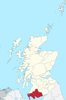
Dumfries and Galloway is one of 32 unitary council areas of Scotland and is located in the western Southern Uplands. It comprises the historic counties of Dumfriesshire, Stewartry of Kirkcudbright and Wigtownshire, the latter two of which are collectively known as Galloway. The administrative centre is the town of Dumfries.
Galloway is a region in southwestern Scotland comprising the historic counties of Wigtownshire and Kirkcudbrightshire.

Nithsdale, also known by anglicised Gaelic names Strathnith, Stranith or Stranit, is the strath or dale of the River Nith in southern Scotland, and the name of the local area. The name Strath Nid may represent the Cumbric Ystrad Nidd; Cumbric was the dominant language in this area from before Roman times until the 11th or 12th centuries, whereas Gaelic influence here was late and transient. The River Nith flows north to south through the Southern Uplands in south-west Scotland, separating the Lowther Hills from the Scaur Hills. Nithsdale has historically been a strategic area as it forms an invasion route from England into central Scotland.

Annandale is a strath in Dumfries and Galloway, Scotland, named after the dale of the River Annan. It runs north–south through the Southern Uplands from Annanhead to Annan on the Solway Firth, and in its higher reaches it separates the Moffat hills on the east from the Lowther hills to the west. A 53-mile (85 km) long-distance walking route called Annandale Way running through Annandale was opened in September 2009.

The Southern Uplands are the southernmost and least populous of mainland Scotland's three major geographic areas. The term is used both to describe the geographical region and to collectively denote the various ranges of hills and mountains within this region. An overwhelmingly rural and agricultural region, the Southern Uplands are partly forested and contain many areas of open moorland.
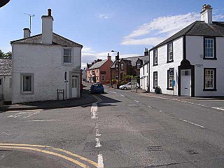
Penpont is a village about 2 miles (3 km) west of Thornhill in Dumfriesshire, in the Dumfries and Galloway region of Scotland. It is near the confluence of the Shinnel Water and Scaur Water rivers in the foothills of the Southern Uplands. It has a population of about 400 people.

The Southern Upland Way is a 344-kilometre (214 mi) coast-to-coast long-distance footpath in southern Scotland. The route links Portpatrick in the west and Cockburnspath in the east via the hills of the Southern Uplands. The Way is designated as one of Scotland's Great Trails by NatureScot and is the longest of the 29 Great Trails. The Southern Upland Way meets with seven of the other Great Trails: the Annandale Way, the Berwickshire Coastal Path, the Borders Abbeys Way, the Cross Borders Drove Road, the Mull of Galloway Trail, the Romans and Reivers Route and St Cuthbert's Way.

New Luce is a civil parish in Dumfries and Galloway, south-west Scotland. It lies in the traditional county of Wigtownshire, and is about 10 miles (16 km) in length and 5 miles (8.0 km) in breath, being the upper part of the original Glenluce Parish. New Luce is shown as a civil parish on John Ainslie's county map of 1782.

Sanquhar Castle, now a ruin, was built by the Crichton family in the 13th century. Situated on the southern approach to the former royal burgh of Sanquhar in Dumfries and Galloway, south west Scotland, it sits on the trail of the Southern Upland Way, and is passed by hundreds of visitors who walk through the grounds each year.
Beattock is a village in Dumfries and Galloway, Scotland, approximately 1⁄2 mile (0.80 km) south-west of Moffat and 19 miles (31 km) north of Dumfries.

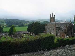
Closeburn is a village and civil parish in Dumfries and Galloway, Scotland. The village is on the A76 road 2 1⁄2 miles (4 km) south of Thornhill. In the 2001 census, Closeburn had a population of 1,119. Closeburn is recorded as Killosbern in 1185. The first element of the name is Gaelic cill 'cell or church'. The second element is a saint's name, but none has definitely been identified.

The Lowther Hills, also sometimes known as the Lowthers, are an extensive area of hill country in the Southern Uplands of Scotland, though some sub-ranges of hills in this area also go under their own local names - see "Hillwalking" below. They form a roughly rhomboidal or lozenge shape on the map with the acute angles being to north and south. It has river valleys along its boundaries to north east (Clydesdale) and south west (Nithsdale) which carry the two largest arterial routes northwards into the west side of the Central Belt of Scotland. A string of small towns have long since developed along these routes. Most of the Lowther Hills lie in the Administrative County of Dumfries and Galloway, though part in the administrative county of South Lanarkshire moves into them around the village of Leadhills and the Daer Reservoir.

The Watch Water is a river in the Scottish Borders area of Scotland. It rises in the Lammermuir Hills, around 8 kilometres (5.0 mi) west of Longformacus, and flows generally eastward to its confluence with the Dye Water, around 700 metres (2,300 ft) west of Longformacus. The Dye Water flows into the Whiteadder Water, which in turn is a tributary of the River Tweed.
The Sir Walter Scott Way is a 92-mile (148 km) long-distance footpath in the Scottish Borders. The route broadly follows the waymarked Southern Upland Way, except for in a few sections. It commemorates Sir Walter Scott, one of Scotland's most renowned writers, who had many connections with the area.
Glencairn is an ecclesiastical and civil parish in Dumfries and Galloway, Scotland.

Bargrennan chambered cairns are a class of prehistoric chambered cairns found only in south-west Scotland, in western Dumfries and Galloway and southern Ayrshire. They form a separate group from the Clyde cairns which are found along the coast of western Britain. Unlike Clyde cairns, Bargrennan monuments are passage graves, with one or more chambers set into a round cairn. As well as being structurally different, Bargrennan cairns are separated from Clyde cairns by their siting and distribution; they are found in upland, inland areas of Galloway and Ayrshire. Murray suggests that there are around twelve Bargrennan monuments in south-west Scotland. She also notes that as sheep rees are often built into and over these types of cairns, more are likely to have been lost under shepherd's buildings.

The Rhinns of Kells are a range of hills in the Galloway Hills range, part of the Southern Uplands of Scotland. The most easterly of three parallel ridges, they are neighboured to the west by the Range of the Awful Hand and the Dungeon Hills. The eastern portion of the Minnigaff Hills range lies immediately southwest of the range. In total, these four ranges are part of the Galloway Forest Park. The ridge is located entirely within Dumfries and Galloway, with the base of the western flanks being a northwestern boundary of the county.
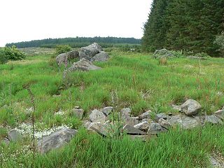
Cairnderry chambered cairn is a chambered cairn in Dumfries and Galloway. It is a Bargrennan cairn, a type of Neolithic or early Bronze Age monument only found in south west Scotland.
