
Calumet Charter Township is a charter township of Houghton County in the U.S. state of Michigan. The population was 6,489 at the 2010 census, down from 6,997 at the 2000 census. Even with a decreasing population, the township remains the largest township by population in Houghton County.

The Farne Islands are a group of islands off the coast of Northumberland, England. The group has between 15 and 20 islands depending on the level of the tide. They are scattered about 1+1⁄2 to 4+3⁄4 miles (2.4–7.6 km) from the mainland, divided into the Inner Group and the Outer Group. The main islands in the Inner Group are Inner Farne, Knoxes Reef, the East and West Wideopens, and the Megstone; the main islands in the Outer Group are Staple Island, the Brownsman, the North and South Wamses, Big Harcar, and the Longstone. The two groups are separated by Staple Sound. The highest point, on Inner Farne, is 62 feet (19 m) above mean sea level.

Tobermory is the capital of, and until 1973 the only burgh on, the Isle of Mull in the Scottish Inner Hebrides. It is located on the east coast of Mishnish, the most northerly part of the island, near the northern entrance of the Sound of Mull. The village was founded as a fishing port in 1788; its layout was based on the designs of Dumfriesshire engineer Thomas Telford. It has a current population of about 1,000.
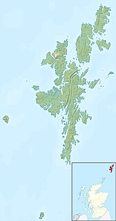
Foula, located in the Shetland archipelago of Scotland, is one of the United Kingdom’s most remote permanently inhabited islands. Owned since the turn of the 20th century by the Holbourn family, the island was the location for the film The Edge of the World. RMS Oceanic was wrecked on the nearby Shaalds of Foula.
The Isle of Mull or just Mull is the second-largest island of the Inner Hebrides and lies off the west coast of Scotland in the council area of Argyll and Bute.

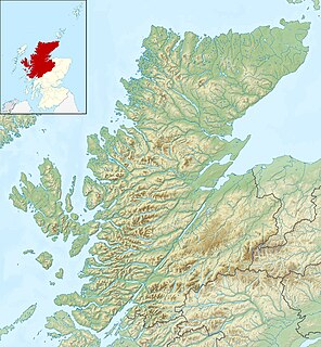
Ross and Cromarty, sometimes referred to as Ross-shire and Cromartyshire, is a variously defined area in the Highlands and Islands of Scotland. There is a registration county and a lieutenancy area in current use, the latter of which is 8,019 square kilometres in extent. Historically there has also been a constituency of the Parliament of the United Kingdom, a local government county, a district of the Highland local government region and a management area of the Highland Council. The local government county is now divided between two local government areas: the Highland area and Na h-Eileanan Siar. Ross and Cromarty border Sutherland to the north and Inverness-shire to the south.

Sanda Island is a small island in Argyll and Bute, Scotland, off the southern tip of the Kintyre peninsula, near Southend and Dunaverty Castle.

The Columbia Bar, also frequently called the Graveyard of the Pacific, is a system of bars and shoals at the mouth of the Columbia River spanning the U.S. states of Oregon and Washington. It is known as one of the most dangerous bar crossings in the world. The bar is about 3 miles (5 km) wide and 6 miles (10 km) long.

The Crowlin Islands are a group of uninhabited islands in the Inner Hebrides of Scotland. They lie between Skye and the Applecross peninsula on the mainland.
Eilean Mhic Coinnich, also known as Mackenzie Island, is an uninhabited island of 17.3 hectares, lying off the southern end of the Rinns of Islay peninsula on the Inner Hebridean island of Islay, Scotland.
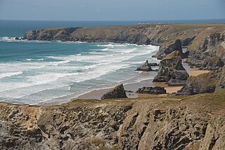
Carnewas and Bedruthan Steps is a stretch of coastline located on the north Cornish coast between Padstow and Newquay, in Cornwall, United Kingdom. It is within the parish of St Eval and is part-owned by the National Trust. The trust maintains a shop and café, and the cliff–top views of rocks stretching into the distance along Bedruthan beach make the area a popular attraction for tourists and painters. The property affords walks along the coast path and the steep steps at Bedruthan allow access to a series of rocky beaches at low tide. Signs at the top of the steps down to the beaches warn visitors not to risk swimming in these waters due to heavy rips, fast tides, and submerged rocks.

Morvern, historically also spelt Morven, is a peninsula and traditional district in the Highlands, on the west coast of Scotland. It lies south of the districts of Ardgour and Sunart, and is bounded on the north by Loch Sunart and Glen Tarbert, on the south east by Loch Linnhe and on the south west by the Sound of Mull. The name is derived from the Gaelic A' Mhorbhairne. The highest point is the summit of the Corbett Creach Bheinn which reaches 853 metres (2,799 ft) in elevation.
The Island of Danna or Danna, is an inhabited tidal island in Argyll and Bute.

Little Bernera is a small island situated off the west coast of the Isle of Lewis in the Outer Hebrides.
SM UC-55 was a German Type UC II minelaying submarine or U-boat in the German Imperial Navy during World War I. The U-boat was ordered on 12 January 1916, laid down on 25 February 1916, and was launched on 2 August 1916. She was commissioned into the German Imperial Navy on 15 November 1916 as SM UC-55.
Eilean Trodday is an island in The Minch just off the north coast of the Trotternish peninsula of Skye in Scotland.
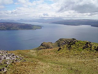
The Sound of Mull is a sound between the Inner Hebridean island of Mull and mainland Scotland. It forms part of the Atlantic Ocean.

The Auchlochan Collieries were several collieries in Auchlochan and Coalburn, South Lanarkshire, Scotland. Production started in 1894 and ended in 1968 when it closed. They were served at Auchlochan Platform railway station, part of the Coalburn Branch of the Caledonian Railway. 8 people were killed at the collieries.
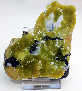
Lizardite is a mineral from the group serpentine; it is the most common type of mineral in the group. It is also a member of the kaolinite-serpentine group.

Tofts Ness is a peninsula located on the north-east tip of the island of Sanday in Orkney, Scotland. It encompasses a prehistoric site which shows evidence of human occupation beginning in the late Neolithic Age and continuing through the Iron Age. The scheduled monument consists of mounds, cairns, enclosures, ancient soils and structural remains. Tofts Ness is also the location of multiple shipwrecks.
