Barnsley (disambiguation)

Last updated

Barnsley is a town in South Yorkshire, England

Contents

Barnsley may also refer to:
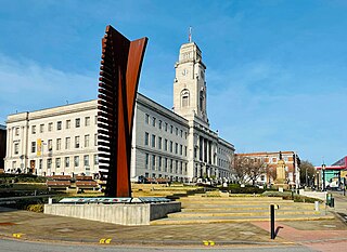
Places

in England
Metropolitan Borough of Barnsley Metropolitan Borough in England

The Metropolitan Borough of Barnsley is a metropolitan borough of South Yorkshire, England; its main town is Barnsley.

Barnsley was a Parliamentary constituency covering the town of Barnsley in England. It returned one Member of Parliament (MP) to the House of Commons of the Parliament of the United Kingdom, elected by the first past the post voting system.

Barnsley, Gloucestershire village in United Kingdom

Barnsley is a village and civil parish in the Cotswold district of Gloucestershire, England, four miles northeast of Cirencester. Barnsley village is 80 miles (129 km) west of London.

Elsewhere

Barnsley is a township in New South Wales, Australia, 21 kilometres (13 mi) west of Newcastle's central business district. It is a suburb of the City of Lake Macquarie local government area.

Barnsley, Manitoba Place in Manitoba, Canada

Barnsley is a locality in south central Manitoba, Canada. It is located approximately 10 kilometers north of Carman, Manitoba in the Rural Municipality of Dufferin.

Barnsley is an unincorporated community in Hopkins County, in the U.S. state of Kentucky.

People

Science

Mathematics
Barnsley fern

The Barnsley fern is a fractal named after the British mathematician Michael Barnsley who first described it in his book Fractals Everywhere. He made it to resemble the black spleenwort, Asplenium adiantum-nigrum.

Michael Fielding Barnsley, born in 1946, is a British mathematician, researcher and an entrepreneur who has worked on fractal compression; he holds several patents on the technology. He received his Ph.D in Theoretical Chemistry from University of Wisconsin–Madison in 1972 and BA in Mathematics from Oxford in 1968. In 1987 he founded Iterated Systems Incorporated, and in 1988 he published a book entitled Fractals Everywhere and in 2006 SuperFractals.

Other

in South Yorkshire, England
Barnsley Building Society

Barnsley Building Society was established on 12 January 1853, by a group of prominent townsfolk who following the example of many other towns and cities at the time decided to form their own building society.

Barnsley Canal

The Barnsley Canal is a canal that ran from Barnby Basin, through Barnsley, South Yorkshire, England to a junction with the Aire and Calder Navigation near Wakefield. It was built in the 1790s, to provide a transport link from coal reserves at Barnsley to a wider market. Both the Aire and Calder Navigation and the River Don Navigation took a keen interest in the project, the former buying many of the initial shares, and the latter constructing the Dearne and Dove Canal to link the canal to their waterway. Water supply issues meant that the AIre and Calder proposed pumping all of the water for the canal from the River Calder, using steam pumps, but a reservoir was built at Cold Hiendley instead, increasing the construction costs, but reducing the running costs. The canal as built was 14.5 miles (23.3 km) long and included 15 locks.

Barnsley F.C. association football club

Barnsley Football Club is a professional association football club based in the town of Barnsley, South Yorkshire, England. The team play in League One, the third tier of the English football league system. Nicknamed "the Tykes", they were founded in 1887 by Reverend Tiverton Preedy under the name Barnsley St. Peter's. The club colours are red and white, and their home ground since 1888 has been Oakwell.

Related Research Articles

South Yorkshire County of England

South Yorkshire is a metropolitan county in England. It is the southernmost county in the Yorkshire and the Humber region and had a population of 1.34 million in 2011. It has an area of 1,552 square kilometres (599 sq mi) and consists of four metropolitan boroughs, Barnsley, Doncaster, Rotherham and Sheffield. South Yorkshire was created on 1 April 1974 as a result of the Local Government Act 1972.Its largest settlement is Sheffield.

Hallamshire

Hallamshire is the historical name for an area of South Yorkshire, England, in the current city of Sheffield.

Grimethorpe village in the United Kingdom

Grimethorpe is a large village in the metropolitan borough of Barnsley in South Yorkshire, England. Historically within the West Riding of Yorkshire, it has a population of 1,873. Grimethorpe is located to the east of Barnsley and south of Hemsworth; until the local government reorganisation of 1974, it was part of the Hemsworth district and constituency. At the 2011 Census the village was part of the North East ward of Barnsley MBC.

Darton village in the United Kingdom

Darton is a large village in the Metropolitan Borough of Barnsley, on the border with West Yorkshire, England. At the time of the 2001 UK census, it had a population of 14,927, increasing to 21,345 for both Darton Wards at the 2011 Census.

Brierley town

Brierley is a small town and former civil parish in the Metropolitan Borough of Barnsley in South Yorkshire, England. The civil parish was abolished in 2016. The settlement is tightly clustered and green buffered on a modest escarpment close to the border with West Yorkshire, it is almost wholly in population south of the A628 road, and is less than 2 miles (3 km) to the south west of Hemsworth.

Royston, South Yorkshire village within the Metropolitan borough of Barnsley, in South Yorkshire, England

Royston is a suburban village within the Metropolitan borough of Barnsley, in South Yorkshire, England. Historically part of the West Riding of Yorkshire, but was incorporated into the Metropolitan borough of Barnsley in 1974 and is now on the border with West Yorkshire. It is part of the Barnsley Central borough constituency, and has a population of 9,375, increasing to 10,728 at the 2011 Census.

Wombwell town in the Metropolitan Borough of Barnsley in South Yorkshire, England

Wombwell is a town near Barnsley, located in the Metropolitan Borough of Barnsley in South Yorkshire, England. The town in the 2011 census was split between a ward called Wombwell, as well as small parts that fell under two other wards called Darfield and Stairfoot. Added together, these list the town's population as roughly 15,316.

Cawthorne village in Yorkshire, United Kingdom

Cawthorne is a village and civil parish in the Metropolitan Borough of Barnsley in South Yorkshire, England. The village was once the centre of a localised iron and coal mining industry, though today it is the centre of a very affluent commuter belt, west of Barnsley. At the 2001 census it had a population of 1,108, increasing to 1,151 at the 2011 Census.

Cudworth, South Yorkshire urban village in South Yorkshire, England

Cudworth is an urban village approximately 3.5 miles (5.6 km) north-east of Barnsley transport interchange in South Yorkshire, England. Historically within the West Riding of Yorkshire, Cudworth has a busy shopping area along the Barnsley to Pontefract Road which serves a local population of 10,977. The modern village equates roughly to the Cudworth ward of Barnsley Metropolitan Borough Council and with a mix of housing types with a great many developments from the inter-war and post-war periods. These supplement a small residual number of more ancient dwellings and buildings reflecting the importance of the rural economy before the opening of the deep mine collieries in the near vicinity at the end of the 19th and early 20th centuries. The village is still surrounded by open space, including green belt, regenerated public open spaces that were formerly part of neighbouring collieries and the remaining agricultural land which still dominates the south and south-east sides of the village.

Monk Bretton village in United Kingdom

Monk Bretton is a village in the Metropolitan Borough of Barnsley in South Yorkshire, England. It lies approximately two miles north-east from Barnsley town centre.

Goldthorpe village within the Metropolitan Borough of Barnsley in South Yorkshire, England

Goldthorpe is a village within the Metropolitan Borough of Barnsley, in South Yorkshire, England. Historically part of the West Riding of Yorkshire, it was anciently a small medieval farming village, Goldthorpe is recorded in the Domesday Book and was under the Manor of Bolton upon Dearne which was once owned by Roger de Busli. The village falls within the Dearne North Ward of the Barnsley MBC.

The Hallam Line is a railway connecting Leeds and Sheffield via Castleford in the West Yorkshire Metro area of northern England. It is a slower route from Leeds to Sheffield than the Wakefield line. Services on this line are operated by Northern. Services from Leeds to Nottingham also use the line.

Silkstone village in the United Kingdom

Silkstone is a village and civil parish in the Metropolitan Borough of Barnsley in South Yorkshire, England. It is situated in the foothills of the Pennines, between the towns of Barnsley and Penistone, and includes the village of Silkstone Common. At the 2001 census it had a population of 2,954, increasing to 3,153 at the 2011 Census.

Netherton, Wakefield village in the United Kingdom

Netherton is a village in the City of Wakefield metropolitan borough of West Yorkshire, England. It lies about 4 miles south-west of Wakefield, 3 miles south of Ossett, 1 mile south of Horbury. The village is in the Wakefield Rural ward of Wakefield Metropolitan District Council. The village name "Nether Shitlington" was changed to Netherton sometime after 1855. The h was dropped from Shitlington and Sitlington was adopted in 1929 with the approval of the county council.

Bolton upon Dearne village in United Kingdom

Bolton upon Dearne is a small village in the Metropolitan Borough of Barnsley, South Yorkshire, England, in the part of the Dearne Valley through which the River Dearne passes. Historically part of the West Riding of Yorkshire, it is approximately 7 miles (11 km) east of Barnsley, 10 miles (16 km) west of Doncaster and 8 miles (13 km) north of Rotherham.

Drewton village in the United Kingdom

Drewton is a hamlet in the East Riding of Yorkshire, England. It is situated on the A1034 road, 6 miles (10 km) south-east from Market Weighton and 11 miles (18 km) west from Hull city centre, and forms part of the civil parish of South Cave.

Sandal Magna human settlement in United Kingdom

Sandal Magna or Sandal is a suburb of Wakefield, West Yorkshire, England with a population in 2001 of 5,432. An ancient settlement, it is the site of Sandal Castle and of a parish church that predates the Domesday Book. It is 2 miles (3.2 km) south from Wakefield, 8 miles (13 km) north of Barnsley. The Battle of Wakefield was fought here in the 15th century during the Wars of the Roses.

Castles in South Yorkshire

While there are many castles in South Yorkshire, the majority are manor houses and motte-and-bailey which were commonly found in England after the Norman Conquest.

Tankersley, South Yorkshire

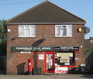
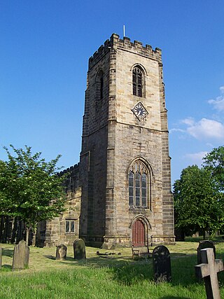
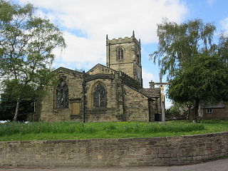
Tankersley is a village and civil parish in the Metropolitan Borough of Barnsley in South Yorkshire, England. At the 2001 census it had a population of 1,414, increasing to 1,671 at the 2011 Census.

South Yorkshire Sports Stadium was a greyhound racing and speedway stadium on Station Road in Wombwell, near Barnsley, South Yorkshire. It was one of two greyhound tracks in the town; the other was called the Wombwell Greyhound Stadium.