Barton, Nebraska | |
|---|---|
 Barton, Nebraska  Barton, Nebraska | |
| Coordinates: 41°00′N102°12′W / 41°N 102.2°W | |
| Country | |
| State | |
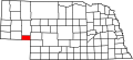
| County | Deuel |
Barton is an unincorporated community in Deuel County, Nebraska, United States. [1] It is located west of Big Springs, along the South Platte River, halfway to the Colorado border[ where? ].