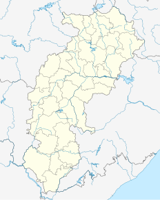
Ambikapur is a city in Surguja district of Chhattisgarh. The district is one of the oldest districts of the Indian state of Chhattisgarh, in east-central India. Ambikapur is also the divisional headquarters of Surguja Division which consists of the five districts of Surguja, Koriya, Balrampur, Surajpur and Jashpur.

The Rihand River is a tributary of the Son River and flows through the Indian states of Chhattisgarh and Uttar Pradesh. Its old name was Renu or Renuka.

Surguja District is a district in the northern part of the state of Chhattisgarh in India. The district headquarters is Ambikapur.

Bhaiyathan is a panchayat village in Surajpur District in the Indian state of Chhattisgarh. Bhaiyathan is part of a development "block", or tehsil under the jurisdiction of Surajpur and is 23 km away from Surajpur town. It is situated on the bank of the Rihand River. Tamor Pingla Wildlife Sanctuary is a major attraction nearby. A famous Devi temple on a hill, Kudargarh, is just 23 km from Bhaiyathan.

Kudargarh is a famous Hindu pilgrim centre situated in Surajpur District of the state of Chhattisgarh in India. It is 40 km from district headquarters of Surajpur connected by an all-weather road. The best time to visit is during Chaitra Navaratra . It is located on a hillock with approximately 800 steps. A very panoramic view from top on addition to the DARSHAN of deity.
Tamor Pingla Wildlife Sanctuary is located in Surajpur District, Chhattisgarh, India. It is named after the Tamor Hill and Pingla Nalla, the old and prominent features of the area.
Jawahar Navodaya Vidyalaya Basdei is a higher secondary school in the village of Basdei in the Indian state of Chhattisgarh. The school is 8 km from district headquarters Surajpur and 2 km from the Surajpur Road Railway Station. This Navodaya school was part of the Surguja district before the Surajpur district's creation on 15 August 2011.
Surguja Lok Sabha constituency is one of the eleven Lok Sabha (parliamentary) constituencies in Chhattisgarh state in central India.
Pratappur is a "Nagar panchayat" area of PIlkha constituency of chhattisgarh in India and is a part of the Surajpur District. Pratappur is nearly 80 km northeast from surajpur and is 45 km away from Ambikapur, which is its nearest big city. it is famous for lord shiva temple in shivpur, which is a tourism place. Tropic of cancer line passes through Pratappur.
Dadri Assembly constituency is one of the 403 constituencies of the Uttar Pradesh Legislative Assembly, India. It is a part of the Gautam Budh Nagar district and one of the five assembly constituencies in the Gautam Buddha Nagar. First election in this assembly constituency was held in 1957 after the "DPACO (1956)" was passed in 1956. After the "Delimitation of Parliamentary and Assembly Constituencies Order, 2008" was passed in 2008, the constituency was assigned identification number 62.
Prem Nagar is a "Nagar panchayat" area of Pilkha constituency of Chhattisgarh state in India and is a part of the Surajpur District. Prem Nagar is nearly 51 km northeast from Surajpur and 91 km from Ambikapur, which is its nearest big city.
Ramanuj Nagar is a "Nagar panchayat" area of PIlkha constituency of chhattisgarh in India and is a part of the Surajpur District. Ramanuj Nagar is about 21 km northeast from Surajpur and is 60 km away from Ambikapur; the nearest big city.
Odagi is a "Nagar panchayat" area of PIlkha constituency of chhattisgarh in India and is a part of the Surajpur District. Odagi is about 20 km northeast from surajpur and is 75 km away from Ambikapur;the nearest big city.
Dainkwan is a village panchayat located in the tehsill Nurpur, and district Kangra.
Bahreliya is a small rajput sect, found in and around the Barabanki district in the Indian state of Uttar Pradesh. They are said to be suryavanshi Rana of marwar and some bais rasildars, who came to Taluqa Surajpur Bahrela, they are called Bahrelia. Vansha - Bais ki God sisodia. Their main king was Singhji who was sent to jail in Lucknow because of his involvement in dacoities, after which his wife shifted the stay from Surajpur Bahrela to Ram sanehi ghat.

The Battle of Mosul (2016–2017) was a major military campaign launched by the Iraqi Government forces with allied militias, the Kurdistan Regional Government, and international forces to retake the city of Mosul from the Islamic State of Iraq and the Levant (ISIL), which had seized the city in June 2014. During the military intervention against ISIL, Iraqi and Peshmerga forces had already made unsuccessful attempts to retake the city in 2015 and again in 2016, despite limited gains.
Government Polytechnic Surajpur is newly opened polytechnic college located in Surajpur district, Chhattisgarh. It is affiliated with Chhattisgarh Swami Vivekanand Technical University.


